
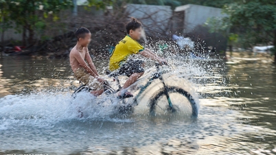
At noon on October 8, Mr. Le Duy Khac (38 years old, in Phan Dinh Phung ward) took advantage of the rain to use a flycam to take pictures of some places in Thai Nguyen that were deeply submerged in the historic flood: Gia Sang ward, Phan Dinh Phung, Gia Bay bridge, Ben Oanh bridge, Huong bridge, the round island area in the center of the old Thai Nguyen city, the North-South underpass, Quan Trieu ward (old Quang Vinh ward), Thai Nguyen University of Education...
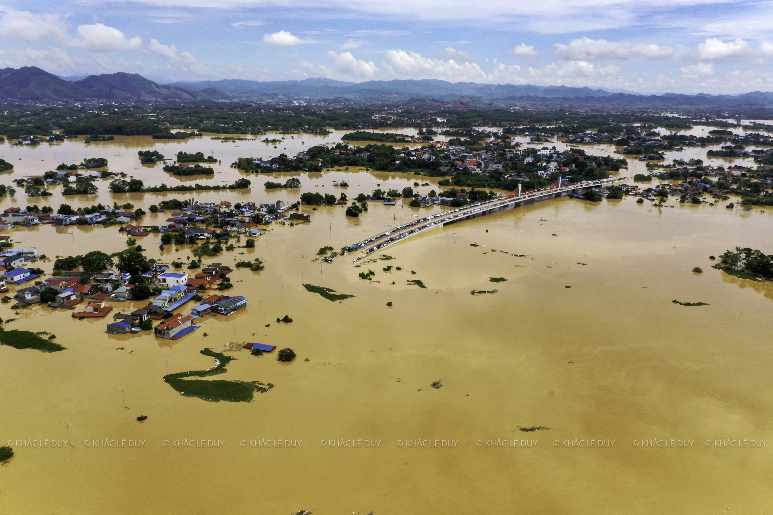
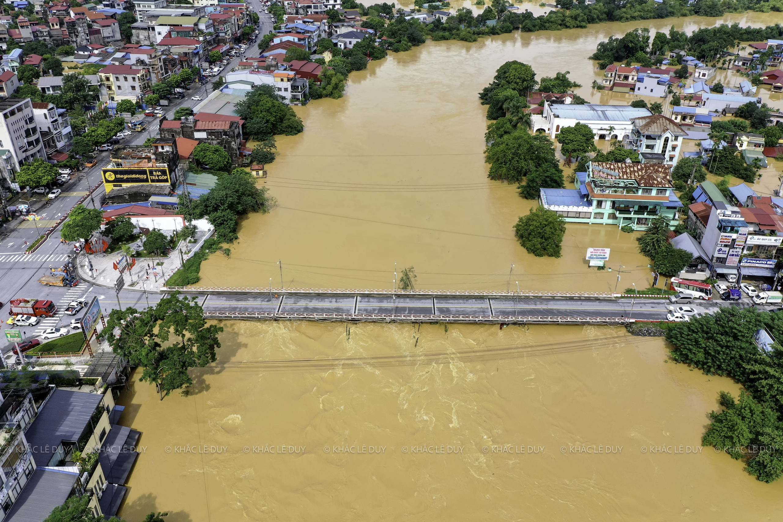
At 5:00 a.m. on October 8, the water level on the Cau River at Gia Bay station was 29.90 m, exceeding alarm level 3 (27 m) by 2.9 m and higher than the historical flood peak in 2024 by 1.09 m.

The central area of Thai Nguyen province during the flood that exceeded last year's historical mark of 1.09 m, on the morning of October 8.
Photo: Le Duy Khac
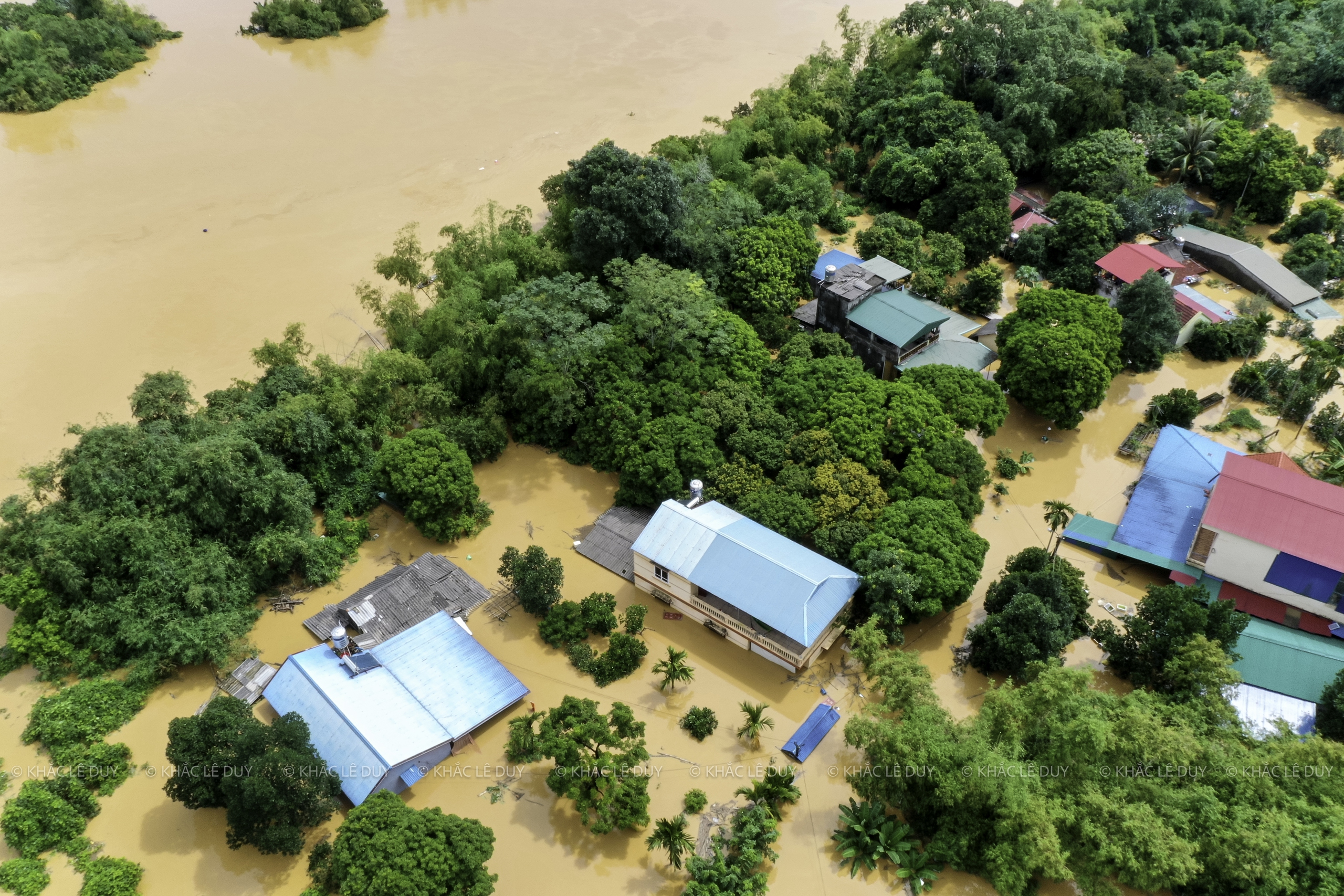
Residential area under Huong bridge is deeply flooded
Photo: Le Duy Khac
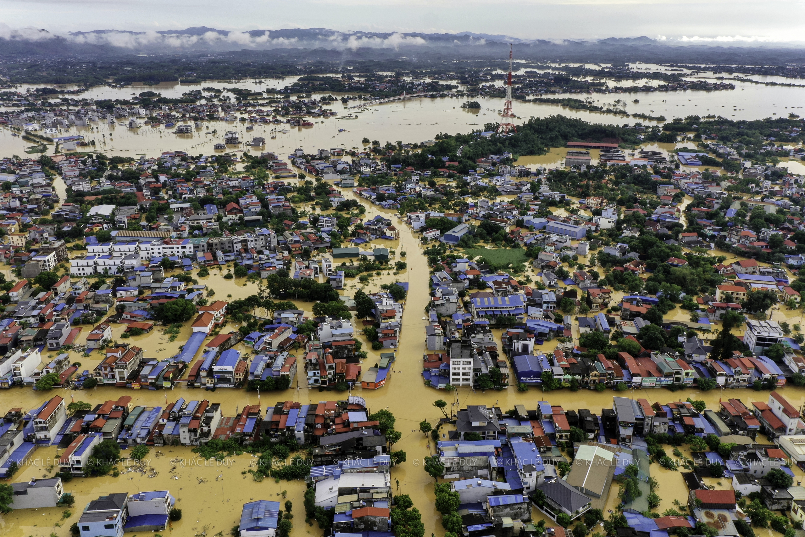
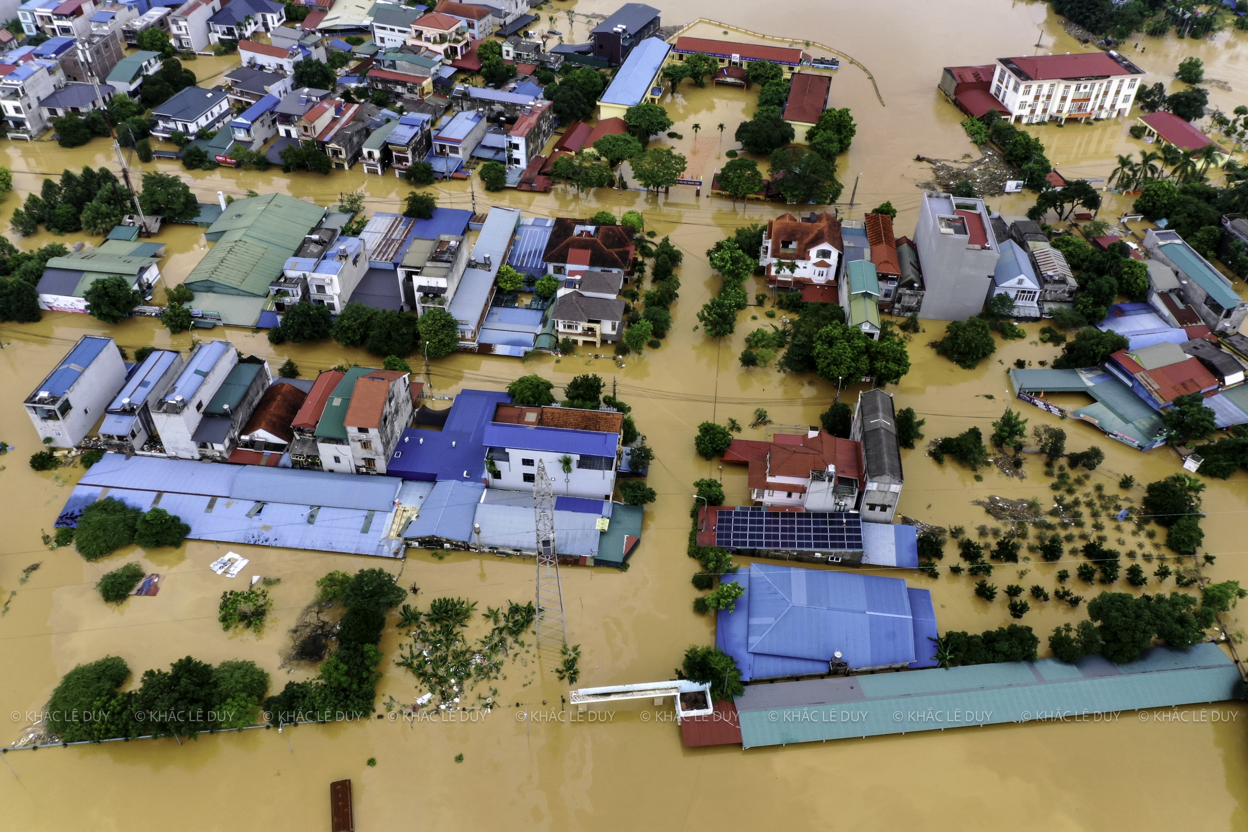
Gia Sang intersection area
Photo: Le Duy Khac
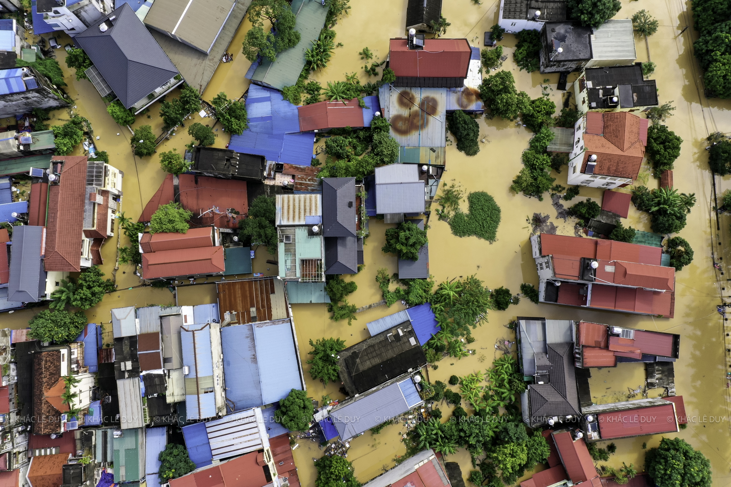
Many households were flooded up to the roof.
Photo: Le Duy Khac
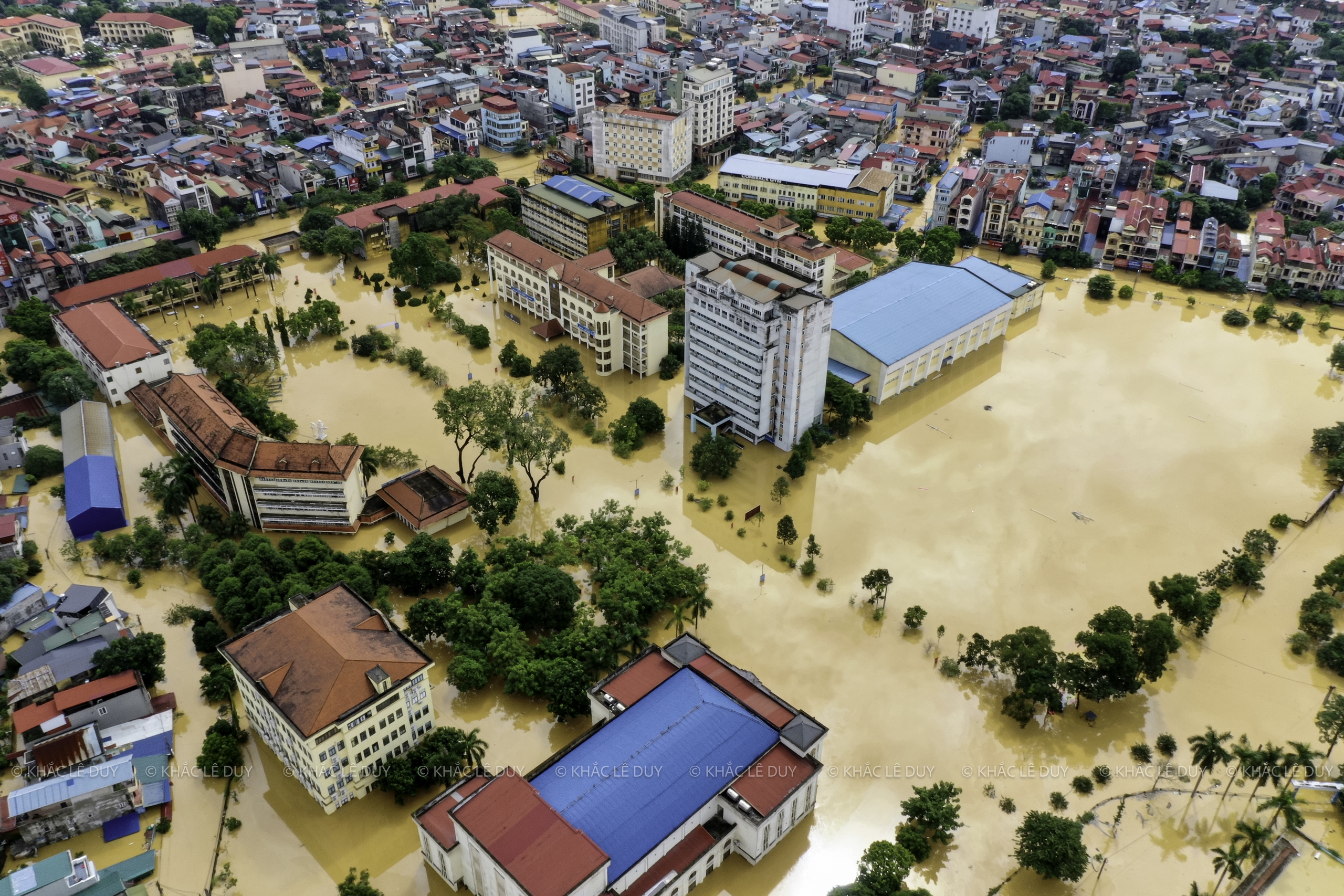
Floodwaters flooded into all the alleys and streets in the central area of Thai Nguyen province.
Photo: Le Duy Khac
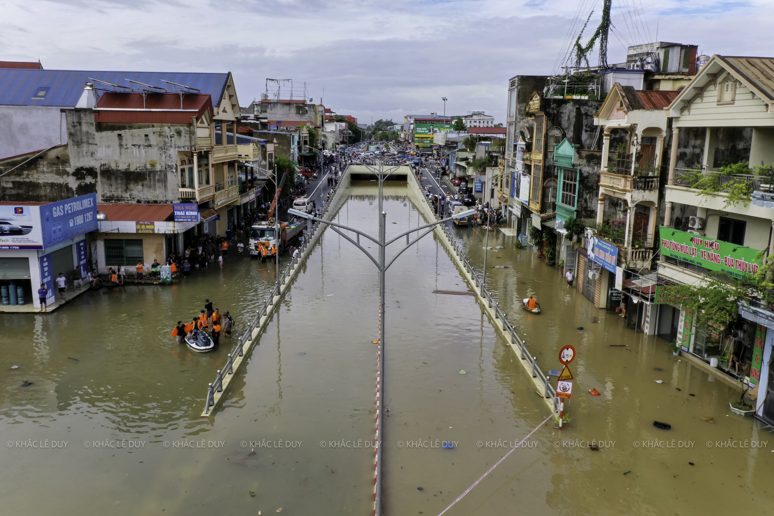
Water flooded almost to the roof of the underpass.
Photo: Le Duy Khac
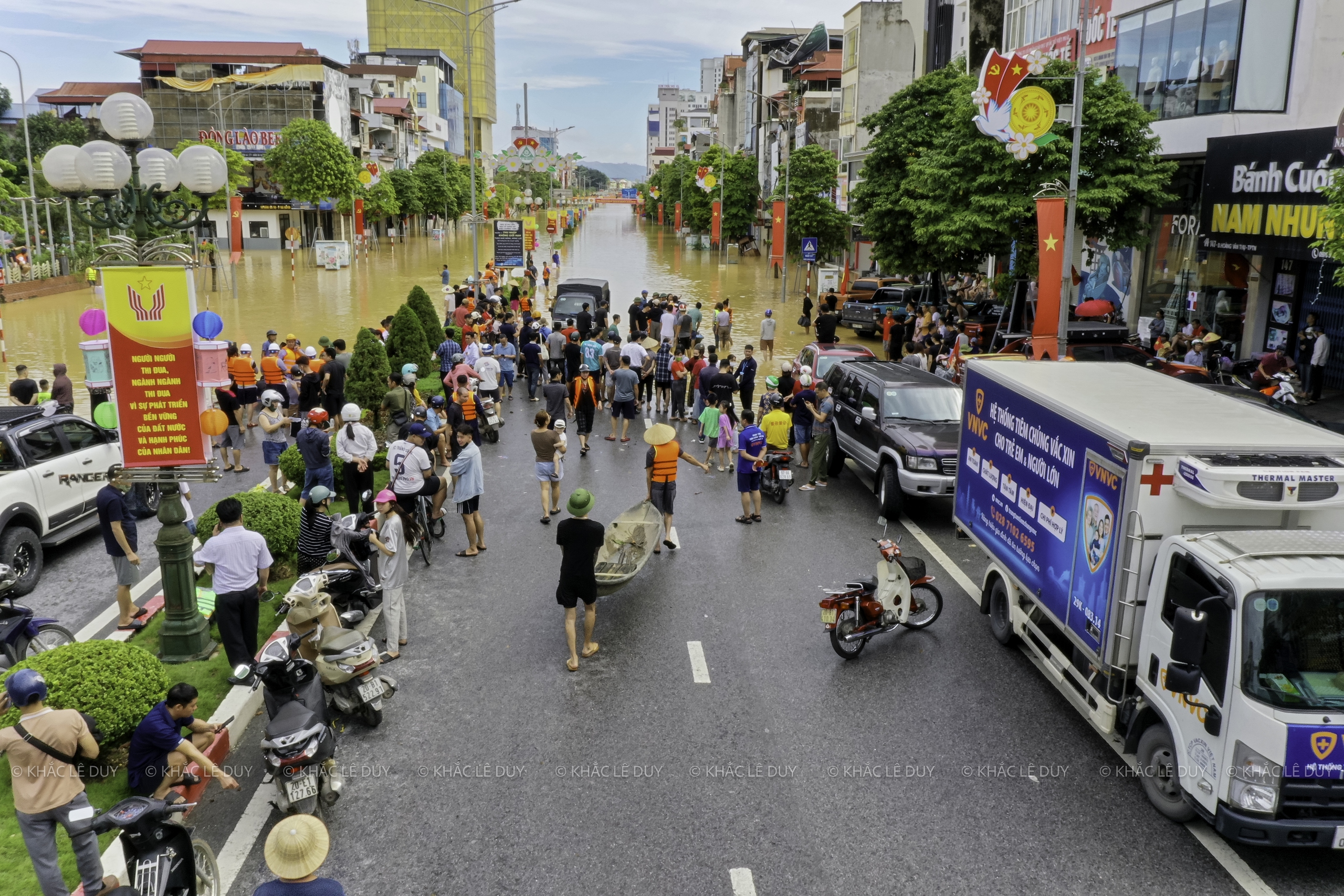
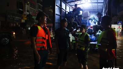
People and rescue forces standing on Hoang Van Thu street
Photo: Le Duy Khac
Immense sea on all central routes of Thai Nguyen province
Photo: Le Duy Khac
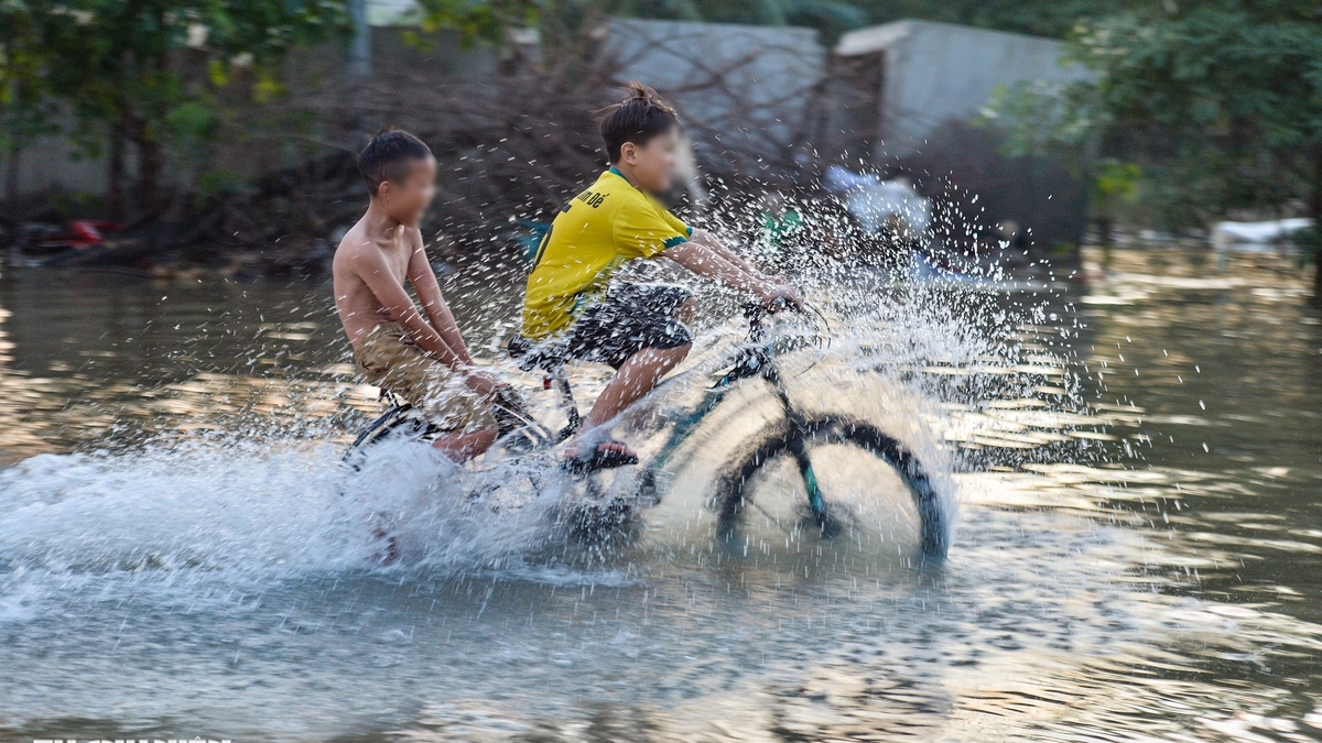
Thai Nguyen people suffer from floods, broken legs cannot go to hospital
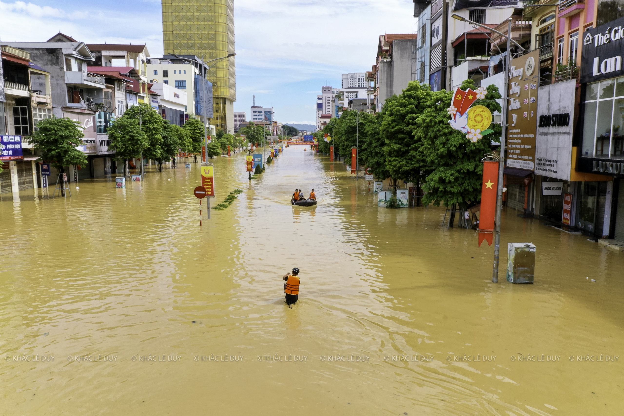
Flood water almost reached Gia Bay bridge
Photo: Le Duy Khac
Thai Nguyen people are still struggling to escape the flood.
Photo: Le Duy Khac
Thai Nguyen University of Education campus
Photo: Le Duy Khac
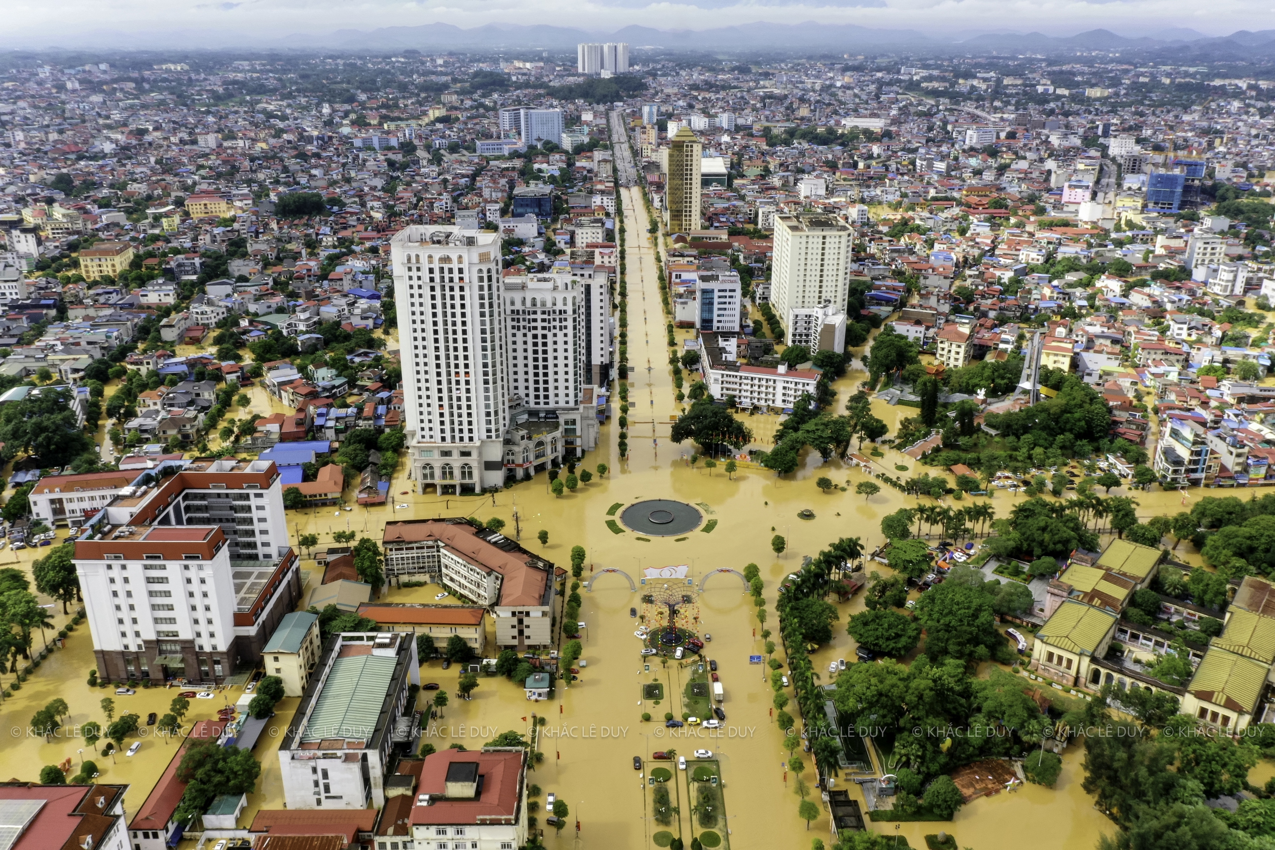
Central area of old Thai Nguyen city
Photo: Le Duy Khac

According to forecasts, Thai Nguyen may be flooded for another 3-4 days.
Photo: Le Duy Khac
Thanhnien.vn
Source: https://thanhnien.vn/lu-lich-su-o-thai-nguyen-anh-tu-tren-cao-nuoc-ngap-bua-vay-khap-noi-185251008141012268.htm
![[Photo] Impressions of the Can Gio Whale Festival](https://vphoto.vietnam.vn/thumb/1200x675/vietnam/resource/IMAGE/2025/10/09/1759984089762_image12334-5642-jpg.webp)

![[Photo] Prime Minister Pham Minh Chinh chairs the Conference to deploy the National Target Program on Drug Prevention and Control until 2030](https://vphoto.vietnam.vn/thumb/1200x675/vietnam/resource/IMAGE/2025/10/09/1759990393779_dsc-0495-jpg.webp)


![[Photo] Impressions of the Can Gio Whale Festival](https://vphoto.vietnam.vn/thumb/402x226/vietnam/resource/IMAGE/2025/10/09/1759984089762_image12334-5642-jpg.webp)


Comment (0)