
 |
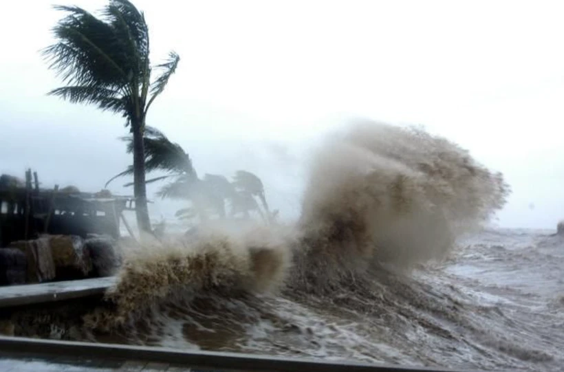
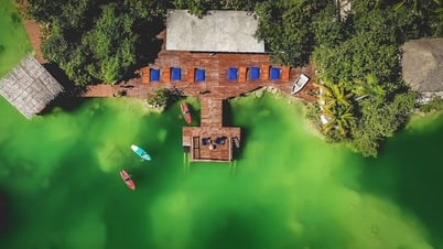
| Storms may appear in late May or early June. Photo source: VNA |
Sharing with reporters, Mr. Mai Van Khiem noted that just one strong storm making landfall is enough to cause serious damage, so response preparations must always be proactive.
Storms may appear in late May
* First, could you please give us your assessment of the storm season in 2025?
- Currently, it is still quite early to make a detailed and certain forecast for the entire 2025 storm season, because there are many uncertain factors that influence storm activity, such as ENSO (the phenomenon of anomalous warming of the surface sea water - El Nino and the phenomenon of anomalous cooling of the surface sea water - La Nina), monsoon, intraseasonal oscillation (MJO), the activity of subtropical air pressure systems, sea surface temperature...
Several factors can change very rapidly on time scales ranging from days to weeks and will determine the intensity and trajectory of any particular storm.
However, based on initial information and long-term forecast models, some preliminary observations can be made that with the current neutral ENSO state, the 2025 hurricane season in the South China Sea and Northwest Pacific is likely to be approximately the multi-year average in both number and intensity.
Average here does not mean no danger, but the number of storms and tropical depressions may not be as high as in strong La Nina years, or as low as in strong El Nino years. However, it should be noted that storm activity is less clearly influenced by ENSO.
Specifically, unlike El Nino years (where storms tend to form and operate further east, with less direct impact on Vietnam) or La Nina years (where storms tend to form and operate closer to the East Sea, with more impact on Vietnam), neutral years often do not have a clear scenario.
This could lead to more diverse and unpredictable storm trajectories, with storms forming in different regions and having more complex paths because they are not strongly influenced by large-scale patterns associated with ENSO.
Hurricane activity is not as concentrated. Hurricanes may occur more sporadically throughout the season, rather than peaking in a few months as during strong El Nino and La Nina phases.
The 2025 hurricane season may not have the same extremes as strong ENSO years, but the unpredictability of its trajectory and intensity may increase. Neutral ENSO conditions create a “stage” where there is no “main actor” (El Nino or La Nina) that dominates the entire play. The “supporting actors” (regional, intra-seasonal, and specific weather patterns at each time) will have more room to play, making the development more diverse and unpredictable.
* So with the above ENSO trend, in your opinion, when and where is the first storm likely to appear in 2025?
- According to the climate law, the first storm or tropical depression in the Northwest Pacific region usually appears around May or June. Although sometimes tropical cyclones form earlier (even from January to April), they are usually weak and less likely to affect the mainland of Vietnam.
With current ENSO neutral conditions, there are no significant factors pushing or holding back the arrival of hurricanes earlier or later than the multi-year average. Therefore, the forecast has a high probability of the first hurricane appearing in late May or June 2025.
Early season typhoons usually form in the East and Southeast of the Philippines, then tend to move west or west-northwest. The possibility of forming a typhoon in the East Sea during the early season (May-June) is lower than that of a typhoon moving from the Philippines into the East Sea. The most potential area is the East Philippine Sea (about 10-15 degrees North latitude).
I want to emphasize that this is a forecast based on climate laws and initial conditions. Depending on specific weather conditions, disturbances may form, which may lead to storms or tropical depressions.
Current accurate forecasts from models are usually only reliable for less than a week. The National Center for Hydro-Meteorological Forecasting will continuously monitor and update when there are signs of tropical cyclone formation.
What should people pay attention to?
* Given the storm development trend as you analyzed above, what recommendations does the National Center for Hydro-Meteorological Forecasting have for localities, especially people, to proactively respond and minimize damage that storms may cause?
- In my opinion, the core principle is not to be subjective even though the forecast for the storm season is at the average level of many years. Just one strong storm making landfall is enough to cause serious damage. Response preparation must always be proactive.
Therefore, functional agencies and local authorities need to update disaster prevention and search and rescue plans in accordance with the actual situation of the locality, paying special attention to scenarios of strong storms, storms with complex trajectories, and storms causing heavy rain. Along with that, it is necessary to organize inspections and safety assessments of reservoirs, dikes, drainage systems, and coastal construction works during the rainy and stormy season, ensuring the ability to withstand storms and floods.
In addition, functional agencies and local governments also need to strengthen information and propaganda work to the people about storm prevention measures in many diverse and easy-to-understand forms; especially, it is necessary to promote the integration and dissemination of early warning forms based on new technology.
People need to closely monitor storm forecasts and warnings from hydrometeorological agencies through traditional channels and disaster warning applications on mobile phones (if available locally); need to check and reinforce houses (roofs, windows, doors); trim large tree branches near the house that are at risk of falling when there is a storm warning; have a plan to move to a safe place if there is an evacuation order.
People should also prepare essential items (flashlights, spare batteries, drinking water, dry food, medicine, important documents) enough for several days. To ensure safety, people should absolutely not go out when the storm is making landfall. Stay away from dangerous areas such as river banks, coastlines, low-lying areas, places at risk of landslides; be on guard against accidents caused by electric shock, falling trees, flying objects, etc.
After the storm, people need to check their homes for safety before returning.
In addition, in the coming time, people need to pay attention to and regularly monitor forecast and warning information on the website of the National Center for Hydro-Meteorological Forecasting at nchmf.gov.vn and provincial, municipal and regional hydro-meteorological stations; regularly update the latest hydro-meteorological forecast information on the official mass media of the Central and local levels.
* Thank you very much!
Source: https://baophuyen.vn/xa-hoi/202505/mua-bao-nam-2025-bao-co-the-hinh-thanh-o-nhieu-khu-vuc-voi-quy-dao-phuc-tap-1f93d81/


Comment (0)