
 |
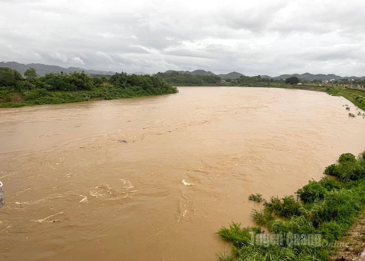
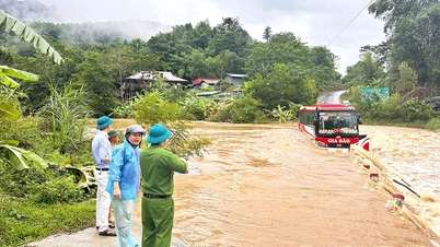
| Lo River water level is rising rapidly, level 2 warning is very dangerous. |
Specifically, the water level of the Lo River is being measured in some inner-city wards at 18.01 m, 10 m lower than the flood peak in 2024; the Gam River in Na Hang is 57 m. Currently, the Tuyen Quang hydropower reservoir is continuously discharging 7 floodgates plus the continuously increasing rainfall, the water level of the rivers is likely to continue to rise with an amplitude of 2-5 m.
Forecast in Bac Me peaks at level 3 and then slowly decreases; in Chiem Hoa peaks above level 3 by 3-4m (level 3: 38.5m), in Na Hang peaks above level 3 by 1-2m (level 3: 57.0m), then changes depending on the discharge flow of Tuyen Quang hydropower plant. The water level of Lo River in inner-city wards is likely to rise from 3.0-5.0m; on Lo Gam River, the rising, strong flow causes flooding in low-lying areas along the river with a common flooding depth of 3.0-5.0m (upstream and downstream of Tuyen Quang hydropower dam, in some places over 7m (time and depth of flooding depend on the flow and opening time of floodgates of Tuyen Quang hydropower plant) and there is a risk of landslides in riverside areas, river banks and beaches, especially in areas with steep slopes and unstable soil structure). In Yen Son, Nhu Khe and My Lam communes, flooding occurred with a common depth of 1-3m, in some places over 4m.
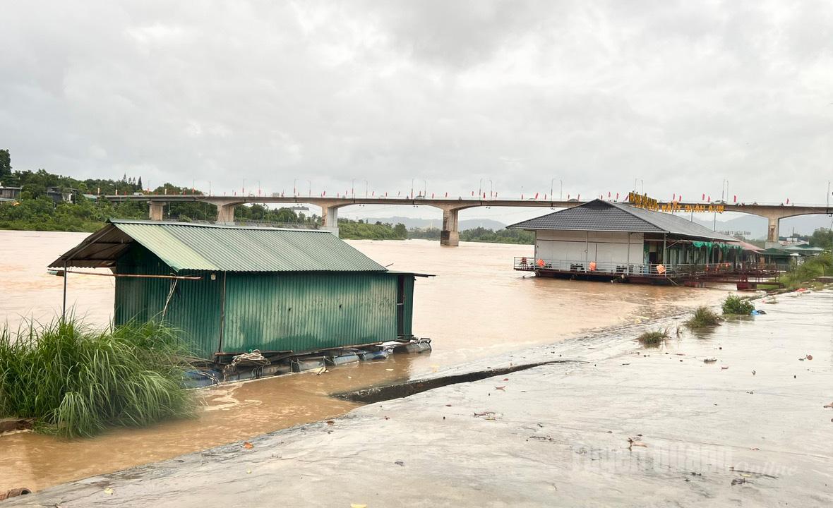 |
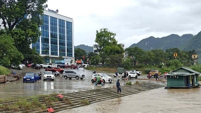
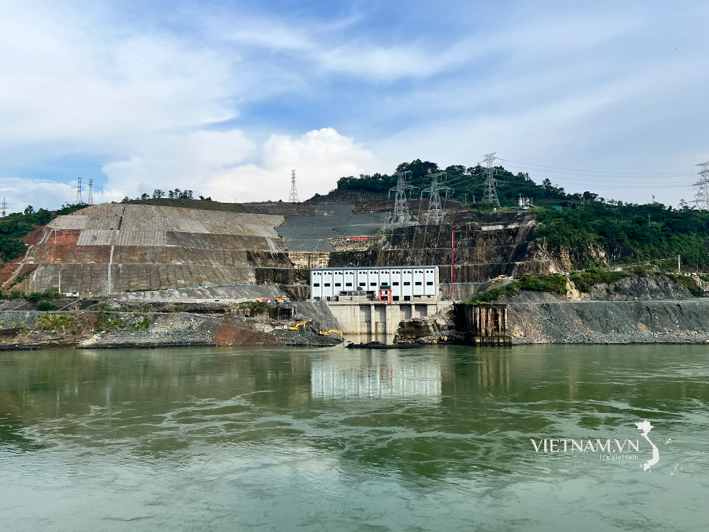
| Water level on the morning of September 30 at Lo River, Minh Xuan ward area. Photo by Viet Hoa |
Floods are inundating low-lying areas along the river, affecting the lives and activities of riverside residents, waterway traffic, surface water exploitation works, dyke works, floating houses and cages for aquaculture, and agricultural production along rivers and streams. The flood situation is still very complicated. Tuyen Quang Newspaper, Radio and Television will continue to update information.
PV
Source: https://baotuyenquang.com.vn/xa-hoi/202509/muc-nuoc-song-lo-song-gam-dang-o-muc-bao-dong-cap-2-cap-3-cap-rat-nguy-hiem-5f37ced/

![[Photo] President Luong Cuong receives President of the Cuban National Assembly Esteban Lazo Hernandez](https://vphoto.vietnam.vn/thumb/1200x675/vietnam/resource/IMAGE/2025/9/30/4d38932911c24f6ea1936252bd5427fa)
![[Photo] Solemn opening of the 12th Military Party Congress for the 2025-2030 term](https://vphoto.vietnam.vn/thumb/1200x675/vietnam/resource/IMAGE/2025/9/30/2cd383b3130d41a1a4b5ace0d5eb989d)
![[Photo] Panorama of the cable-stayed bridge, the final bottleneck of the Ben Luc-Long Thanh expressway](https://vphoto.vietnam.vn/thumb/1200x675/vietnam/resource/IMAGE/2025/9/30/391fdf21025541d6b2f092e49a17243f)
![[Photo] General Secretary To Lam, Secretary of the Central Military Commission attends the 12th Party Congress of the Army](https://vphoto.vietnam.vn/thumb/1200x675/vietnam/resource/IMAGE/2025/9/30/9b63aaa37ddb472ead84e3870a8ae825)
![[Photo] The 1st Congress of Phu Tho Provincial Party Committee, term 2025-2030](https://vphoto.vietnam.vn/thumb/1200x675/vietnam/resource/IMAGE/2025/9/30/1507da06216649bba8a1ce6251816820)


Comment (0)