

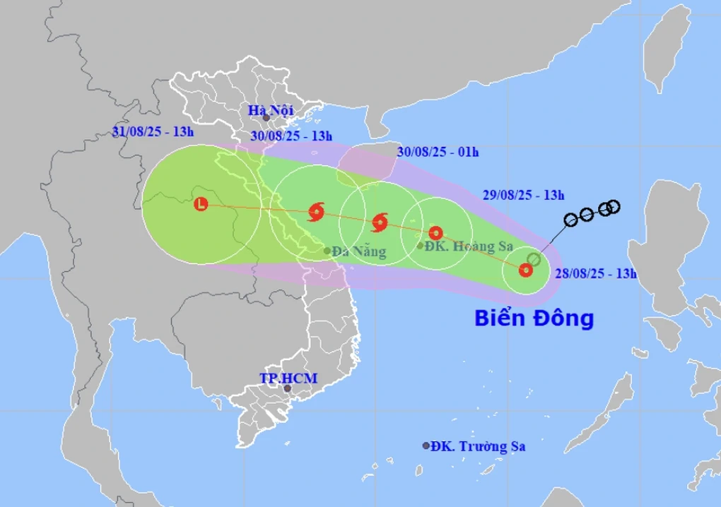
Tropical depression likely to strengthen into storm on August 30. (Photo: NCHMF).
At 1:00 p.m. on August 28, the center of the tropical depression was operating in the North East Sea, about 420km East Southeast of Hoang Sa special zone, level 6-7 (39-61km/h), gusting to level 9, moving southwest at a speed of about 10-15km/h.
It is forecasted that at around 1:00 p.m. on August 29, the tropical depression will be at level 7, gusting to level 9, in the Hoang Sa special zone sea area and is likely to strengthen further.
At 1:00 a.m. on August 30, the tropical depression is likely to strengthen into a storm with a level 8 intensity, gusting to level 10, in the sea northwest of Hoang Sa special zone.
Due to the influence of the tropical depression (which may strengthen into a storm), the North East Sea area (including Hoang Sa special zone), the western sea area of the North East Sea area (including Hoang Sa special zone), and the sea area from Thanh Hoa to Da Nang will have strong winds of level 6-7, the area near the storm center will have strong winds of level 8, gusting to level 10; waves 2-5m high; rough seas.
The Central and Southern East Sea area (including Truong Sa special zone) has strong southwest winds of level 6-7, gusting to level 8-9; waves 2.0-3.5m high, rough seas. The sea area from Khanh Hoa to Ho Chi Minh City has strong southwest winds of level 6, gusting to level 7-8; waves 2.0-3.5m high; rough seas.
Ships operating in dangerous areas are susceptible to storms, whirlwinds, strong winds and large waves.
Level of natural disaster risk due to strong winds at sea: level 2; in the eastern sea area of the North East Sea, level 3.
LP
Source: https://baothanhhoa.vn/ngay-30-8-ap-thap-nhiet-doi-co-the-manh-len-thanh-bao-tren-bien-259891.htm
![[Photo] Red flag with yellow star flutters in France on National Day September 2](https://vphoto.vietnam.vn/thumb/1200x675/vietnam/resource/IMAGE/2025/8/28/f6fc12215220488bb859230b86b9cc12)
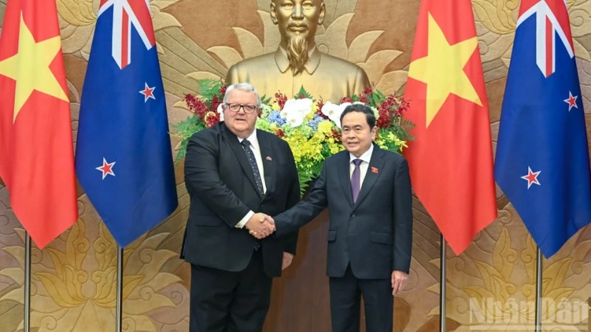
![[Photo] Prime Minister Pham Minh Chinh meets with Speaker of the New Zealand Parliament Gerry Brownlee](https://vphoto.vietnam.vn/thumb/1200x675/vietnam/resource/IMAGE/2025/8/28/cec2630220ec49efbb04030e664995db)
![[Photo] Politburo works with the Standing Committee of Cao Bang Provincial Party Committee and Hue City Party Committee](https://vphoto.vietnam.vn/thumb/1200x675/vietnam/resource/IMAGE/2025/8/28/fee8a847b1ff45188749eb0299c512b2)
![[Photo] General Secretary To Lam attends the opening ceremony of the National Achievements Exhibition](https://vphoto.vietnam.vn/thumb/1200x675/vietnam/resource/IMAGE/2025/8/28/d371751d37634474bb3d91c6f701be7f)
![[Photo] General Secretary To Lam presents the 45-year Party membership badge to comrade Phan Dinh Trac](https://vphoto.vietnam.vn/thumb/1200x675/vietnam/resource/IMAGE/2025/8/28/e2f08c400e504e38ac694bc6142ac331)


Comment (0)