
Scary omens hidden in strange clouds that few people know about
Thursday, September 19, 2024 21:28 PM (GMT+7)
Behind the strange beauty of dragon scale clouds, nacreous clouds, tsunami clouds... are worrying signs for humans about weather and climate change.
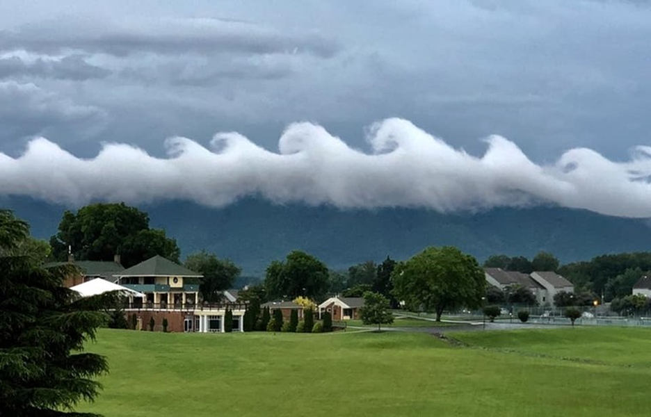
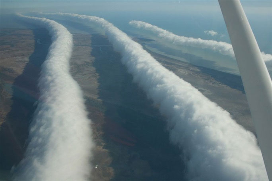
Tsunami clouds: This phenomenon is called "Kelvin-Helmholtz" cloud waves, which occur when there are two different wind layers at two different heights moving at two different speeds.
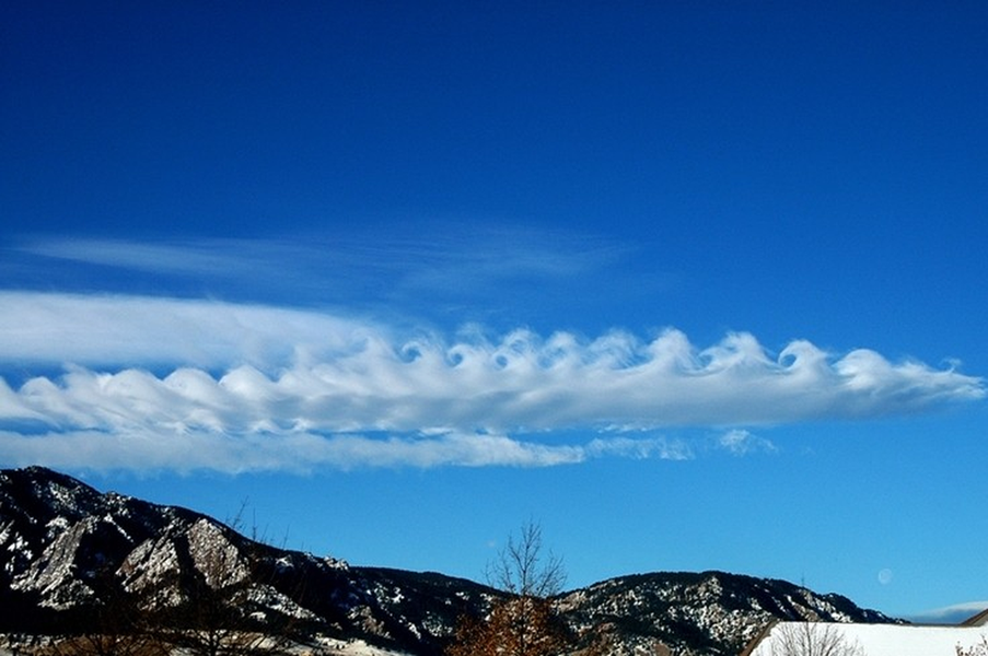
When the upper layer of wind moves at a greater speed than the lower layer of wind, it causes the upper part of the cloud to form a wave-like shape. An easy example to explain this phenomenon is when a strong wind blows over a slow-moving sea, it creates waves.
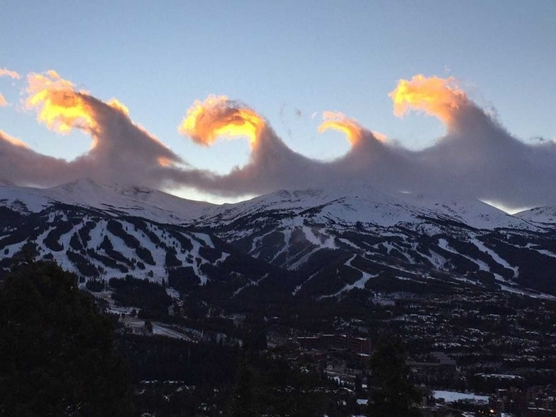
The phenomenon is named after two meteorologists, Lord Kelvin and Hermann von Helmholtz, who studied the causes behind the wave-shaped clouds in the 1800s.
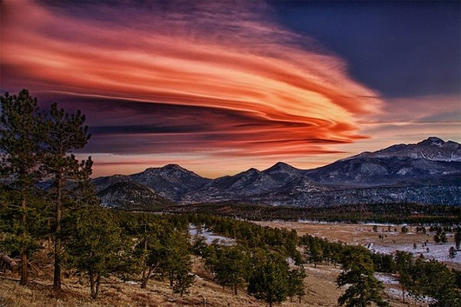
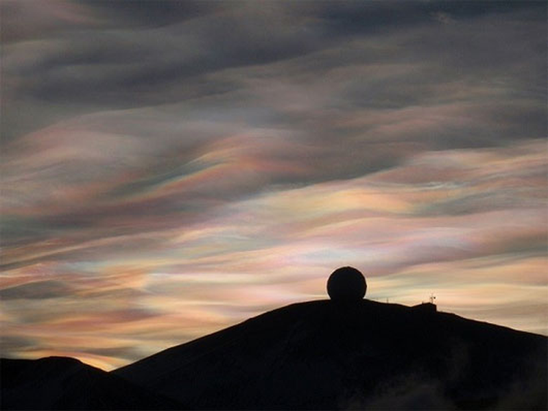
Lenticular clouds are rare and usually occur along high mountain ranges and on leeward slopes, especially when there is a steady flow of dry, moist air passing over the mountain or hill. As the moist air is pushed up and reaches a saturation point, it condenses into clouds. Lenticular clouds have a fluffy, layered appearance, resembling flying saucers from a distance.
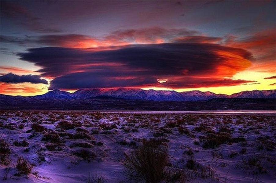
However, few people know that the appearance of these clouds is a warning sign of changes in the weather such as storms and floods. They usually exist for about 10 - 15 minutes before the weather changes occur. At this time, the sky may appear to have ripples both vertically and horizontally, depending on the height of the clouds.
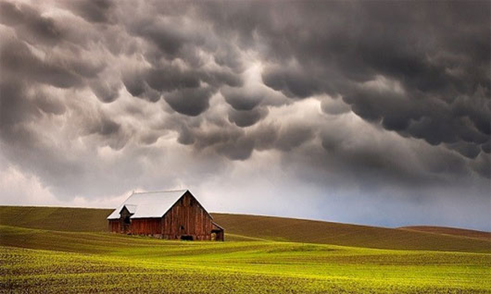
Mammatus clouds, or “dragon scale clouds,” are a meteorological term for the strange spherical clouds found around the world . These bumpy clouds are made up of many small cloud pockets that come together to form a large, floating, dense cloud mass that stretches hundreds of meters into the sky. These cloud pockets overlap and intertwine, making them resemble the bulging biceps of a giant bodybuilder.
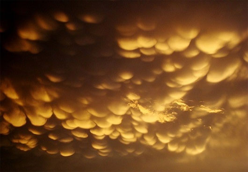
According to astronomers, Mammatus clouds are a sign of severe thunderstorms, accompanied by lightning in the hot, warm weather months. Because the movement of the air layer when Mammatus clouds is extremely complex and violent, airlines recommend that aircraft should not operate in this cloudy weather area.
According to astronomers, Mammatus clouds are a sign of severe thunderstorms, accompanied by lightning in the hot, warm weather months. Because the movement of the air layer when Mammatus clouds is extremely complex and violent, airlines recommend that aircraft should not operate in this cloudy weather area.
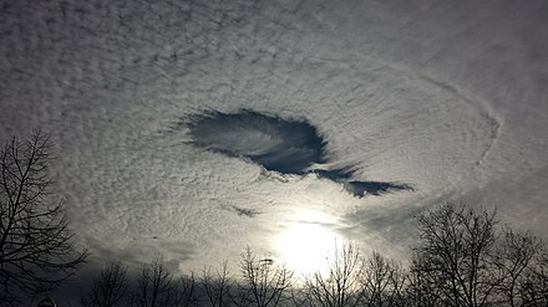
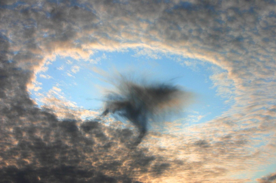
When part of a cloud begins to freeze, it causes a domino effect, causing the water vapor around it to also freeze and fall. This creates a hole, usually circular, in the middle of the cloud.

One hypothesis is that disturbances in the cloud layer (caused by aircraft) can trigger a chain reaction of evaporation and create cloud holes.
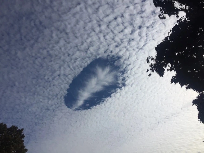
Experts say the cloud hole phenomenon could be a sign of global climate change, increasing the likelihood of snowfall in areas with cloud holes. However, some scientists remain skeptical about this issue.
Roll clouds are low, horizontal clouds that roll across the sky like a column. They are rare but can appear anywhere, depending largely on the wind circulation. The skies over Queensland, Australia are a common place for roll clouds, especially around October due to the influence of sea breezes from the Cape York Peninsula.
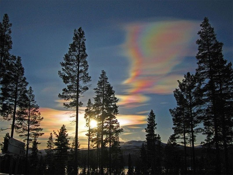
Nacreous Clouds are a type of cloud that forms in extremely cold areas of the lower stratosphere, at altitudes of 15,000 - 25,000m. As described, nacreous clouds look like thin membranes, rolled up and then unfurled, spread out and then suddenly contracted in the twilight sky. In extremely low temperature conditions (-78 degrees Celsius), clouds of many different types are formed, classified according to their physical state and chemical composition.
This phenomenon is believed to be a direct result of humans releasing too much methane into the air, which reacts with ozone to form chlorine clouds. The appearance of nacreous clouds is a worrying sign that the Earth is warming.
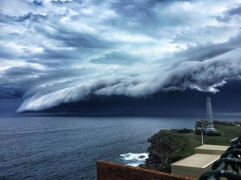
The phenomenon of "tsunami clouds" (also known as cloud shelves) often appears before a storm hits. The large clouds often stretch several kilometers long, covering the entire sky. The special natural phenomenon looks scary like rolling ocean waves, often appearing before storms and storms.
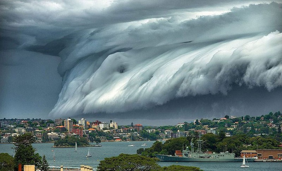
This type of cloud usually forms along the leading edge of a thunderstorm. It is a sign of a strong storm. The cloud band will cause heavy rain and lightning in the areas where it appears.
PV (according to ANTĐ)
Source: https://danviet.vn/nhung-diem-bao-dang-so-an-trong-cac-dam-may-doc-la-it-nguoi-biet-2024091921212095.htm


![[Maritime News] More than 80% of global container shipping capacity is in the hands of MSC and major shipping alliances](https://vphoto.vietnam.vn/thumb/402x226/vietnam/resource/IMAGE/2025/7/16/6b4d586c984b4cbf8c5680352b9eaeb0)


Comment (0)