
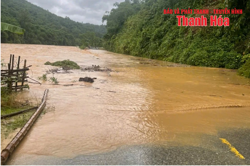
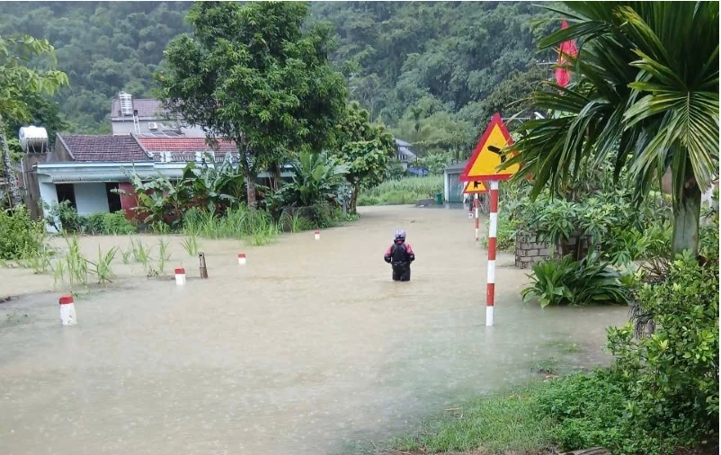
4km of National Highway 15C flooded
According to information from the Forward Command in the central mountainous region, due to the impact of storm No. 5, many sections of National Highway 15C were flooded since 6:00 a.m. on August 26.
National Highway 15C flooded (section km14+700)
Specifically, due to prolonged heavy rain, the rising water level of the Luong River caused flooding, cutting off National Highway 15C. The flooded road section is about 4km long, from Km10+500 to Km14+700, in Nam Xuan commune.
According to initial observations, the flooded road is about 50-80cm deep. Meanwhile, the water level of the Luong River continues to rise.
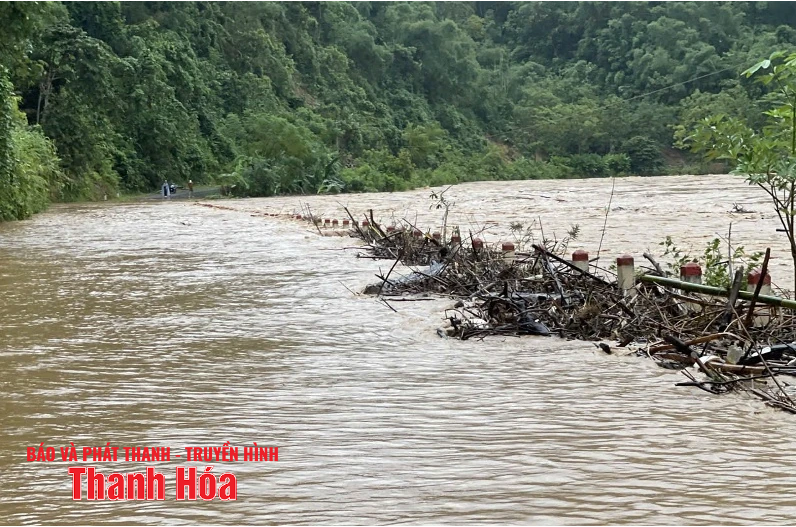
The flooded road is at km10+500.
The Department of Construction has directed the units in charge of managing the road to block traffic through the flooded section. Meanwhile, the local authorities have assigned forces to stand guard, preventing people and vehicles from entering the dangerous area.
The authorities have also informed the authorities of communes in the old Muong Lat district to notify people and businesses to proactively direct traffic along National Highway 16 if needed, to ensure safety.
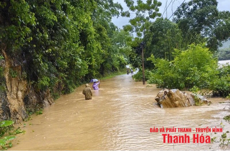
Flooded National Highway 15 through Nam Xuan commune.
At Km43+500-Km44+200/QL.47 Tho Phu commune, the water level is 0.4m deep, causing traffic jams. At Km14+500-Km14+600/QL.15 Nam Xuan commune, the water level is 0.7m deep and causing traffic jams. At Mun bridge Km92+660/QL.217 Ba Thuoc commune, the water level is 0.3m deep, causing traffic jams.
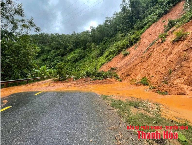
Landslide on National Highway 15 through Pu Nhi commune.
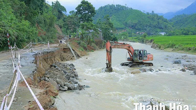
Landslides and flooding on national highways and provincial roads
On the national highways, there were landslides on the positive slope at 6 locations, with a volume of about 10,000m 3 . Of which, on Highway 16 At Km8+250 in Trung Son commune, Km27+300 in Muong Ly commune, Km70+080 and Km73+00 in Hien Kiet commune; National Highway 15C at Km91+750 in Pu Nhi commune currently has continuous landslides causing safety risks for people and vehicles. Currently, the landslide causing traffic jam at Km55+390-Km55+420/QL.15 in Hoi Xuan commune has been opened to traffic.
On provincial roads, heavy rain caused flooding at 14 locations causing traffic jams , sections passing through the communes of Thang Binh, Kim Tan, Thuong Xuan, Luan Thanh, Van Xuan, Hoa Quy, Ngoc Trao, Quy Luong, Thanh Ky, Tam Van... Currently, due to the location of the overflow on the roads being deeply flooded, causing traffic jams; therefore, the road management unit has not yet approached the location to ensure traffic and handle the cleaning.
Heavy rains caused flooding on Provincial Road 521B through Ba Thuoc Commune.
When the flood occurred, the Thanh Hoa Department of Construction directed the Maintenance Management Board and road management units to urgently deploy inspections, reviews, updates, and reports on damage on the roads to promptly direct units to immediately implement handling measures and ensure traffic, such as: cutting trees, clearing sediment, placing warning signs, barricades at landslides, slides, deep flooded roads, etc. At the same time, coordinate with local authorities to organize propaganda, arrange guards, guide traffic, etc. to ensure safety for people and vehicles traveling on the route. Therefore, in addition to the above-mentioned locally blocked landslides and overflows; landslides and damage on national highways and provincial roads have been handled to ensure smooth and safe traffic up to the time of reporting.
Source: https://sxd.thanhhoa.gov.vn/thong-tin-hoat-dong-nganh/sat-lo-nhieu-tuyen-giao-thong-quoc-lo-15c-bi-chia-cat-604013
![[Photo] Prime Minister Pham Minh Chinh chairs the 14th meeting of the Steering Committee on IUU](https://vphoto.vietnam.vn/thumb/1200x675/vietnam/resource/IMAGE/2025/9/23/a5244e94b6dd49b3b52bbb92201c6986)


![[Photo] Editor-in-Chief of Nhan Dan Newspaper Le Quoc Minh received the working delegation of Pasaxon Newspaper](https://vphoto.vietnam.vn/thumb/1200x675/vietnam/resource/IMAGE/2025/9/23/da79369d8d2849318c3fe8e792f4ce16)


Comment (0)