
.png)
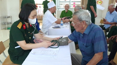
According to the forecast of the Hai Phong City Hydrometeorological Station, due to the influence of super typhoon Ragasa (typhoon No. 9), the northern sea area of the North East Sea will have strong winds of level 10 - 14, the area near the center of the super typhoon will have winds of level 15 - 17, gusts above level 17, waves over 10 m high; rough seas.
From September 24, the eastern sea area of Bac Bo Gulf (including Bach Long Vy special zone) will have winds gradually increasing to level 6 - 7, gusting to level 9. From the evening and night of September 24, the Bac Bo Gulf area (including Bach Long Vy special zone, Cat Hai special zone, Lan Ha Bay, Hon Dau Island) will have winds gradually increasing to level 8 - 9, waves 2 - 4 m high, the area near the storm center will have winds of level 10 - 12, gusting to level 14, waves 4 - 6 m high; the sea will be very rough.
From early morning on September 25, coastal waters of Hai An, Dong Hai, Nam Trieu, Do Son, Nam Do Son, Duong Kinh wards, Chan Hung, Hung Thang, Kien Hai communes had winds gradually increasing to level 6 - 7, then increasing to level 8, near the storm center level 9 - 10, gusting to level 12.
On land, from early morning on September 25, communes and wards located deep inland of Hai Phong city have had strong winds of level 6 - 7, gusting to level 8 - 9.
Forecasting the impact of strong winds, all vessels, anchorages, aquaculture areas, sea dykes and other activities in the above sea areas are at very high risk of being affected by storms, whirlwinds, strong winds and big waves.
Strong winds break trees, damage houses, traffic works and infrastructure, endangering human lives.
The coastal areas of Hai Phong city have storm surges of 0.5-1.0m high. There is a high risk of landslides, sea dykes, and destruction of aquaculture areas and ships and boats anchored along the coast due to strong winds, rising sea levels, and large waves.
From the night of September 24 to September 26, the sea area of Bach Long Vi special zone will have heavy to very heavy rain with common rainfall from 150-200mm.
From the night of September 24 to September 26, the sea area of Cat Hai special economic zone - Lan Ha bay, the sea area of Hon Dau island, Nam Do Son ward, Do Son ward will have heavy rain with common rainfall from 100 - 150mm, locally over 150mm.
From the night of September 24 to September 26, inland areas will have moderate to heavy rain. Forecast locations: Thuy Nguyen, Le Chan, Hai An, Duong Kinh, An Duong, An Lao, Kien An, Tien Lang, Vinh Bao) with average rainfall of 80 - 130mm. Forecast locations: Hai Duong , Chi Linh, Thanh Ha, Kim Thanh, Ninh Giang, Thanh Mien, Cam Giang, Kinh Mon and Tu Ky with average rainfall of 70 - 120mm.
Due to the influence of the wide storm circulation, it is necessary to guard against the risk of thunderstorms, tornadoes and strong gusts of wind both before and during the storm. Thunderstorms and heavy rain can overload urban drainage systems, causing flooding in residential areas, traffic jams due to flooded roads and reduced visibility when driving, causing slippery roads and traffic accidents. Thunderstorms can be accompanied by tornadoes, lightning and strong gusts of wind that can break trees, damage houses, traffic works and infrastructure. Heavy rain in a short period of time can cause landslides in mountainous areas, flooding urban areas and low-lying areas.
PVSource: https://baohaiphong.vn/sieu-bao-ragasa-anh-huong-nhu-the-nao-toi-hai-phong-521576.html


![[Photo] Prime Minister Pham Minh Chinh attends the groundbreaking ceremony of two key projects in Hai Phong city](https://vphoto.vietnam.vn/thumb/1200x675/vietnam/resource/IMAGE/2025/9/27/6adba56d5d94403093a074ac6496ec9d)


Comment (0)