Geographical location : Kon Tum is a mountainous, border province, located in the northern Central Highlands in geographical coordinates from 107020'15" to 108032'30" east longitude and from 13055'10" to 15027'15" north latitude.
Kon Tum has a natural area of 9,676.5 km2 , accounting for 3.1% of the national area, bordering Quang Nam province to the north (border length 142 km); Gia Lai province to the south (203 km), Quang Ngai to the east (74 km), and Laos and Cambodia to the west (sharing a common border of 280.7 km).
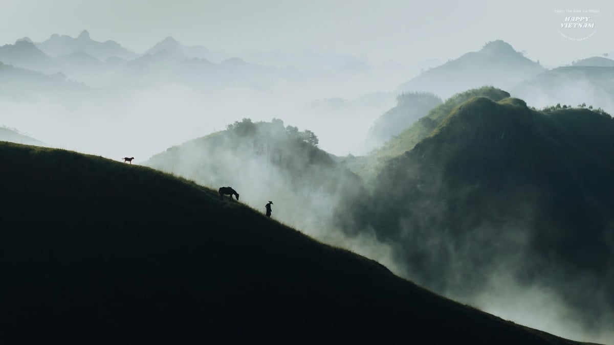
Terrain : Most of Kon Tum province is located west of Truong Son mountain range, the terrain gradually decreases from north to south and from east to west. The terrain of Kon Tum province is quite diverse: hills, plateaus and lowlands interspersed. In which:
(1) Hilly and mountainous terrain: accounts for about 2/5 of the province's total area, including continuous hills and mountains with a slope of 150 or more. The mountains in Kon Tum are made of ancient metamorphic rocks, so they have a block shape like Ngoc Linh block (with Ngoc Linh peak 2,598 m high) - the source of many rivers flowing to Quang Nam, Da Nang such as Thu Bon river and Vu Gia river; flowing to Quang Ngai such as Tra Khuc river. The continuous high mountain terrain is mainly distributed in the north - northwest running to the east of Kon Tum province. In addition, Kon Tum also has a number of mountains such as: Bon San peak (1,939 m); Ngoc Kring peak (2,066 m). The terrain is ruggedly dissected, forming narrow valleys, ravines, and streams. The hilly terrain is mainly concentrated in Sa Thay district, sloping to the west and gradually decreasing to the southwest, interspersed with the hills is the Chumomray mountain range.
(2) Valley terrain: located along the Po Ko River to the south of the province, has a trough shape that gradually decreases to the south, along the valley there are undulating hills such as Dak Uy, Dak Ha and many places have flat surfaces such as the Kon Tum city area. Sa Thay Valley is formed between the mountain ranges extending to the east along the Vietnam - Cambodia border.
(3) Highland terrain: Kon Tum province has Kon Plong plateau located between An Khe range and Ngoc Linh range with an altitude of 1,100 - 1,300 m, this is a small plateau, running in the Northwest - Southeast direction.
Climate : Kon Tum belongs to the tropical monsoon climate zone of the highlands. The average annual temperature ranges from 22 - 23 0 C, with a daily temperature range of 8 - 9 0 C.
Kon Tum has two distinct seasons: the rainy season mainly starts from April to November, the dry season from December to March of the following year. Annually, the average rainfall is about 2,121 mm, the highest annual rainfall is 2,260 mm, the lowest annual rainfall is 1,234 mm, the month with the highest rainfall is August. In the dry season, the wind is mainly from the northeast; in the rainy season, the wind is mainly from the southwest.
The average annual humidity ranges from 78 - 87%. The highest monthly humidity is August - September (about 90%), the lowest month is March (about 66%).
Minerals : Kon Tum is located on the Kon Tum uplift, so it is very diverse in geological structure and minerals. In the area, there are 21 stratigraphic units and 19 magma complexes that have been researched and established by geologists. A series of mineral types such as iron, chromium, gold, refractory materials, precious stones, semi-precious stones, radioactive metals, rare earths, raw materials for the production of construction materials, etc. have been discovered. Many areas with mineral prospects are being investigated to establish geological maps at a scale of 1/50,000, along with other specialized research projects, etc., which will be an important basis for planning the socio-economic development of the locality. Through surveys by specialized agencies, Kon Tum is currently focusing on the following types of minerals:
(1) Mineral group serving the production of construction materials: this group is very diverse, including: clay (bricks and tiles), construction sand, gravel, marble, limestone, granite, pozzolan,...
(2) The group of minerals for soundproofing, heat insulation and environmental treatment materials, including diatomite and bentonite, is mainly concentrated in Kon Tum city.
(3) Refractory mineral group: includes sillimanite, dolomite, quartzite, mainly concentrated in Dak Glei, Dak Ha, and Ngoc Hoi districts.
(4) Combustible mineral group: includes peat, mainly concentrated in Kon Tum city, Dak Ha district, Dak To district.
(5) Group of ferrous, non-ferrous, and rare metal minerals: including manganese in Dak Ha; tin, molybdenum, tungsten, uranium, and thorium, concentrated mainly in Dak To, Dak Glei, Ngoc Hoi, and Konplong; bauxite concentrated mainly in Kon Plong.
(6) Precious stone mineral group: includes ruby, sapphire, opalcalcedon concentrated in Dak To, Kon Plong.
Land resources of Kon Tum province are divided into 5 groups with 17 main soil types :
(1) Alluvial soil group: includes three main types of soil: deposited alluvial soil, patchy alluvial soil, and stream alluvial soil.
(2) Gray soil group: includes two main types of soil: gray soil on acidic magma and gray soil on ancient alluvium.
(3) Yellow soil group: includes 6 main types: yellow-brown soil on ancient alluvium, yellow-red soil on acidic magma, yellow-red soil on clay and metamorphic rock, red-brown soil on weathered basalt, light yellow soil on sandstone and purple-brown soil on basalt.
(4) Yellow humus soil group on mountains: includes 5 main soil types: light yellow humus soil with some Potzonized places, light yellow humus soil on clay and metamorphic rocks, reddish brown humus soil on basic and neutral magma, reddish yellow humus soil on acidic magma.
(5) Valley soil group: there is only one main soil type, which is valley soil with accumulating slope products.
Water resources:
(1) Surface water sources: mainly rivers and streams originating from the north and northeast of Kon Tum province, often with steep slopes, narrow valleys, and fast-flowing water, including:
- Se San River: consists of two main branches, Po Ko and Dakbla. The Po Ko branch is 121 km long, originating from the south of Ngoc Linh mountain range, flowing in the north-south direction. This branch is supplied by DakPsy stream, 73 km long, originating south of Ngoc Linh mountain from Ngoc Lay and Mang Ri communes, Dak To district. The Dakbla branch is 144 km long, originating from Ngoc Krinh mountain range.
- Other rivers and streams: the northeast of the province is the source of the Tra Khuc River flowing into Quang Ngai and the north of the province is the source of the Thu Bon and Vu Gia rivers flowing into Quang Nam and Da Nang. In addition, there is the Sa Thay River originating from the top of Ngoc Rinh Rua mountain, flowing in a north-south direction, almost parallel to the Cambodian border, flowing into the Se San River.
In general, the water quality, potential energy,... of surface water sources are favorable for the construction of hydroelectric and irrigation works.
(2) Groundwater resources: the underground water resources in Kon Tum province have potential and industrial reserves of level C2: 100 thousand m3 /day, especially at a depth of 60 - 300 m with relatively large reserves. In addition, Dak To and Konplong districts also have 9 points with hot mineral water, which can be exploited and used as soft drinks and for medical treatment.
Forests and forest resources:
(1) Forests: by 2008, Kon Tum's forestry land area was 660,341 hectares, accounting for 68.14% of the natural area. Kon Tum has the following main forest types:
- Mixed tropical closed forest with trees and broad leaves: this is a typical forest type of Kon Tum province, distributed mainly at an altitude of 500 m, found in most districts and towns in the province.
- Tropical moist deciduous forests: found mostly in the province and often distributed along rivers.
- Subtropical closed forests: distributed in high mountainous areas.
- Dry dipterocarp forest (dipterocarp forest): mainly distributed in Ngoc Hoi district, Dak Glei district (along the border of Vietnam, Laos, Cambodia).
(2) Forest resources:
- Flora: According to initial survey results, Kon Tum province has about more than 300 species, belonging to more than 180 genera and 75 families of flowering plants. Gymnosperms have 12 species, 5 genera, 4 families; angiosperms have 305 species, 175 genera, 71 families; monocotyledonous plants have 20 species, 19 genera, 6 families; dicotyledonous plants have 285 species, 156 genera, 65 families. Of which, the most numerous families are the legume family, Dipterocarpaceae family, Camphoraceae family, Castor bean family, Mimosa pudica family, Cashew family, Melaleuca family and Canarium family. In general, the vegetation in Kon Tum is diverse, showing many different types of forests in the general landscape of the tropical monsoon forest zone, with 3 different high and low belts: 600 m or less, 600 - 1,600 m and over 1,600 m. Currently, the most prominent is still the dense forest, in the dense forest there are mainly two-leaf pine, chestnut, re, pơmu, do rhododendron, chua,... at an altitude of 1,500 - 1,800 m mainly three-leaf pine, chua, chestnut, re, khao, chec,... Mentioning the forest resources in Kon Tum, we must mention the Ngoc Linh mountain area with precious medicinal plants such as Ngoc Linh ginseng, codonopsis, polygonum multiflorum and cinnamon. In recent years, Kon Tum's forest area has been reduced due to war, illegal logging and other forest products. But in general, Kon Tum is still a province with many precious wood forests and high economic value.
- Animals: very rich, diverse, including many rare species, including 165 bird species, 40 families, 13 orders, almost all bird species; 88 mammal species, 26 families, 10 orders, accounting for 88% of mammal species in the Central Highlands. Most notable are herbivores such as: elephants, wild buffalo, gaur, wild buffalo, deer, muntjac, ... Of which, elephants are abundant in the southwest of Kon Tum (Sa Thay district). Wild buffalo include: gaur (or min) scientific name Bosgaurus often appears in forests of Sa Thay and Dak To districts; Den Teng cow scientific name Bosjavanicus. In recent years, tigers have appeared in Sa Thay, Dak To, Kon Plong, this is a good sign of the existence of this precious animal species. In addition, Kon Tum forests also have sun bears, moon bears, wolves.
In addition to animals, Kon Tum also has many rare birds that need to be protected such as peacocks, crested pheasants, purple-feathered pheasants and striped pheasants. In conditions of forest encroachment, illegal hunting is increasing, and the environment is constantly changing, affecting the survival of animals, especially rare animals. Kon Tum province has planned to build primary forests and put them into national rankings to have plans for exploitation, research and protection, while promoting propaganda, education, and raising awareness of protecting animals and plants in particular, and the ecological environment in general.
Provincial Information Portal











































Comment (0)