
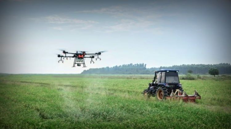
The use of drones in almost every sector of the economy is growing rapidly, but it is in agriculture that is seeing a boom.
According to the US research firm Ocean Report, the global agricultural drone market was worth $13.59 billion in 2022 and will reach $64.5 billion by 2030, with an average annual growth rate of 24.3%.
The information collected by drones can be used to make better decisions in precision agriculture systems.
In September 2023, a special experimental legal regime will be implemented in Russian regions, allowing the use of drones in various agricultural activities. This shows that the application possibilities of drones are constantly expanding.
Crop monitoring
Drones help monitor crop health by creating color maps of field and garden surfaces. In doing so, they use an indicator called NDVI (Normalized Difference Vegetation Index) – a standardized relative vegetation index that reflects the amount of plants capable of photosynthesizing. The color maps allow farmers to monitor crops as they grow and quickly identify problem areas in their fields.
Drones also use cameras to monitor crop health. The data they transmit is often more accurate than satellite data because low-flying drones don’t have to deal with interference from clouds or poor light.
Additionally, access to satellite data is generally still expensive. In Russia, there are now several companies that offer dedicated platforms that combine data from drones and create field maps that reflect various indicators.

Ground monitoring
Drones are used to monitor soil and field conditions. They map the surface of the field, allowing farmers to spot any irregularities, map out drainage systems and dry spots so they can plan and use irrigation systems more efficiently.
They also help analyze soil salinity and the amount of elements in it, including nitrogen, potassium, and phosphorus. This allows farmers to plan crops more accurately, predict yields, and allocate fertilizer.
MapWire/US company is now providing specialized software for drones that can create high-resolution field maps, as well as assess soil condition and other indicators using a set of measurement tools.
Crop
Modern drones have also begun to be used in seeding. Currently, autonomous drone seeders are mainly used in the forestry industry. Their use is of particular significance, making it possible to plant trees in hard-to-reach areas.
A team of two operators and ten drones can plant up to 400,000 trees per day. Such drones have been developed by the UK company Biocarbon Engineering.
In Chuvashia/Russia, drones have begun to be used to plant potatoes. In the Samara region/Russia, drones have also been used to sow mustard and clover in fields. A typical drone can carry up to 20kg of seeds.
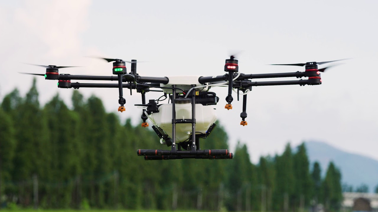
Spraying and pollinating plants
Drones can operate over fields at high speeds, even in hard-to-reach areas. For example, they can be used to spray chemicals on tea fields located at high altitudes. In particular, drones equipped with high-precision spray nozzles can target specific areas to maximize efficiency and save chemicals.
Typically, the smart drone of Precision AI/Canada company with high-resolution camera is capable of identifying and spraying pesticides in necessary areas with 96% accuracy.
Chinese company DJI offers a line of specialized Agras drones, equipped with radar, allowing spraying chemicals on crops over an area of about 40 hectares per day.
Drones can also be used to pollinate crops. Dropcopter, a US company, offers such a solution. When plants bloom, Dropcopter drones can be programmed to fly between specific rows of plants to collect pollen, which is then distributed to the areas where it is needed.
Drone pollination has been successfully tested in the US on a number of crops, including almonds, apples, cherries and pears. Over three years, crop yields have increased by 25–50%.
Pest control
Drones are not only capable of dispersing chemicals, but also of actively controlling pests in fields. For example, researchers from Wageningen University/Netherlands have introduced the PATS infrared camera system, which can distinguish moths from other flying insects based on the frequency and size of their wing beats. The drones then take to the air and kill the insects.

Security monitoring
Using drones allows you to see far corners of your fields and monitor all activities on the ground. Security drones can be used to monitor valuable crops, helping to protect them from wildlife and other threats. What’s more, the monitoring process takes just minutes instead of hours.
DMM Agri Innovation/Japan has collaborated with Niigata Prefecture to start using a drone system equipped with infrared cameras and artificial intelligence systems, allowing local farmers to protect farmland from wild boar attacks.
Drones can track animal movements even in the dark and map their activities. That data helps farmers build fences and trap animals more effectively.
Meanwhile, Chinese company DJI offers the Mavic 3 Enterprise and Mavic 3 Thermal drones with thermal imaging capabilities, which can be used to track wildlife in fields and identify fires. The Mavic 3E drones have a 20MP wide-angle camera, while the Mavic 3T has a 48MP wide-angle camera, with an effective control distance of up to 15km.
Drones using artificial intelligence
Many companies have started researching the application of artificial intelligence (AI) technology to the operation of drones used in agriculture. Among them, the Dutch startup MultiRotorResearch is researching a drone that can find its way thanks to the AI system.
Smart software will be able to calculate optimal routes for a drone flight with just three GPS coordinates on the map and the desired altitude.
In the future, drones will also be able to automatically avoid obstacles in their path, which could allow them to be used to map farmland and inspect complex agricultural structures.
(according to ReportOcean)
Source
![[Photo] Editor-in-Chief of Nhan Dan Newspaper Le Quoc Minh received the working delegation of Pasaxon Newspaper](https://vphoto.vietnam.vn/thumb/1200x675/vietnam/resource/IMAGE/2025/9/23/da79369d8d2849318c3fe8e792f4ce16)
![[Photo] Prime Minister Pham Minh Chinh chairs the 14th meeting of the Steering Committee on IUU](https://vphoto.vietnam.vn/thumb/1200x675/vietnam/resource/IMAGE/2025/9/23/a5244e94b6dd49b3b52bbb92201c6986)

![[Photo] The 1st Congress of Party Delegates of Central Party Agencies, term 2025-2030, held a preparatory session.](https://vphoto.vietnam.vn/thumb/1200x675/vietnam/resource/IMAGE/2025/9/23/e3a8d2fea79943178d836016d81b4981)
![[Photo] General Secretary To Lam meets voters in Hanoi city](https://vphoto.vietnam.vn/thumb/1200x675/vietnam/resource/IMAGE/2025/9/23/d3d496df306d42528b1efa01c19b9c1f)


Comment (0)