
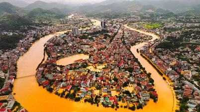
A 7.7 magnitude earthquake on March 28 with its epicenter in Myanmar shook South Asia, causing serious damage and killing many people.
This could be considered the strongest earthquake the country has suffered in about 100 years.

Devastation in Myanmar after the earthquake (Photo: Getty).
Although the epicenter was far away, thousands of kilometers away from Vietnam, the fact that many people in Hanoi and Ho Chi Minh City could clearly feel the tremors is raising many concerns.
Dan Tri reporter had an interview with Dr. Nguyen Xuan Anh, Director of the Earthquake Information and Tsunami Warning Center, Institute of Earth Sciences , Vietnam Academy of Science and Technology to clarify the impact of the earthquake, as well as Vietnam's response capacity to this natural disaster.
Vietnam once had a 6.8 magnitude earthquake.
Sir, why when the 7.7 magnitude earthquake occurred in Myanmar, many people living in Hanoi and Ho Chi Minh City felt the shaking but other areas did not feel anything?
- The feeling of earthquake vibration depends on three main factors.
First is the distance. The epicenter of this earthquake is in Mandalay, Myanmar (at coordinates 22.013 north latitude, 95.922 east longitude). This area is more than 1,000km away from us. When an earthquake occurs, seismic waves will spread but the further away they are, the less they will be.


The second factor is the wave propagation environment, which is the ground. For example, an earthquake in Myanmar will cause seismic waves to propagate from there to Hanoi or Ho Chi Minh City, which will be affected by the ground factor along the propagation path.
Depending on the characteristics of the ground, the waves can be strengthened or weakened, although basically the farther they travel, the weaker they become. Historically, it has been recorded that places farther from the epicenter are more severely affected than those closer to the epicenter due to the resonance factor of the ground with the seismic waves.
This dependence is quite complex and so it is entirely possible that Hanoi is further away from Myanmar than Hoa Binh , but due to this interaction, Hanoi may experience stronger shaking. Studies on the effects of earthquakes from distant sources need to be done to assess this phenomenon. It can be seen that earthquakes in Myanmar have strong effects in Bangkok, Thailand.

Dr. Nguyen Xuan Anh, Director of the Earthquake Information and Tsunami Warning Center, Institute of Earth Sciences, Vietnam Academy of Science and Technology, shares about the impact of earthquakes (Photo: Thanh Dong).
Third is the building factor. Basically, the higher the building, the easier it is to feel the shaking. In fact, in big cities like Hanoi and Ho Chi Minh City, there are many high-rise buildings, so many people can clearly feel the shaking from this earthquake.
However, according to our assessment, due to the distance of the earthquake, the impact of the earthquake on Vietnam is very little. Therefore, when it happened, the Earthquake Information and Tsunami Warning Center issued a warning of only "0" risk level.
We still need studies to assess the ground effects from distant earthquakes like the recent one.

People in high-rise buildings in Ho Chi Minh City evacuated outside when they felt tremors (Photo: Contributor).
We expect aftershocks in the coming period. However, they will be weaker than the main shock and the possibility of affecting Vietnam is very low.
For example, on March 28, there were actually earthquakes in Myanmar, but in Vietnam, we only felt the tremors from the biggest earthquake, which occurred at 1:20 p.m.
Previously, when talking about earthquakes, many people considered it a thing that only happened abroad. Why has Vietnam been continuously affected by earthquakes in recent years? Besides aftershocks from earthquakes abroad, have there been many earthquakes recorded in the Northwest or Kontum?
- This needs to be looked at from two factors.
The first is the impact of climate change. Humans have created many unusual changes that have significantly increased the intensity and frequency of natural disasters such as super typhoons and earthquakes.
Different types of natural disasters can be linked together, for example, heavy rains and strong intensity can change the ground and have a long-term impact on earthquake activity. The construction of hydroelectric projects has caused stimulated earthquakes in some areas such as the Northwest, Quang Nam and Kontum.

Vietnam has also recorded many earthquakes (Photo: Thanh Dong).
Regarding the second aspect, in the past, in urban areas like Hanoi or Ho Chi Minh City, there were not many high-rise buildings, so people could hardly feel the earthquake as clearly as they do now. When more people feel it and the information is shared, we will feel like the impact of the earthquake is more.
In fact, earthquakes have been recorded in Vietnam up to now. Even in the Northwest region, strong earthquakes with magnitudes of up to 6.7-6.8 have been recorded.
In addition, unlike hurricanes, earthquakes are natural disasters with very long recurrence periods, especially the larger the earthquake, the longer it will recur. This period can be 100 years, several hundred years or even thousands of years, for example, the 2023 M = 7.8 earthquake in Türkiye has a recurrence period of several hundred years.

According to Dr. Xuan Anh, earthquakes are a type of natural disaster with a very long recurrence cycle, especially the larger the earthquake, the longer it takes to repeat (Photo: Thanh Dong).
Therefore, in-depth studies are needed to assess whether the number of earthquakes in Vietnam is currently greater than before, as it is a combination of many factors.
What are the high risk areas for earthquakes in Vietnam, sir?
- Vietnam has an earthquake zoning map and earthquake hazard assessment. Based on this zoning, Hanoi is in the zone with earthquakes of level 7 and level 8. Meanwhile, the Northwest region is where the strongest earthquakes can occur in our country.
This place has recorded earthquakes of magnitude 6.7-6.8 in 1935 and 1983.
In the Central Highlands recently, many small earthquakes have been recorded due to stimulation from lakes and hydroelectric dams.
Controlling the seismic resistance of structures is particularly important.
What is our country's current capacity to monitor and warn of earthquakes and tsunamis?
- Vietnam has more than 30 national seismic stations to monitor earthquake activity across the country. In addition, there are nearly 100 local seismic stations monitoring key projects such as hydropower plants and areas planned for nuclear power development.
Data from the stations will be immediately transmitted to the Earthquake and Tsunami Warning Center located in Hanoi for automatic analysis, thereby determining the epicenter and depth of the earthquake to issue the fastest warning.

The Earthquake Information and Tsunami Warning Center in Hanoi receives information from seismic stations (Photo: Thanh Dong).
According to the regulations, we will issue an announcement for all earthquakes with a magnitude of over 3.5. However, we are now also announcing earthquakes with a magnitude of 2.5 to inform the public.
Note that, not only our country but also in the world has not been able to predict the exact time of an earthquake. Even countries with many earthquakes like Japan or the most advanced countries. Basically, predicting the magnitude in an area can be done, but predicting the exact time of an earthquake is not yet possible.
Need to install vibration meter in high-rise building
The fact that an apartment building in Ho Chi Minh City showed signs of cracks in the walls after the aftershocks of the recent earthquake in Myanmar has made many people wonder about the earthquake resistance of buildings in Vietnam. What is your opinion on this issue?
- Earthquake prevention is very important for construction projects.
Currently in Vietnam there are standards for earthquake resistant design for constructions, in which earthquake hazard maps with ground acceleration values for the whole country have been built. Accordingly, all constructions must be designed to withstand earthquakes according to this standard.

According to Dr. Xuan Anh, ensuring the earthquake resistance of structures is very important (Photo: Tran Khang).
The role of local authorities and relevant specialized agencies is very important. It is necessary to not be subjective, to conduct periodic inspections, monitoring and evaluation of the seismic resistance quality of the construction according to the Government's earthquake prevention regulations.
For example, in Hanoi, there are many apartment buildings and collective housing areas that are degraded and have weak structures that require earthquake risk assessment.
When a structure is weak and cannot withstand earthquakes, it is very dangerous. Authorities need to periodically evaluate it to have a plan to either reinforce it or demolish it to ensure people's safety.
For high-rise buildings, we also recommend many times to install vibration meters to evaluate how the vibration is and how much impact it has.
Currently, the assessment of the impact on construction is mainly done by people using their senses. These monitoring devices allow to accurately determine the level of vibration, and from that data, give appropriate warnings and recommendations to people.
In the near future, we will build key projects such as high-speed railways, subways, nuclear power plants or marine economic development projects that must also carefully calculate the risk factors of earthquakes and tsunamis.
Urgent need to build a national program to assess earthquake hazards
From a professional perspective, in your opinion, what are the solutions that need to be implemented soon to improve earthquake response capacity in Vietnam, especially in the context of climate change and increasingly complex natural disasters?
- We emphasize the urgency of developing a national program to assess earthquake hazards across the country.
The earthquake zoning and earthquake hazard assessment map we are using has been around since 2006. Although it has been updated since then, it requires updating the data as well as making detailed assessments, especially in dangerous areas.

Dr. Xuan Anh emphasized the urgency of building a national program to assess earthquake hazards nationwide (Photo: Thanh Dong).
Through risk assessment, we will provide a scientific and technical basis for socio-economic development orientation; helping policy makers to make the most effective regulations and legal documents.
For example, we should not build cities with many high-rise buildings in places with high earthquake risk, it will be costly; in large urban areas such as Hanoi and Ho Chi Minh City, there needs to be detailed zoning of earthquake risk to plan for sustainable city development.
Second, we need to improve our earthquake and tsunami warning capabilities. This includes increasing the number of monitoring stations, and as I mentioned earlier, the equipment to measure vibrations directly in high-rise buildings.
Third is to step up the propaganda work for people about earthquake response skills. In fact, the recent earthquake also revealed the lack of earthquake response skills among many people.
How are countries in the region adapting to earthquakes?
- Countries located on the belt of large earthquakes such as Japan, Indonesia or the Philippines have proactively built long-term earthquake adaptation strategies.
In Japan, the government strictly regulates building standards, requiring buildings to have a very high level of earthquake resistance. They also invest in early warning systems, regular drills and strong communications to raise public awareness.
However, building structures with high resilience means large investment costs.
Therefore, here I re-emphasize the importance of earthquake hazard assessment and risk assessment research.
How to determine the appropriate earthquake level for each area to come up with appropriate and effective economic and technical solutions. The implementation of this project will provide scientific arguments, help save unnecessary costs and serve sustainable socio-economic development.
Thank you for the chat!
Source: https://dantri.com.vn/khoa-hoc/viet-nam-can-danh-gia-rui-ro-dong-dat-thich-ung-tu-khau-do-mong-xay-nha-20250401071241997.htm
![[Photo] Opening of the World Cultural Festival in Hanoi](https://vphoto.vietnam.vn/thumb/1200x675/vietnam/resource/IMAGE/2025/10/10/1760113426728_ndo_br_lehoi-khaimac-jpg.webp)
![[Photo] General Secretary attends the parade to celebrate the 80th anniversary of the founding of the Korean Workers' Party](https://vphoto.vietnam.vn/thumb/1200x675/vietnam/resource/IMAGE/2025/10/11/1760150039564_vna-potal-tong-bi-thu-du-le-duyet-binh-ky-niem-80-nam-thanh-lap-dang-lao-dong-trieu-tien-8331994-jpg.webp)


![[Photo] Discover unique experiences at the first World Cultural Festival](https://vphoto.vietnam.vn/thumb/1200x675/vietnam/resource/IMAGE/2025/10/11/1760198064937_le-hoi-van-hoa-4199-3623-jpg.webp)


![[Photo] Ho Chi Minh City is brilliant with flags and flowers on the eve of the 1st Party Congress, term 2025-2030](https://vphoto.vietnam.vn/thumb/1200x675/vietnam/resource/IMAGE/2025/10/10/1760102923219_ndo_br_thiet-ke-chua-co-ten-43-png.webp)


Comment (0)