Current status of tropical depression
At 4 p.m., the center of the tropical depression was at about 13.4 degrees North latitude; 113.0 degrees East longitude, in the western sea area of the central East Sea. The strongest wind near the center of the tropical depression was level 6 (39-49 km/h), gusting to level 8; moving slowly in the northwest direction at a speed of 5-10 km/h.
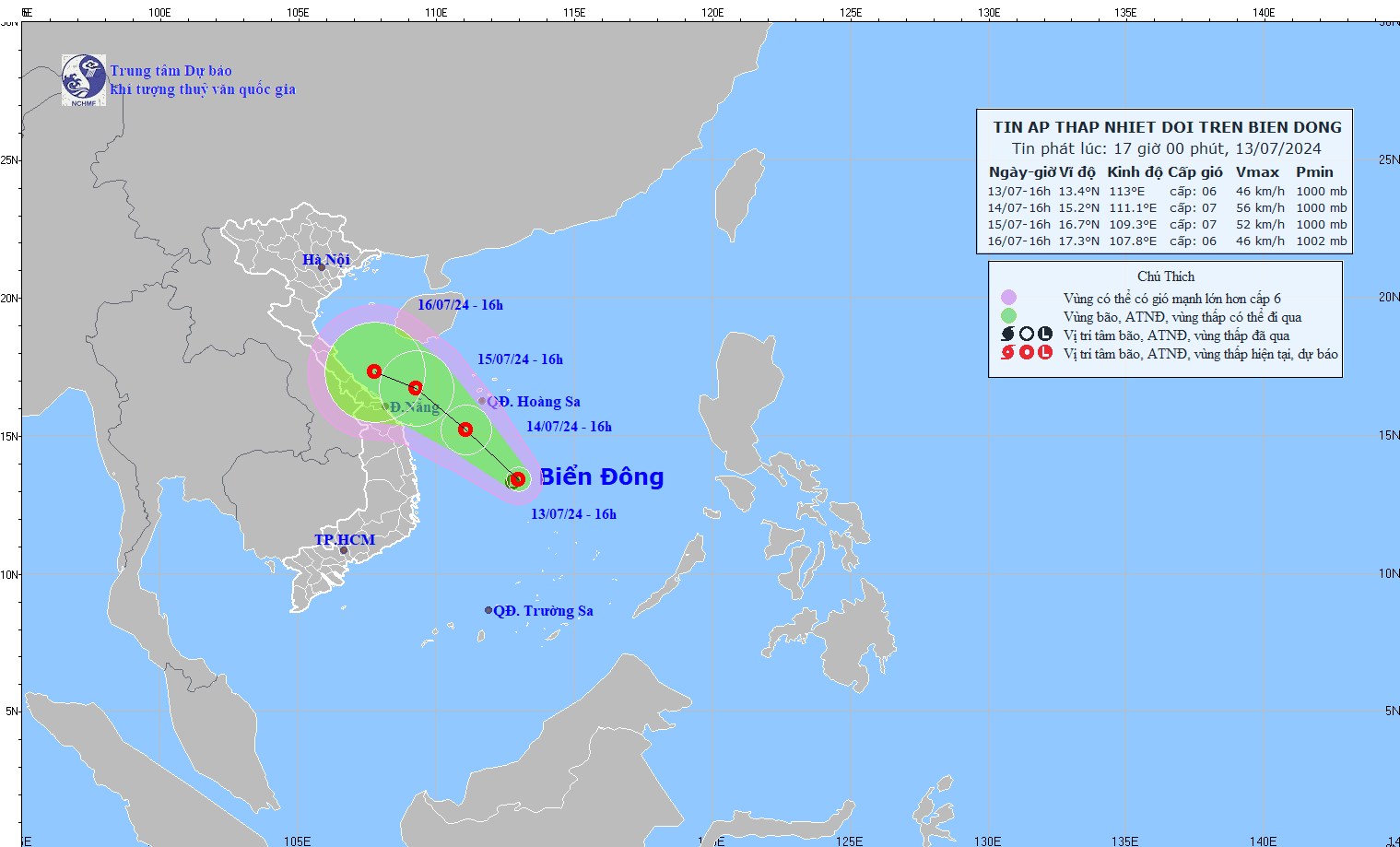
Current status of the tropical depression in the East Sea (Photo: NCHMF)
Forecast of tropical depression (in the next 24 to 48 hours)
Warning of tropical depression developments (from next 48 to 72 hours)
From the next 48 to 72 hours, the tropical depression will move in the West Northwest direction, traveling 5-10 km per hour. and gradually weaken.
Forecast impact of tropical depression:
The western sea area between the East Sea and the southwestern sea area of the North East Sea (including the Hoang Sa archipelago) has heavy showers and thunderstorms, strong winds of level 6, then increasing to level 7, gusting to level 9, rough seas.
From July 14, the offshore sea area from Thua Thien Hue to Binh Dinh will have strong winds of level 6-7, gusting to level 9, and rough seas.
The western sea area of the area between the East Sea and the southwestern sea area of the northern East Sea area (including the sea area of the Hoang Sa archipelago) has waves 2.0-4.0m high.
From July 14, the offshore sea area from Thua Thien Hue to Binh Dinh has waves 1.5-3.0m high.
The East Sea may welcome storms and tropical depressions in the coming days.
Previously, the Global Forecast System of the US Environmental Prediction Center (GFS) and the European Center for Medium-Range Weather Forecasts (ECMWF) predicted that there is a possibility of an active tropical cyclone appearing in the East Sea this weekend and early next week.
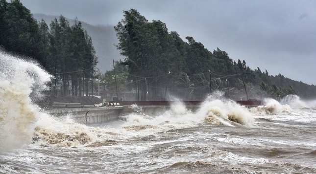
The East Sea may welcome two storms in the coming days.
Specifically, around the end of this week (July 13-14), a tropical convergence zone is likely to form in the East Sea. This tropical convergence zone may form a tropical cyclone (storm/tropical depression) that will affect the weather in the North and Central regions of our country.
In addition, a tropical convergence zone may form in the central part of the East Sea this weekend. There is a high possibility of disturbances forming in this zone, which may strengthen into a low pressure area, tropical depression or storm. Initial assessments show that this tropical cyclone may affect the weather in the northern and central provinces of our country this weekend and early next week.
Models also predict that a tropical cyclone could form in the coming days off the coast of the Philippines, possibly moving into the East Sea.
Source: https://danviet.vn/nong-vung-ap-thap-o-khu-vuc-giua-bien-dong-da-manh-len-thanh-ap-thap-nhiet-doi-20240713173342257.htm
























Comment (0)