
From early June onwards, the press continuously reported that the water level of the hydroelectric reservoir on the Da River had decreased abnormally, and in some places the Da River had dried up... Mr. Lu Van Tung, 68 years old, a member of the White Thai ethnic group, who has been a ferryman along the Da River for more than half his life, warned me when I called to book a boat: "It is impossible to go because at the river junction, where the Da River, Nam Na River and Nam Lay stream meet, the water is so dry that people herding cows can take a shortcut back and forth." He also sent a video clip to prove what he said.
I was really worried and wanted to move to another location many times. But when the plane tilted to land at Noi Bai airport, I still decided to get on the car and drive all the way to Lai Chau and then find a way to go down the Da River from Muong Lay town - Dien Bien to Quynh Nhai - Son La, a distance of more than 100 km.

A white Thai man in Huoi So commune - Tua Chua is preparing to pull the net in front of a cave that has been exposed due to low water levels.
Before reaching Muong Lay, I followed National Highway 4D through Phong Tho and Sin Ho of Lai Chau and ran parallel to the Nam Na River. This is a large river originating from China and the starting point into Vietnam is the Ma Lu Thang border gate. On its journey through the wild mountains and forests, it opened its heart to welcome many rivers and streams to become the vital waterway connecting the two provinces of Dien Bien and Lai Chau.
This river is also associated with the lifeblood and villages of the Thai, H'mong, Dao, Mang ethnic groups... especially with the all-night Thai xoe dances. It is said that during the French colonial period, "Thai king" Deo Van An was very fond of xoe dances, so he selected many beautiful girls to form a xoe dance team and encouraged people to regularly organize xoe dances on the riverbank. It is the beginning of the rainy season, but except for the reservoir area of the Nam Na 1, 2, 3 hydroelectric projects, the water level is low. Downstream, most of the riverbed reveals white sandbanks hundreds of meters wide.
By the end of the journey, the Nam Na River was only a small stream flowing in front of the ruins of the "Thai King" Deo Van Long before merging into the Nam Te River (Da River), which had already narrowed and was winding its way between alluvial flats encroaching on the shore. On it lay scattered iron boats and rafts that had been stranded, exposed to the sun for a long time along with the tiny currents of the Nam Lay stream.

The Da River has narrowed to just a creek when it flows from Muong Te district to Muong Lay town.
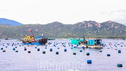
Fishermen living on the Da River said: This year, the weather is unusual, with little rain, prolonged heat, and the rapid receding of the river water, leaving people unable to react. Those who make a living by raising fish in cages have suffered losses due to risks, while those who live by the water can only wait for early rain and rising water to make a living. The water level in the Muong Lay town area is approximately at the dead water level in mid-June, and is lower than the same period last year. This is the first time the water level of the Son La hydropower reservoir has dropped to a record low in many years.
The next day, on one hand, we hoped for rain, on the other hand, we suggested and supported the boat owner to go on a small boat to check the water situation, including contacting acquaintances living along the Da River to connect if the boat ran aground. We also considered the worst case scenario, which was to take a car around the mountain to Tua Chua district - Dien Bien, then go down to Huoi So boat station to continue to Quynh Nhai, although this river route is short and misses many beautiful scenes.

The river junction that was once vast, green, and rippling has now narrowed its flow or has a bare bottom.
Late in the afternoon, we also received two good news from Mr. Tung: Although some sections of the river were only half a meter high, medium-sized iron boats could still pass through. In addition, the Lai Chau hydropower plant in Nam Nhun district in the upper reaches of the Da River was operating, so in the coming days, the water level in the lower reaches would gradually rise.
After a night of showers, early in the morning, the clouds drifted across the mountain range in Sin Ho district - Lai Chau as if bidding farewell to the group of travelers boarding the boat leaving Hang Tom bridge, which had exposed its pillars. We began to drift along the red mud-colored water, contrasting with the image of the blue river with rippling waves of the past. Not long after, the boat passed the two remaining pillars of the old Hang Tom bridge, built in 1960, once famous as the most beautiful cable-stayed bridge in Indochina.
Since 2012, when Son La Hydropower Plant was put into operation, the entire old Hang Tom Bridge has sunk deep into the lake, ending its historic mission. Later, to ensure safe passage for boats, the transport sector dismantled the bridge body and left only two pillars on both banks, which has sown much regret in the hearts of travelers. Suddenly, a high alluvial land appeared, seemingly overwhelming the entire river, along with ancient tree stumps scattered here and there, causing more difficulties and dangers for boats than ever before.

The group of tourists boarded the boat leaving the temporary dock at Hang Tom bridge - the only place in Muong Lay where the boat can dock.
I followed the boat across this section of the river during the flood season for almost ten years. Every year, I went up and down nearly ten times, so the scenery was familiar to my eyes... But the first time I went during the dry season, what appeared under the riverbed was extremely strange and exciting. That was the vertical cliff with countless stalactites and sculpted lines of the wind and waves in Kan Chua canyon - a symbol of the fierceness and majesty of the Da River, today it seemed to be higher up to the sky. Or the underground caves lying quietly under the riverbed now revealed a series of water caves with many stalactites hanging down to the water surface like a fantasy place that before, even in dreams, one could not see.
The closer the boat got to Quynh Nhai, the wider the river surface became. People said: This place used to be a dangerous rapid, many boats were wrecked because "water pushed rocks, rocks pushed waves, waves pushed wind". We pulled the boat to Cao Po hill, where a landmark was erected to mark the center of the old Quynh Nhai district to remember the bustling times on the wharf and under the boats. Now, the landmark is located nearly 50m above the river surface and visitors who want to visit have to take a 10-minute walk. Unlike in the flood season, the boat can dock right at the foot of the tower, visitors only need a few steps to get there.

The landmark marking the center of the old Quynh Nhai district is now located nearly 50m from the river surface. During the flood season, boats can dock right at the foot of the tower, and visitors only need a few steps to arrive.
A short trip but helped us discover many things hidden under the river described as fierce and violent.
Source link


![[Photo] President of the Cuban National Assembly visits President Ho Chi Minh's Mausoleum](https://vphoto.vietnam.vn/thumb/1200x675/vietnam/resource/IMAGE/2025/10/1/39f1142310fc4dae9e3de4fcc9ac2ed0)

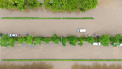
![[Photo] Hanoi morning of October 1: Prolonged flooding, people wade to work](https://vphoto.vietnam.vn/thumb/1200x675/vietnam/resource/IMAGE/2025/10/1/189be28938e3493fa26b2938efa2059e)
![[Photo] Keep your warehouse safe in all situations](https://vphoto.vietnam.vn/thumb/1200x675/vietnam/resource/IMAGE/2025/10/1/3eb4eceafe68497989865e7faa4e4d0e)


Comment (0)