
.jpg)
Kinh Mon town has 20 low-lying areas prone to flooding, the most in the province. These areas are located in the following communes and wards: Le Ninh, Hien Thanh, Duy Tan, Minh Hoa, Thuong Quan, Hiep An, Pham Thai, Lac Long, Phu Thu, Long Xuyen, Bach Dang, Tan Dan, An Phu, Hiep Hoa, Thang Long, Quang Thanh, Thai Thinh, An Sinh, Minh Tan, Hiep Son.
Chi Linh City and Thanh Mien District both have 16 areas. Thanh Ha and Tu Ky Districts both have 15 areas. Nam Sach District has 13 areas. Gia Loc District has 11 areas. Cam Giang and Ninh Giang Districts both have 10 areas. Kim Thanh and Binh Giang Districts both have 9 areas. Hai Duong City has 3 areas (including the inner city area and Quyet Thang and Tien Tien communes).
The total area of low-lying areas prone to flooding in Hai Duong is 11,383 hectares. Hai Duong city has 2,067 hectares, the most in the province, followed by Chi Linh city with 1,144 hectares, Tu Ky district with 1,675 hectares, Thanh Mien district with 1,257 hectares, Binh Giang district with 1,060 hectares...
Kinh Mon town has the most areas at risk of flash floods and landslides in the province with 15 areas. Chi Linh city has 11 areas, Nam Sach district has 3 areas. Hai Duong city and the remaining 8 districts have no areas at risk of flash floods and landslides.
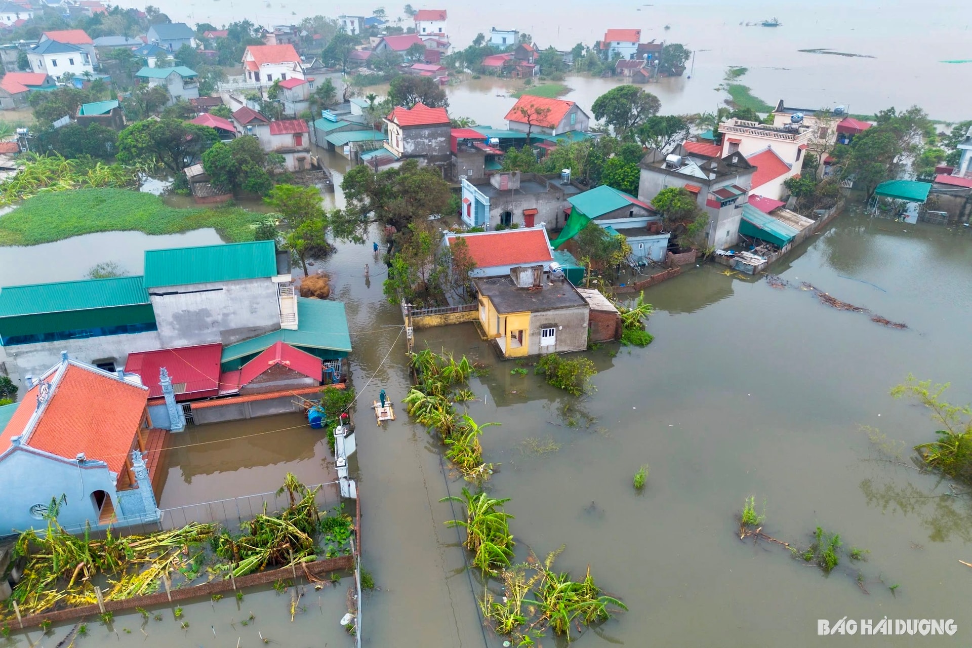
The whole province currently has about 7,563 households living in low-lying areas at risk of flooding, flash floods, and landslides with 31,838 people.
It is forecasted that from the night of May 22 to 24, Hai Duong will have heavy rain. To cope with all natural disasters, relevant units and localities in Hai Duong have developed plans and measures to prevent flooding, flash floods, landslides and evacuate people in dangerous situations.
In September 2024, Storm No. 3 (Storm Yagi ) and its circulation caused heavy rain and prolonged flooding, causing 2,136 houses in Hai Duong province to be flooded, of which 359 households had to be urgently evacuated; 943 hectares of rice, 3,153 hectares of corn, vegetables and thousands of hectares of fruit trees were flooded; 340 hectares of aquaculture ponds were flooded and overflowed...
Source: https://baohaiduong.vn/146-khu-vuc-de-bi-ngap-ung-29-khu-vuc-co-nguy-co-lu-quet-sat-lo-dat-412198.html


Comment (0)