
Chief of the Party Central Office Le Hoai Trung signed Official Dispatch No. 16188 announcing the Secretariat's direction on responding to storm No. 3 (Wipha).
Official dispatch to provincial party committees, municipal party committees, party committees directly under the Central Committee; central party committees; party committees of ministries, branches, socio -political organizations at the Central level; party committees of central public service units; members of the Central Party Committee.
Accordingly, at the meeting on July 22, before the complicated developments of storm No. 3, implementing the opinion of General Secretary To Lam , the Secretariat directed a number of important contents.
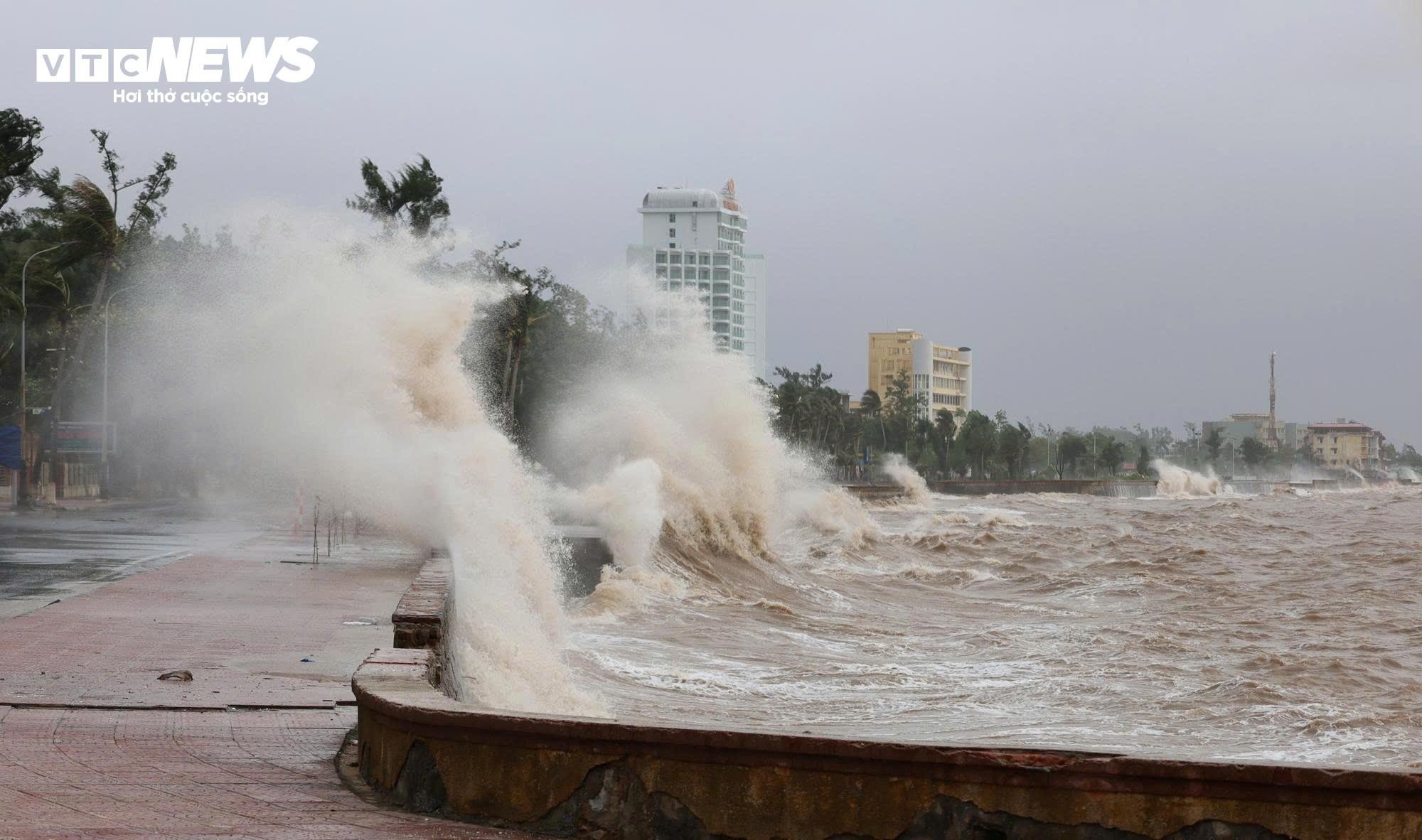
The Secretariat assessed that this is a very strong storm, moving quickly, with a wide and dangerous range and intensity of influence on sea and land.
According to forecasts, from July 22, coastal areas from Quang Ninh to Thanh Hoa will be directly affected by the storm, causing strong winds and heavy rains in the Northern provinces and North Central provinces (Thanh Hoa, Nghe An, Ha Tinh ).
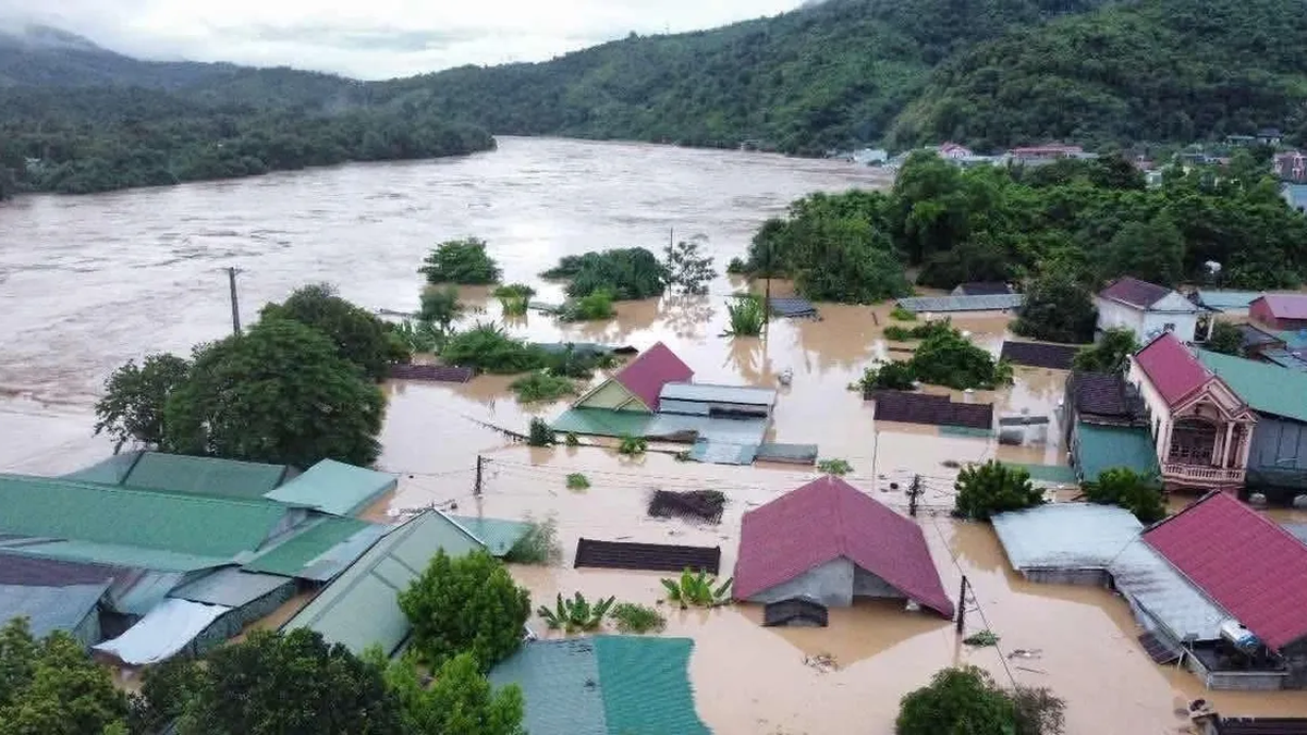
To proactively respond to storms and heavy rains, the risk of flash floods, landslides, and inundation, and ensure the safety of people's lives and property and state assets, the Secretariat requests Party committees at all levels, Party organizations, authorities, the Vietnam Fatherland Front, and socio-political organizations not to be subjective, to strengthen direction, supervision, inspection, and response to storm Wipha, and to minimize damage.
The Secretariat noted to update the situation daily and send reports to the Central Party Office (before 4:00 p.m. daily).
The Secretariat assigned the Party Central Office to preside over and coordinate with relevant agencies to monitor and synthesize the situation, and daily report to the Politburo and the Secretariat on related situations.
The National Center for Hydro-Meteorological Forecasting said that at 1:00 p.m. on July 22, storm No. 3 Wipha was located on the coastal mainland between Ninh Binh and Thanh Hoa.
The strongest wind near the storm center is level 8 (62-74km/h), gusting to level 10; moving west at a speed of 10-15km/h.
On the afternoon of July 22, the Bac Bo Gulf area (including the special zones of Bach Long Vi, Co To, Van Don, Cat Hai, Hon Dau and Hon Ngu islands) had strong winds of level 6-7, near the storm center of level 8, gusting to level 10; waves 2-4m high; rough seas.
Coastal areas of Ninh Binh - Quang Ninh have storm surges of 0.4-0.8m high. In Ba Lat (Hung Yen), the water level is 2.8-3.1m high, in Hon Dau (Hai Phong), it is 3.9-4.2m high and in Cua Ong (Quang Ninh), it is 4.4-4.8m high. There is a high risk of flooding in coastal areas and river mouths.
From the afternoon of July 22 to the morning of July 23, Thanh Hoa, Nghe An, southern Phu Tho and Son La will have heavy to very heavy rain and thunderstorms with common rainfall of 60-120mm, locally over 200mm; other places in the Northern region and Ha Tinh will have rain, moderate rain, locally heavy rain and thunderstorms with rainfall of 20-40mm, locally over 100mm.
Warning of risk of heavy rain (>150mm/3h). Heavy rain in a short period of time can cause flash floods, landslides in mountainous areas, and flooding in low-lying areas.
Source: https://baolangson.vn/ban-bi-thu-chi-dao-ung-pho-bao-so-3-yeu-cau-han-che-den-muc-thap-nhat-thiet-hai-5053899.html


Comment (0)