
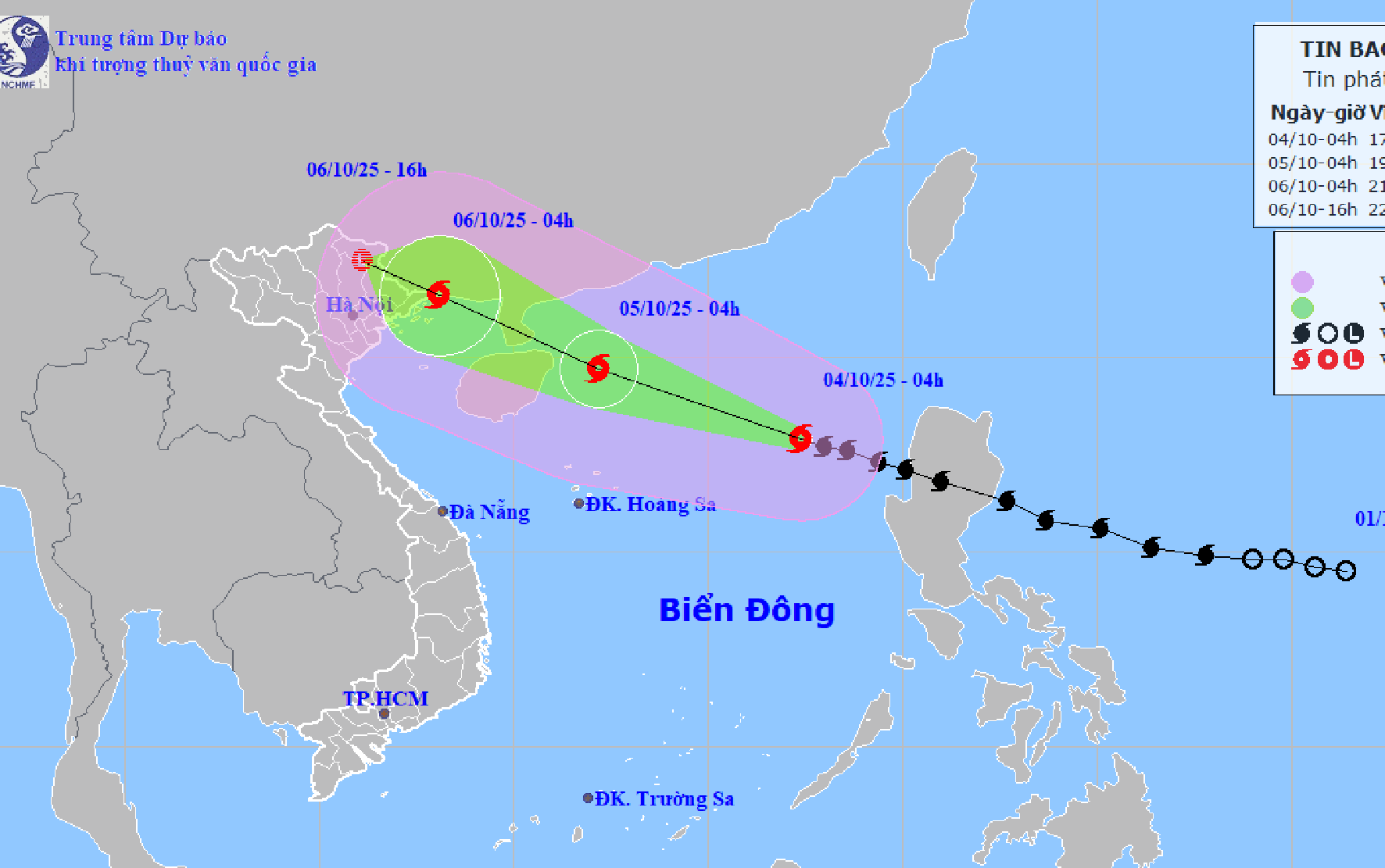
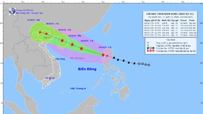
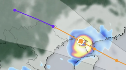
According to the National Center for Hydro-Meteorological Forecasting, at 4:00 a.m. on October 4, the center of storm Matmo (storm No. 11) was located at about 17.9 degrees North latitude; 117.4 degrees East longitude, in the eastern sea of the North East Sea, about 570km East Northeast of Hoang Sa special zone.
The strongest wind near the storm center is level 11 (103 - 117 km/h), gusting to level 14. The storm moves in the West Northwest direction at a speed of about 25 km/h.
It is forecasted that in the next 24 - 60 hours, storm Matmo will move in the West Northwest direction, at a speed of 20-25km/h and may strengthen.
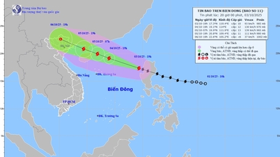
At 4:00 a.m. on October 5, storm Matmo was located at approximately 19.7 degrees North latitude; 112.2 degrees East longitude; in the North East Sea, approximately 130km east of Leizhou Peninsula (China). The strongest wind near the storm center was level 13, gusting to level 16.
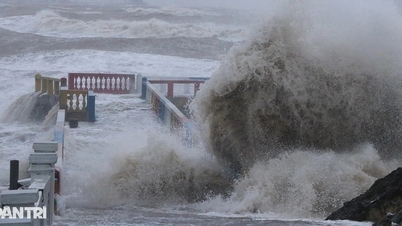
Due to the influence of the storm, the North East Sea area has strong winds of level 8 - 10, the area near the storm's eye has winds of level 11 - 13, gusts of level 16, waves 4.0 - 6.0m high, the area near the storm's eye has waves of 6.0 - 8.0m, the sea is very rough (extremely destructive, extremely strong waves. Sinking large ships).
From the afternoon of October 5, the sea area east of the Northern Gulf of Tonkin (including Bach Long Vi special zone) has winds gradually increasing to level 6 - 7, then increasing to level 8 - 9.
From the evening of October 5, the Northern Gulf of Tonkin area (including Bach Long Vi, Van Don, Co To, Cat Hai and Hon Dau islands) will have stronger winds of level 8 - 9, waves 2.0 - 4.0m high, near the storm center will be level 10 - 11, gusts of level 14, waves 3.0 - 5.0m high, and very rough seas (very rough seas, very dangerous for ships).
Coastal areas and islands in Quang Ninh - Hai Phong provinces have storm surges of 0.4 - 0.6 m. Beware of flooding in low-lying coastal areas and river mouths due to surges and big waves from the afternoon and evening of October 5.
From the night of October 5, on the mainland from Quang Ninh to Ninh Binh, winds will gradually increase to level 6 - 8, near the storm center level 9 - 10 (wind force can knock down trees, houses, electric poles, causing very heavy damage). Inland areas in the Northeast, winds will be strong at level 6, in some places level 7, gusting to level 8 - 9.
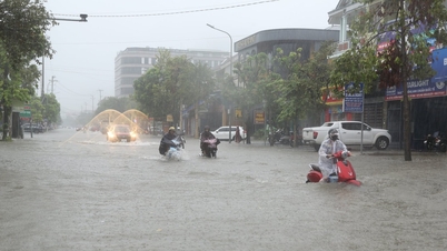
From the night of October 5 to the end of the night of October 7, in the Northern region, Thanh Hoa and Nghe An, there will be heavy to very heavy rain with common rainfall of 100 - 200mm, locally over 300mm; in the mountainous and midland areas of the North, common rainfall will be from 150 - 250mm, locally over 400mm.
PVSource: https://baohaiphong.vn/bao-matmo-manh-cap-11-anh-huong-den-khu-vuc-quang-ninh-hai-phong-tu-chieu-5-10-522528.html
![[Photo] Students of Binh Minh Primary School enjoy the full moon festival, receiving the joys of childhood](https://vphoto.vietnam.vn/thumb/1200x675/vietnam/resource/IMAGE/2025/10/3/8cf8abef22fe4471be400a818912cb85)


![[Infographic] Notable numbers after 3 months of "reorganizing the country"](https://vphoto.vietnam.vn/thumb/1200x675/vietnam/resource/IMAGE/2025/10/4/ce8bb72c722348e09e942d04f0dd9729)


![[Photo] Prime Minister Pham Minh Chinh chairs meeting to deploy overcoming consequences of storm No. 10](https://vphoto.vietnam.vn/thumb/1200x675/vietnam/resource/IMAGE/2025/10/3/544f420dcc844463898fcbef46247d16)


Comment (0)