
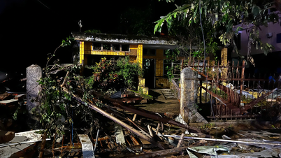
 on October 3, the amount of work that needs to be done is huge. Photo: TAT THANG")
According to the National Center for Hydro-Meteorological Forecasting, after moving into the East Sea, the storm encountered relatively favorable sea surface temperature conditions (about 29 degrees Celsius), and small wind shear in the North East Sea (where the center of storm Matmo moved), favorable for the storm's development.
Meanwhile, the subtropical high pressure (the shape that determines the speed and direction of the storm) is moving strongly to the West, causing the storm to tend to strengthen and move quickly (average 25-30km/h). The storm's maximum intensity may reach level 12-13, gusting to level 14-15 when it is in the East of Leizhou Peninsula (China) tomorrow evening, October 4.

From the time the storm moves into the sea area of Guangdong province (China), the subtropical high pressure tongue tends to weaken, at this time there will be 2 scenarios.
The first scenario (with a probability of about 70-75%) corresponds to the trend of the subtropical high pressure tongue weakening rapidly and retreating to the East, storm No. 11 will move more to the North, moving more over land (quite similar to the path of storm No. 9), so when it reaches the northern area of Quang Ninh province, it will weaken by 2-4 levels compared to the time when the storm is at its strongest. With this scenario, in the Gulf of Tonkin there will be strong winds of level 9-10, in the mainland of Quang Ninh- Hai Phong there will be strong winds of level 8-9 and heavy rain in the North (focusing on the midlands and mountainous areas).
The second scenario is more extreme (only has a probability of about 25-30%): when the subtropical high pressure weakens insignificantly, causing the storm to move mainly over the sea, so it weakens less than the first scenario. Therefore, the storm intensity when entering the Quang Ninh - Hai Phong area will be stronger, possibly causing strong winds of level 9-10 (gusts of level 12-14), the impact of strong winds will extend further south (Quang Ninh - Ninh Binh ), the rain will also be heavier, the strong wind area will also be deeper inland.
On the evening of October 3, speaking to the press, Deputy Minister of Agriculture and Environment Nguyen Hoang Hiep noted: after two consecutive storms 9 and 10, especially storm No. 10 which caused very serious consequences, people in many localities suffered heavy damage and were worried. Therefore, the propaganda and information about storm No. 11 must ensure that people are not subjective, but also need accurate information, comprehensive analysis, including the possibility that storm No. 11 may have less widespread impact, so that people do not panic, but also be mentally prepared and have a plan to respond to the new storm.
Director of the Department of Dyke Management and Natural Disaster Prevention Pham Duc Luan also requested that press agencies fully and clearly propagate the two scenarios that storm No. 11 could develop in the coming days.
Source: https://www.sggp.org.vn/thu-truong-nguyen-hoang-hiep-can-thong-tin-du-2-kich-ban-cua-bao-so-11-post816241.html


Comment (0)