
At a meeting to respond to storm Ragasa at the Department of Hydrometeorology on the morning of September 23, experts assessed that it is likely that super storm Ragasa will weaken significantly before entering the Gulf of Tonkin.
On the morning of September 23, at the Department of Hydrometeorology ( Ministry of Agriculture and Environment ), a meeting on forecasting to respond to storm Ragasa was held, chaired by Deputy Minister Nguyen Hoang Hiep.
 |
| Deputy Minister of Agriculture and Environment Nguyen Hoang Hiep chaired a meeting on forecasting work to respond to storm No. 9 (Ragasa). |
Reporting at the meeting, Mr. Mai Van Khien - Director of the National Center for Hydro-Meteorological Forecasting commented: "There are many scenarios regarding the direction, intensity and affected areas, but it is highly likely that Ragasa storm will deviate to the North. Due to the impact of cold air and friction when passing through China,... it is highly likely that this storm will weaken when entering the Gulf of Tonkin."
According to Mr. Khiem, when entering the Northern Gulf of Tonkin, storm No. 9 will decrease to level 10-12, then decrease further to level 8-9 and will be strongest at level 10 when making landfall on the coast from Quang Ninh - Thanh Hoa.
 |
| Mr. Mai Van Khien - Director of National Center for Hydro-Meteorological Forecasting. |
Agreeing with the National Center for Hydrometeorological Forecasting, Ms. Pham Thi Thanh Nga, Director of the Institute of Meteorology, Hydrology and Climate Change (Ministry of Agriculture and Environment) commented: "Storm Ragasa has reached its peak intensity, so it is likely to last only for the next 12-24 hours. It is very likely that the storm will interact with cold high pressure, leading to many complex weather patterns. With such an impact, the storm is likely to weaken very quickly when passing through the Leizhou peninsula. With the cold air cushion interacting like now, there is a possibility of moderate rain."
 |
| Ms. Pham Thi Thanh Nga, Director of the Institute of Meteorology, Hydrology and Climate Change (Ministry of Agriculture and Environment). |
Mr. Hoang Duc Cuong - Deputy Director of the Department of Hydrometeorology assessed: "This is the biggest storm ever to enter the East Sea. Current forecasts are leaning towards moving more north than storm Yagi. The worst scenario is that the storm passes through the middle of China's Leizhou peninsula, which will be similar to Yagi. The trend, up to this point, the storm has begun to weaken but is still at the level of a super typhoon and very strong. The path of the storm, forecasting centers around the world all agree that the storm's path will tilt towards Hong Kong, Macau, through the Leizhou peninsula into the Gulf of Tonkin and will weaken when entering Vietnam".
|

According to Mr. Cuong, the forecast is that the waves will be 6-8m high, and near the storm center, the waves will be very large, over 10m high. The offshore area of Bac Bo Gulf (including Bach Long Vy special zone) will have waves 4-6m high. The coastal waters of Quang Ninh-Thanh Hoa provinces (including Van Don, Co To and Cat Hai special zones) will have waves 2-4m high.
 |
| Deputy Minister of Agriculture and Environment Nguyen Hoang Hiep. |
Due to the influence of the storm, heavy rain is concentrated in the North, Thanh Hoa - Ha Tinh (70-150mm). Thai Nguyen, South Tuyen Quang, Lao Cai, Phu Tho, the Northern Delta, Thanh Hoa rain 150-250mm, locally over 400mm.
 |
| Overview of the meeting. |
Speaking at the conclusion of the meeting, Deputy Minister of Agriculture and Environment Nguyen Hoang Hiep affirmed: "The storm will impact Vietnam with reduced intensity when it reaches the shore. The rainfall is likely not as extreme as previous storms, especially storm number 5.
This storm poses a very high risk of dangerous weather patterns, so it is recommended to maintain sea warnings, including the Gulf of Tonkin and Hoang Sa special zone.
Response measures at sea remain high. Onshore, the main affected area is the North, part of the North Central region.
When it makes landfall in Vietnam, the wind will be reduced to about level 8-9. With this wind speed, it can cause trees and houses to fall, and there is a high risk of tornadoes. This is a phenomenon that is very difficult to warn about."
According to Van Ngan/VOV.VN
Source: https://baovinhlong.com.vn/thoi-su/202509/bao-ragasa-dang-giam-cap-nhung-van-o-cap-sieu-bao-va-rat-manh-e141b29/
![[Photo] Unique Phu Gia horse hat weaving craft](https://vphoto.vietnam.vn/thumb/1200x675/vietnam/resource/IMAGE/2025/10/10/1760084018320_ndo_br_01-jpg.webp)
![[Photo] Ho Chi Minh City is brilliant with flags and flowers on the eve of the 1st Party Congress, term 2025-2030](https://vphoto.vietnam.vn/thumb/1200x675/vietnam/resource/IMAGE/2025/10/10/1760102923219_ndo_br_thiet-ke-chua-co-ten-43-png.webp)


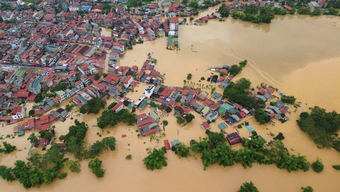
![[Photo] "Exposing letters" in the flood center of Lang Son](https://vphoto.vietnam.vn/thumb/1200x675/vietnam/resource/IMAGE/2025/10/10/1760080117518_ndo_br_z7101324112737-07cd4d1c01801a8ccf4ae0cbaf31c4a3-507-jpg.webp)


Comment (0)