
Attending the meeting were Deputy Minister of Natural Resources and Environment Le Cong Thanh, Deputy Director General of the General Department of Hydrometeorology La Duc Dung and leaders of some units under the Ministry of Natural Resources and Environment ; leaders of units under the General Department of Hydrometeorology. The meeting was connected online to the regional Hydrometeorological Stations and the provincial Hydrometeorological Stations forecasting that it would be affected by storm No. 3.
The storm increased by 4 levels compared to when it first entered the East Sea.
According to reports, Typhoon Yagi formed in the waters east of the Philippines and entered the East Sea on the morning of September 2, becoming the third typhoon of 2024. Updating the latest information on the storm's developments, Mr. Mai Van Khiem, Director of the National Center for Hydro-Meteorological Forecasting, said: As of this morning, typhoon No. 3 is in the waters east of the North East Sea. The strongest wind near the storm's center is level 12 (118-133km/h), gusting to level 15. Thus, the storm has increased by 4 levels compared to when it first entered the East Sea, and its location is about 750km east of Hainan Island (China).
According to Mr. Khiem, this is a very strong storm with a wide circulation. The area with strong winds of level 10 has a radius of about 250km, the area with strong winds of level 10 is about 150km around the eye of the storm. International storm forecasting centers all have the same opinion that storm No. 3 has an intensity of level 14 - 15, gusting to level 17 when approaching Hainan Island (China).
Regarding the impact of the storm on Vietnam's sea area, it is forecasted that around the night of September 6 and the morning of September 7, the storm will pass the northern area of Hainan Island (China) and move into the Gulf of Tonkin, then directly affect all coastal provinces of the North and North Central regions (from Quang Ninh - Ha Tinh).
“This is a very strong storm, forecast to be the strongest storm in the past 10 years to affect the North, the level of impact is likely to be equivalent to storm No. 3 in 2014 and storm No. 1 in 2016” – Mr. Khiem emphasized and said that from September 7 to 9, there will be a period of heavy to very heavy rain in the North and North Central regions. In the less likely case, the storm will move further north, along the coast of Guangxi (China), then the impacts of rain and wind will be reduced.
The biggest risk and danger at this time is the very strong wind and very large waves at sea along the 19th degree North latitude, where the storm passes through with wind intensity of level 14-15, gusts of level 17, waves 8-10m high, which can sink all ships, including large tonnage ships. The island districts of Bach Long Vi and Co To are likely to be greatly affected by strong winds from storm No. 3.
From the night of September 6 to the morning of September 8, coastal waters from Quang Ninh to Ha Tinh will have strong winds of level 10-13, waves of 4-6m high, and 6-8m high near the storm center; there is a high risk of flooding in low-lying coastal and river mouth areas. Boat mooring areas and aquaculture cages are at risk of being greatly affected by strong winds and big waves, especially in the areas from Quang Ninh to Thanh Hoa.
In recent days, forecasting work for storm No. 3 has been carried out very early and has received attention from the entire political system. The Prime Minister, Deputy Prime Minister, National Steering Committee for Disaster Prevention and Control, and the Ministry of Natural Resources and Environment have closely directed hydrometeorological forecasting units.
According to Deputy Director General of the General Department of Hydrometeorology La Duc Dung, since the low pressure area appeared off the coast of the Philippines, the General Department of Hydrometeorology has issued a document directing units to closely monitor, forecast, and promptly warn of developments from the time of signs until the low pressure area develops into a storm. On September 3, the Prime Minister issued Official Dispatch No. 86/CD-TTg directing ministries, branches, and localities to urgently deploy responses to storm No. 3 in 2024. The General Department of Hydrometeorology has submitted to the Ministry's leaders to sign and issue a document directing units under the Ministry to focus on performing assigned tasks.
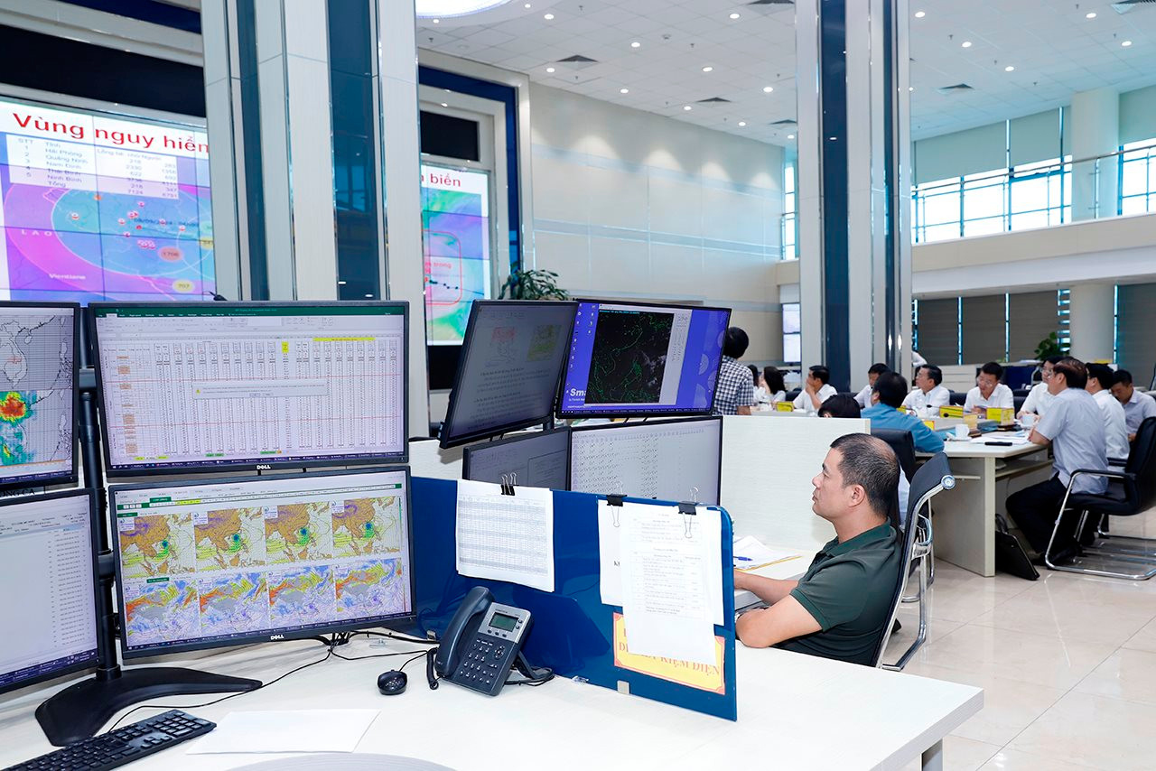
To urge the strengthening of forecasting and warning of storm No. 3, the General Department of Hydrometeorology has directed its subordinate units to carry out specific tasks. The Department of Hydrometeorological Network Management coordinates with the National Hydrometeorological Network Center to monitor, inspect and urge regional Hydrometeorological Stations to ensure that the national hydrometeorological monitoring network operates stably in the event of natural disasters. Data information work ensures a smooth transmission and communication system to serve hydrometeorological forecasting and warning work, and to develop backup plans in case of incidents.
The national hydrometeorological forecasting and warning system is highly focused on closely monitoring the developments and impacts of storms such as: strong winds, big waves, rising water, heavy rain, thunderstorms before storms, risks of floods, inundation, flash floods, landslides... after storms; updating, providing full and timely bulletins on natural disaster forecasts and impact forecasts, avoiding being passive and surprised in order to serve well the work of directing the prevention, mitigation and overcoming of consequences of natural disasters to all levels and people to proactively deploy response measures.
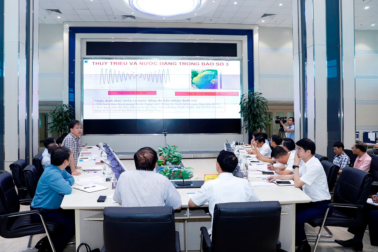
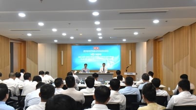
Unit leaders reported on the storm situation at the meeting.
The current issue, according to Deputy Director General La Duc Dung, is that the Law on Civil Defense stipulates that disaster prevention, search and rescue, and civil defense units at all levels will be merged into Steering Committees and Civil Defense Command Committees at all levels. However, up to now, the Decree guiding the implementation of the Law on Civil Defense has not been issued. The General Department recommends that the Ministry of Natural Resources and Environment report to the Government to soon issue a Decree so that the system of disaster prevention units at all levels can soon stabilize their organizational structure to ensure effective disaster prevention and control work and minimize damage when disasters occur.
At the meeting, representatives of the Institute of Hydrometeorology and Climate Change, the Department of Water Resources Management, and the Institute of Geosciences and Minerals also provided additional information on factors affecting the development of storm No. 3, and the subjects that may be directly affected and impacted. Currently, the water levels of reservoirs, especially those in the Northern region, are high, so forecasting heavy rains needs special attention, ensuring accurate forecasts, avoiding the situation where reservoirs have to release too much to lower the water level, leading to water shortages during the dry months. The focus of rain will be in the Northern region, so it is necessary to guard against the risks of floods, flash floods, and landslides. In particular, this is a very strong storm, so dangerous weather phenomena such as strong thunderstorms, tornadoes, and lightning may appear before the storm approaches the shore.
Proactive forecasting before, during and after storms

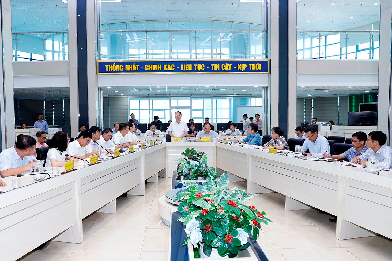
According to Deputy Minister Le Cong Thanh, up to now, the Central Steering Committee and the local Command Committees for natural disaster prevention, search and rescue have grasped the situation. The Hydrometeorological Stations continue to maintain contact with the focal points to promptly inform about developments and warn of the risks of impacts of storm No. 3. In preparation for the Government meeting to direct the prevention of storm No. 3, the Deputy Minister requested the General Department of Hydrometeorology to closely update the latest information on the path, intensity, and speed of the storm.
The Deputy Minister also noted the risk of thunderstorms before the storm and that we cannot be complacent even though the storm is still far from the mainland. Currently, the weather in the mainland is hot and humid, and the storm only needs to pass Hainan Island to cause thunderstorms. Therefore, forecasting units need to carefully assess the risks, use the thunderstorm and lightning warning system and assess unstable factors onshore to have the best warning.

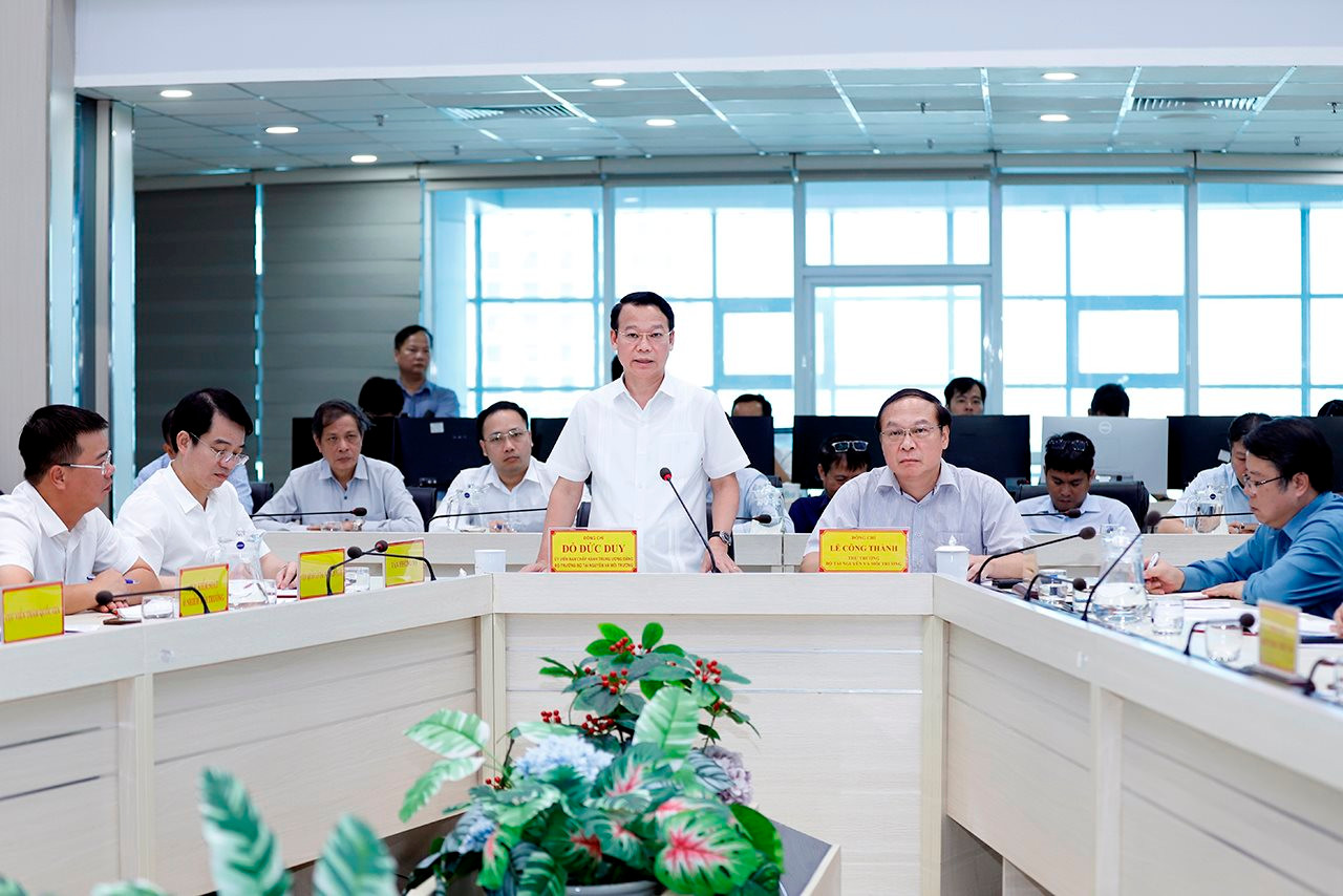
Speaking at the meeting, Minister Do Duc Duy highly appreciated the agencies of the Ministry for being very proactive in monitoring and updating information about the storm and at the same time giving early forecasts and warnings. Up to now, the forecasts have been quite accurate due to the complicated developments of the storm.
Storm No. 3 is assessed to move quickly, the storm's affected area is large, and its intensity is high. If not proactively responded to, it will cause great damage. Therefore, storm forecasting and warning are very important. In particular, the storm formed at the end of the flood season, so there is a risk of flash floods and landslides, which will pose a challenge to the forecasting and warning work of the Ministry's agencies to advise the Central Steering Committee to make timely decisions; at the same time, there are also instructions for the operation of inter-reservoirs to both regulate floods and ensure water storage for the dry season to ensure multiple objectives...
With immediate solutions, Minister Do Duc Duy suggested that the Ministry's specialized agencies focus on prioritizing forecasting, warning and providing fast, timely and accurate information about storm No. 3. The Minister recommended that the units strengthen coordination in promoting professional work, refer to international information sources, combine historical data to have early and timely warning information before, during and after storm No. 3, as well as warnings about storms, floods, landslides, etc.
The Minister requested that specialized agencies provide recommendations and professional information so that the Central Steering Committee on Natural Disaster Prevention and Control can provide timely instructions on tasks related to inter-reservoirs, flood discharge, landslide response, etc. and discuss with the Central Steering Committee on Natural Disaster Prevention and Control and Search and Rescue on flood discharge or water storage plans appropriate to the actual situation.
With the characteristics of storm No. 3 moving fast, the affected area of the storm is large, and has high intensity, Minister Do Duc Duy suggested that it is necessary to issue a plan of the Ministry of Natural Resources and Environment on responding to storm No. 3, including assessments of the situation from the Ministry's specialized agencies such as Meteorology and Hydrology, Water Resources, Geology, Climate Change, etc., thereby developing plans with different response scenarios, with technical contacts of each specialized field for localities to monitor and proactively respond to the storm.
With the spirit of not being subjective even though the storm is still far from the mainland, Minister Do Duc Duy hopes that the officers of the Meteorological and Hydrological Department will make more efforts to complete their tasks well, and give timely forecasts and warnings so that the response to storm No. 3 can be best.
Source: https://baotainguyenmoitruong.vn/bo-truong-do-duc-duy-kiem-tra-cong-tac-du-bao-dien-bien-bao-so-3-va-cac-tac-dong-cua-bao-379253.html


Comment (0)