
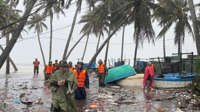
The Ministry of Agriculture and Environment also requested that the evacuation of people on boats, rafts, watchtowers, aquaculture areas, coastal areas, and low-lying areas must be completed before 3:00 p.m. on September 28.
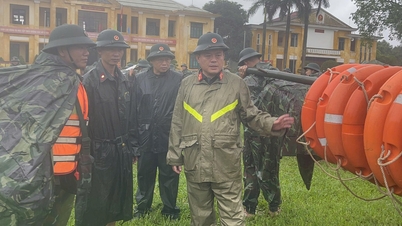
The dispatch stated that localities are fully responsible to the Prime Minister for vessel safety and strictly implement Official Dispatch No. 173/CD-TTg dated September 26, 2025.
In addition, the Ministry of Agriculture and Environment also sent a separate dispatch to Da Nang, Quang Ngai and Gia Lai, urgently calling on ships to return to shore because some ships from these localities are still in areas at risk of danger.
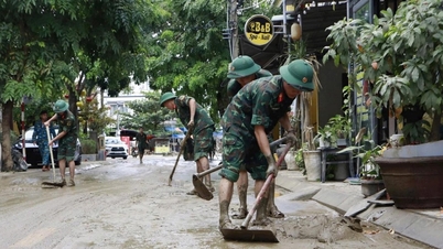
On the same day, the Ministry of Agriculture and Environment issued another document requesting 7 provinces and cities from Ninh Binh to Hue to immediately deploy measures to ensure the safety of the dike system and urgently handle vulnerable locations. The specific list includes: Con Tron sea dyke, Hai Thinh, Thinh Long embankment (Nam Dinh); Quang Nham sea dyke, Hai Binh (Thanh Hoa); Dien Thanh sea dyke, Quynh Tho, Long - Thuan (Nghe An); Nghen left dyke, Cam Nhuong embankment, Hoi Thong (Ha Tinh); Vinh Thai sea dyke (Quang Tri).

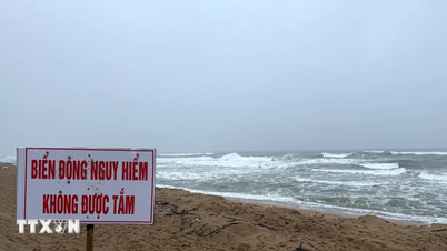
Meanwhile, at a press briefing held on the afternoon of September 27 in Hanoi, Deputy Directors of the National Center for Hydro-Meteorological Forecasting said that Storm No. 10 is a strong storm, moving very quickly at a speed of 30-35km/h, nearly double the average. Its intensity tends to increase as it approaches the shore, and strong circulation has caused early rain since the evening of September 27.

From tomorrow afternoon, September 28, the storm's winds on land will be significantly stronger in Quang Tri - Thanh Hoa. Experts predict that around the morning of September 29, the storm's eye will make landfall in the North Central region, with a focus on Nghe An - Quang Tri with winds of level 10-12, gusting to level 14. Rainfall will be generally 100-300mm, with some places over 600mm.
Source: https://www.sggp.org.vn/can-so-tan-dan-bao-ve-de-dieu-truoc-bao-so-10-post815091.html

![[Photo] Special class in Tra Linh](https://vphoto.vietnam.vn/thumb/1200x675/vietnam/resource/IMAGE/2025/11/14/1763078485441_ndo_br_lop-hoc-7-jpg.webp)

![[Photo] Deep sea sand deposits, ancient wooden ship An Bang faces the risk of being buried again](https://vphoto.vietnam.vn/thumb/1200x675/vietnam/resource/IMAGE/2025/11/13/1763033175715_ndo_br_thuyen-1-jpg.webp)


![Dong Nai OCOP transition: [Article 3] Linking tourism with OCOP product consumption](https://vphoto.vietnam.vn/thumb/402x226/vietnam/resource/IMAGE/2025/11/10/1762739199309_1324-2740-7_n-162543_981.jpeg)


Comment (0)