
According to the news, from 5am to 11am on October 16, Khanh Hoa province had moderate to heavy rain, and in some places very heavy rain. At measuring stations such as Ninh Tan 220.4mm, Duc My bridge 104.3mm. Soil moisture model shows that some areas in the province are nearly saturated (over 85%) or have reached a saturated state.
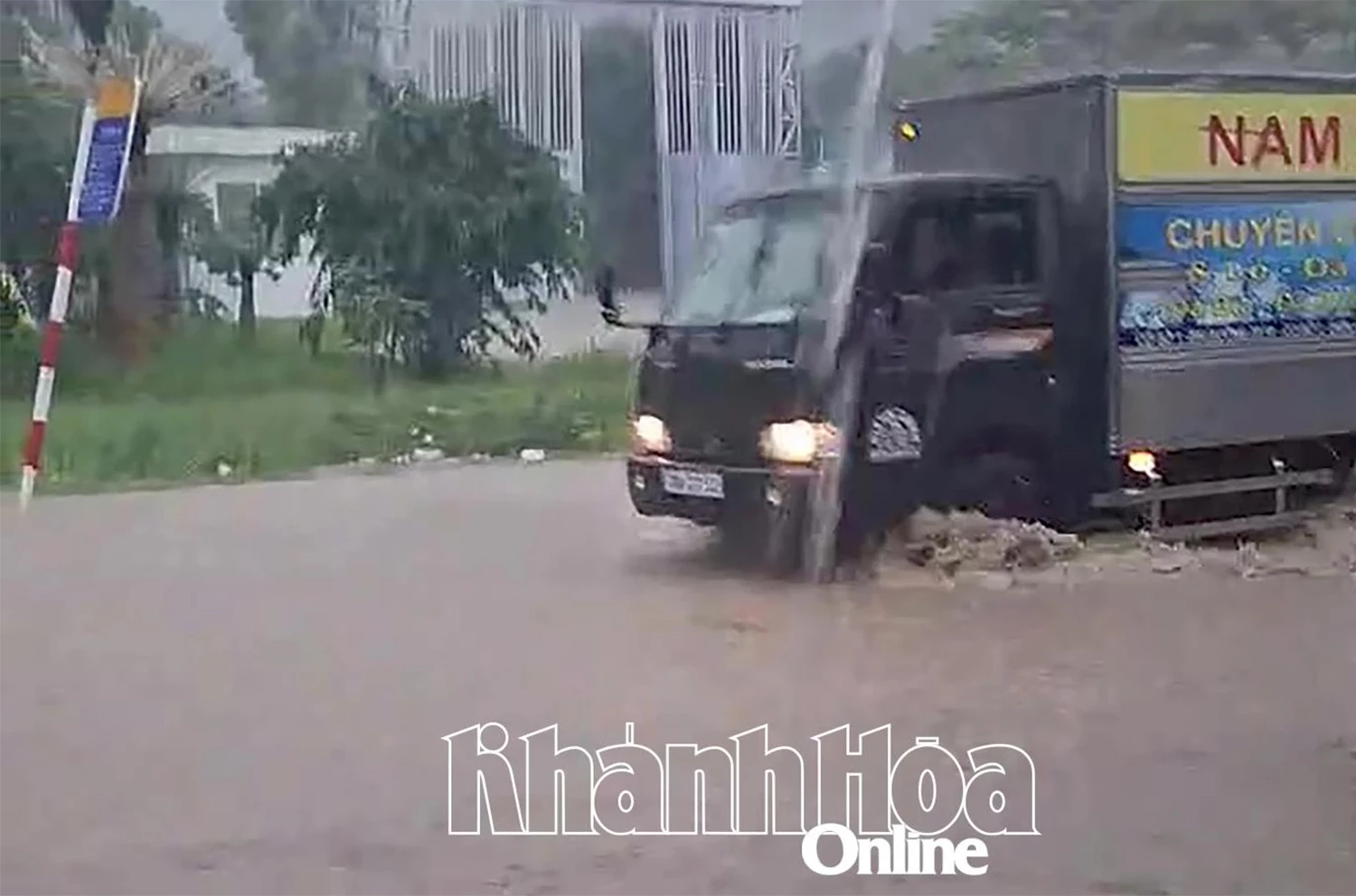 |
| Many areas were flooded on the morning of October 16. Photo: Vu Hoa |
Experts predict that in the coming time, there will continue to be rain in the province; there is a risk of flash floods on small rivers and streams, and landslides on steep slopes. Flash floods and landslides can have a very negative impact on the environment, threaten people's lives, cause local traffic congestion, affect the movement of vehicles, destroy civil and economic works, and cause damage to production and socio-economic activities.
 |
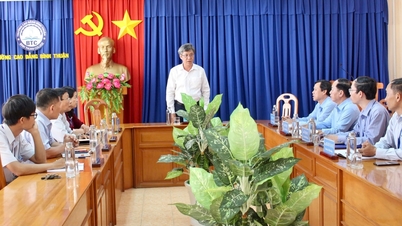
| Members of the Civil Defense Command of Nam Nha Trang Ward inspect landslide risks in the mountainous area of Thanh Phat and Thanh Dat Residential Groups. Photo: Vu Hoa. |
According to the Disaster Risk Warning Map updated by the Department of Hydrometeorology at 2:00 p.m. on October 16, Khanh Hoa province has 26 communes and wards warned of flash floods and landslides. Of which, Nam Ninh Hoa commune has the highest warning level, the most dangerous; 11 communes and wards have high warning levels including: Tay Nha Trang, Nam Nha Trang, Ninh Hoa, Bac Ninh Hoa, Tay Ninh Hoa, Hoa Tri, Dong Ninh Hoa, Tan Dinh, Hoa Thang, Dien Dien, Suoi Dau.
The remaining 14 communes and wards have medium-level warnings for vulnerable locations, including: Bac Nha Trang, Nha Trang, Van Ninh, Tu Bong, Dai Lanh, Van Thang, Van Hung, Khanh Vinh, Trung Khanh Vinh, Dien Khanh, Dien Lam, Dien Tho, Dien Lac, Suoi Hiep.
H.D
Source: https://baokhanhhoa.vn/xa-hoi/202510/canh-bao-nguy-co-lu-quet-sat-lo-dat-tai-26-xa-phuong-0a26383/


![[Photo] Closing ceremony of the 18th Congress of Hanoi Party Committee](https://vphoto.vietnam.vn/thumb/1200x675/vietnam/resource/IMAGE/2025/10/17/1760704850107_ndo_br_1-jpg.webp)


![[Photo] Nhan Dan Newspaper launches “Fatherland in the Heart: The Concert Film”](https://vphoto.vietnam.vn/thumb/1200x675/vietnam/resource/IMAGE/2025/10/16/1760622132545_thiet-ke-chua-co-ten-36-png.webp)


Comment (0)