It is forecasted that on September 23, storm No. 9 will maintain its intensity at level 16-17, gusting above level 17. By the morning of September 25, storm No. 9 will move into the Gulf of Tonkin, directly affecting our country from Quang Ninh to Ha Tinh .
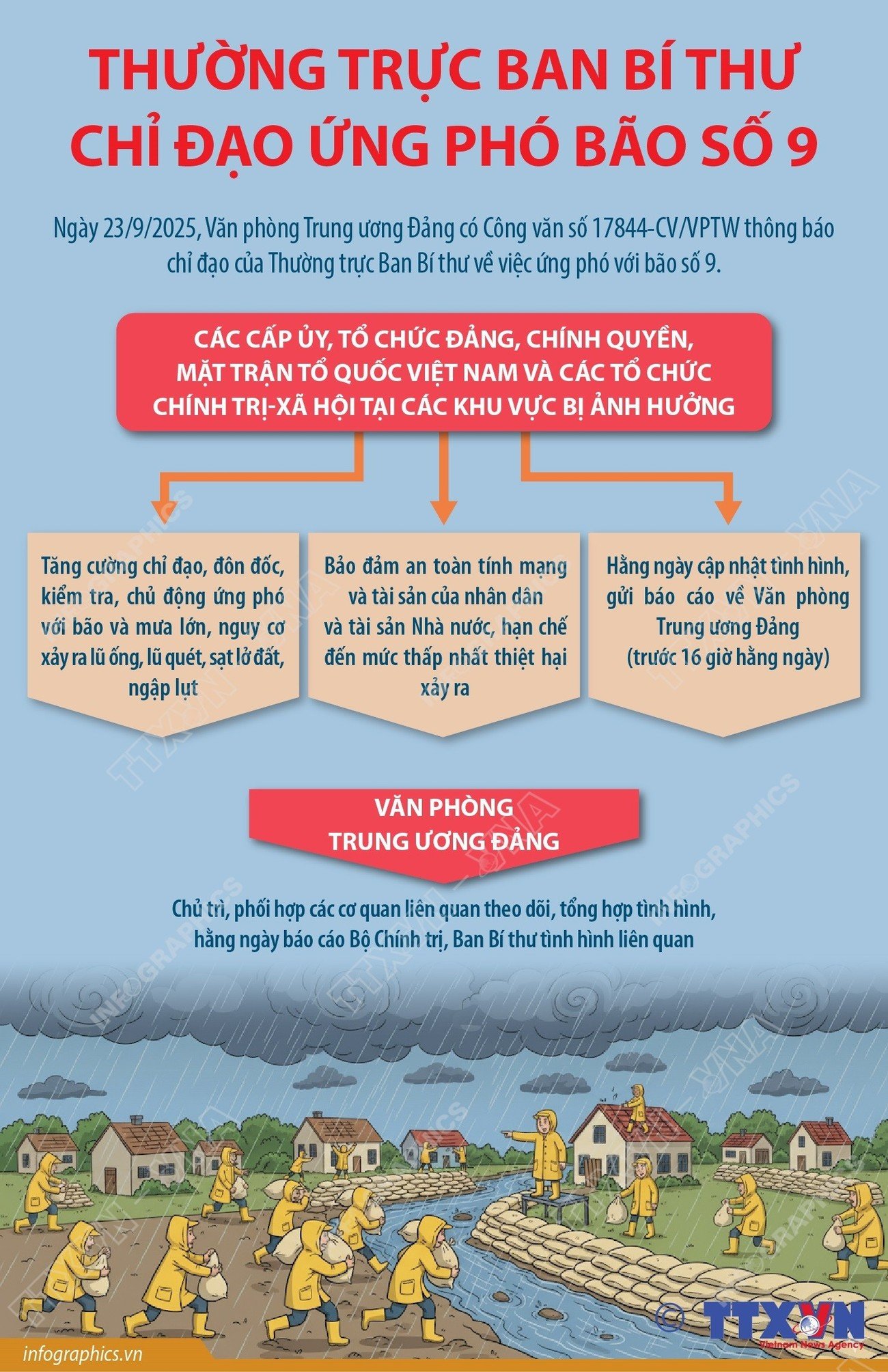
On September 23, the Central Party Office issued Official Dispatch No. 17844-CV/VPTW announcing the direction of the Standing Secretariat on responding to storm No. 9 (Ragasa).
The dispatch stated that according to the report of the National Center for Hydro-Meteorological Forecasting, super typhoon Ragasa (typhoon No. 9) moved into the East Sea, at 1:00 p.m. on September 23, the center of the super typhoon was at about 20.3 degrees north latitude; 117.1 degrees east longitude in the northeastern sea area of the northern East Sea. The strongest wind near the center of the super typhoon was level 17 (202 km/h - 221 km/h).
It is forecasted that on September 23, storm No. 9 will maintain its intensity at level 16-17, gusting above level 17. By the morning of September 25, storm No. 9 will move into the Gulf of Tonkin, directly affecting our country from Quang Ninh to Ha Tinh.
This is a very strong storm, moving quickly, with a wide and dangerous range and intensity of impact on sea and land./.
Source: https://baolangson.vn/chi-dao-cua-thuong-truc-ban-bi-thu-ve-viec-ung-pho-voi-bao-so-9-5059916.html




![[Photo] Closing of the 1st Congress of Party Delegates of Central Party Agencies](https://vphoto.vietnam.vn/thumb/1200x675/vietnam/resource/IMAGE/2025/9/24/b419f67738854f85bad6dbefa40f3040)


![[Photo] Editor-in-Chief of Nhan Dan Newspaper Le Quoc Minh received the working delegation of Pasaxon Newspaper](https://vphoto.vietnam.vn/thumb/1200x675/vietnam/resource/IMAGE/2025/9/23/da79369d8d2849318c3fe8e792f4ce16)







![[Photo] Solemn opening of the 1st Congress of Party Delegates of Central Party Agencies](https://vphoto.vietnam.vn/thumb/402x226/vietnam/resource/IMAGE/2025/9/24/82a89e250d4d43cbb6fcb312f21c5dd4)










Comment (0)