

The National Steering Committee for Natural Disaster Prevention and Control held a meeting to respond to storm Wipha - Photo: VGP/Do Huong
On the afternoon of July 18, the National Steering Committee for Natural Disaster Prevention and Control held a meeting to provide information and organize responses to storm Wipha.
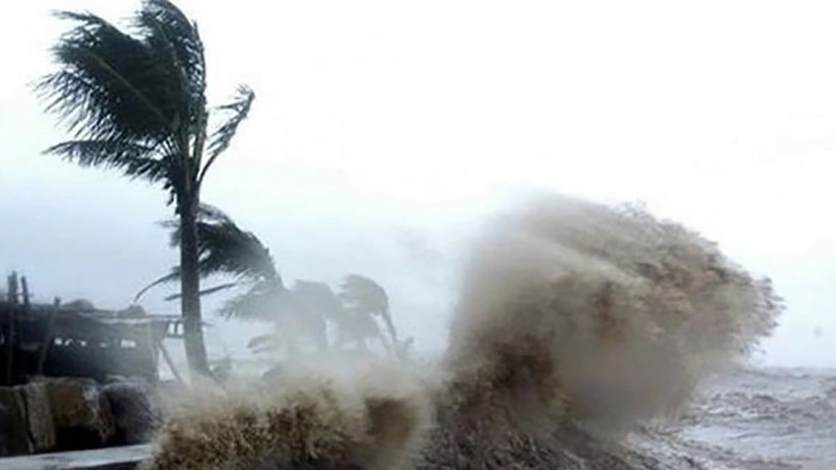
At the meeting, Mr. Mai Van Khiem - Director of the National Center for Hydro-Meteorological Forecasting said that tomorrow morning (July 19), storm Wipha will enter the East Sea - becoming storm number 3. It is forecasted that on the night of July 20 and early morning of July 21, the storm with level 12 gusts of level 15 will move west of Hainan Island (China).
Currently, storm Wipha is moving at a speed of 30km/h. According to Mr. Khiem, with its current fast speed, the possibility of the storm making landfall is very high.
Current status of the storm at 1:00 p.m. on July 19: The center of the storm is located at approximately 18.3 degrees North latitude; 123.5 degrees East longitude, in the sea northeast of Luzon Island (Philippines). The strongest winds reach level 8-9 (62-88 km/h), with gusts up to level 11 (103-117 km/h) near the center of the storm.
"With the current environmental conditions in the East Sea, it is forecasted that storm Wipha will increase in intensity when entering the East Sea. There is a high possibility that it will make landfall in Vietnam, affecting Quang Ninh - Nghe An ," said Mr. Khiem.
Regarding rainfall, Typhoon Wipha is expected to cause heavy rains over a wide area of the Northern and North Central regions (from Quang Ninh to Nghe An). Rainfall distribution will depend on the direction of the storm. Rainfall is forecast to be from 200 - 300 mm; some places over 500 mm.
Mr. Khiem said that it will be until noon on Sunday (July 20) that the specific rainfall of storm Wipha can be assessed.
According to Mr. Khiem, after storm Wipha makes landfall, another storm will appear and move north, creating a low trough, causing prolonged rain on July 24-25.
"Current forecast models are not yet consistent in terms of the intensity, rainfall, and direction of storm Wipha," Mr. Khiem informed.
Mr. Khiem noted that storm Wipha will tend to move north, less likely to cause damage like storm No. 3 in September 2024. However, we still have to maintain a mindset to face a strong storm.
Regarding ships and aquaculture at sea, a representative of the Department of Fisheries and Fisheries Surveillance said that through counting, from Quang Ninh to Nghe An, there are nearly 15,000 ships fishing and exploiting aquatic products at sea. Up to now, through checking, there are 23 anchorage areas and can organize anchorage for about 17,000 ships when the storm comes.
Also through review, currently from Quang Ninh - Nghe An, there are 150,000 hectares of aquaculture, with 20,000 cages and rafts. To avoid damage like that caused by Typhoon Yagi , from now until Sunday (July 20), depending on the path and level of the storm, the Department of Fisheries and Fisheries Control will direct, harvest, and sell fish and shrimp if there is enough weight.
Be proactive in dealing with a strong storm
With the current path and speed of storm Wipha, Deputy Minister of Agriculture and Environment Nguyen Hoang Hiep said that the most worrying thing is that this storm has the "shadow" of storm No. 3 in September 2024. Therefore, we must not be subjective, we must be proactive in responding to a strong storm.
This is the peak tourist season, aquaculture activities at sea and rice are tillering, citrus trees are bearing fruit... if a storm comes, it will cause great damage, so we must calculate and carefully prepare response plans.
Regarding reservoirs, Deputy Minister Hiep expressed concern that all reservoirs currently have a water capacity of 80 - 85%. Thus, when a storm makes landfall, causing heavy rain, it will cause great pressure. Especially for reservoirs without spillways, if not carefully calculated, it will be very dangerous for the reservoir system.
Deputy Minister Nguyen Hoang Hiep said that if this storm makes landfall in our country, it will be right at the time when the new two-tier local government model comes into operation. Therefore, this is also a time for localities to organize on-call duty, organize and deploy tasks and solutions to respond to natural disasters.
According to the report of the Border Guard's Civil Defense, Disaster Prevention and Search and Rescue Command (PTDS, PCTT&TKCN), as of 11:00 a.m. on July 18, 2025, 35,183 vehicles/147,336 workers have been notified, counted, and instructed, of which 790 vehicles/4,160 workers are operating in the North East Sea and Hoang Sa archipelago; currently there are no vehicles operating in the Northeast of the North East Sea (the area affected by the storm).
The total aquaculture area in coastal provinces and cities from Quang Ninh to Thanh Hoa is 126,583 hectares; 19,099 cages; 3,693 aquaculture watchtowers are at risk of being affected by storms and floods.
Regarding the situation of reservoirs and dikes, at reservoirs in the Northern region, Hoa Binh Lake's upstream water level at 1:00 p.m. on July 18 was 102.94 m; 3 bottom spillway gates are currently open to bring the water level back to 101 m (the highest water level before the flood during the main flood season from July 20 to August 21); Tuyen Quang Lake's upstream water level at 1:00 p.m. on July 18 was 104.98 m; 1 bottom spillway gate is currently open (will close at 3:00 p.m. on July 18); Son La and Thac Ba Lakes are lower than the highest water level before the flood.
In the North, there are 2,543 irrigation reservoirs, the average water volume in the reservoirs is currently about 55% - 84% of the design capacity. Currently, 47 reservoirs are being repaired and upgraded. The sea dyke system, river dyke system in coastal provinces from Quang Ninh to Thanh Hoa still has 20 key weak dyke points.
The Department of Dyke Management and Natural Disaster Prevention emphasized that in recent times, many large-scale heavy rains have caused flooding, flash floods, and landslides, causing great damage to people and property in the Northern region; a number of serious dike incidents have occurred; reservoirs in the Red River basin are at high levels and currently must operate to open the sluice gates to gradually bring the water level back to the prescribed flood level.
Do Huong
Source: https://baochinhphu.vn/chu-dong-tam-the-ung-pho-mot-con-bao-manh-co-kha-nang-anh-huong-bac-bo-102250718153730565.htm


![[Video] More than 100 universities announce tuition fees for the 2025–2026 academic year](https://vphoto.vietnam.vn/thumb/1200x675/vietnam/resource/IMAGE/2025/7/18/7eacdc721552429494cf919b3a65b42e)


![[Infographic] In 2025, 47 products will achieve national OCOP](https://vphoto.vietnam.vn/thumb/402x226/vietnam/resource/IMAGE/2025/7/16/5d672398b0744db3ab920e05db8e5b7d)


Comment (0)