

Panning the lens from the forest to the stream, transferring each frame to the computer at the control center. This is one of the support tools that has become the new "eyes and ears" for the Son La forest rangers.
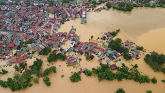
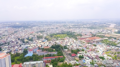
According to Decision No. 384/QD-UBND of the People's Committee of Son La province dated February 20, 2025, announcing the current status of forests until December 31, 2024, Son La province is currently managing more than 671,000 hectares of forest.
Of which, special-use forests are more than 72,000 hectares, protective forests are nearly 293,000 hectares, the coverage rate is 47.6%, the scale and ecological significance of Son La forests are also posing requirements for strict management. Mr. Nguyen Huy Tuan, Head of the Provincial Forest Protection Department, said: Since the 2000s, the forestry sector has started using GPS and maps for measurement.
By 2016, with the support of the Forest Protection Department and JICA, Son La had deployed the FRMS Desktop and FRMS Mobile forest monitoring systems, initiating forest management based on digital data. In the following years, the technology ecosystem gradually improved, such as: GIS, remote sensing, flycam, SMART software, AI-integrated cameras and forest fire forecasting models.
Through practical implementation in Son La province, it has been shown that the technology brings clear effectiveness in monitoring and detecting changes. Remote sensing allows comparison of multi-time images to detect deforestation, degradation or encroachment as soon as changes appear. Flycam tool helps to verify quickly, collect sharp image evidence; AI camera placed at the watchtower is capable of detecting smoke and fire, sending automatic warnings to the operation center.
Forest fire forecasting models, combining weather, humidity, wind and cover factors, help assess risk by area and time. Currently, at the grassroots level, rangers no longer carry a single notebook. They have phones or tablets with integrated FRMS/SMART applications, recording coordinates, images, videos , time and all data synchronized to the center.
Mr. Hoang Tuan Anh, Deputy Head of Forest Protection Department of Region XIII and Muong La Nature Reserve, said: Previously, to verify a suspicious point, the forest rangers spent several days on the forest road. Now with satellite images and flycams, they can be present and handle the situation in just a few hours. Applying digital technology makes forest management and protection much less difficult. According to a report from the Son La forest rangers, in the first 9 months of 2025, the forest rangers of the whole province inspected, detected and filed 197 cases of illegal deforestation, including seven criminal prosecutions for forest destruction.
Many cases were detected thanks to remote sensing monitoring systems and verified by flycams, helping to shorten the time from detection to scene access from several days to several hours, even tens of minutes depending on the terrain. Not only stopping at detection, digital data also changes the way of handling and prevention. Digital mapping systems (GIS) store boundaries, forest owners, and forest history; FRMS and management software allow quick access to records, statistics, and reporting.
When a fluctuation point appears, officers can immediately compare it with legal documents, verify the license, and then decide on administrative measures or propose timely prosecution. According to Mr. Nguyen Huy Tuan, the industry has proposed a series of practical solutions, such as: Promoting training and popularizing digital skills for the entire force; arranging specialized staff for digital transformation; prioritizing capital for infrastructure and equipment; expanding social mobilization and international projects; strengthening cooperation between the Department of Agriculture and Environment with departments, branches and local authorities to complete the shared data framework.
In particular, continue to closely coordinate with the community to promote the role of people as "eyes and ears" on the spot through information reporting applications... Mr. Nguyen Thanh Cong, Vice Chairman of the People's Committee of Son La province said: Digital transformation in forest management is one of the survival tools for forests. When data is digitized, when each sub-area and each forest plot has clear electronic records, management responsibilities become transparent, and accountability is carried out quickly and fairly.
Data also opens up new value in assessing biomass reserves, participating in the carbon credit market, tracing the origin of forest products, contributing to sustainable forestry development. In the forests of Son La, each flycam, AI camera and digital map does not replace forest rangers, but makes their work more effective and safer. If they maintain their determination and continue to invest in the right direction, Son La can become a model for forest management using technology, where data is truly a modern "forest ranger", keeping the forest green and the community more sustainable.
Source: https://nhandan.vn/chuyen-doi-so-trong-quan-ly-bao-ve-rung-o-son-la-post914497.html
![[Photo] Unique Phu Gia horse hat weaving craft](https://vphoto.vietnam.vn/thumb/1200x675/vietnam/resource/IMAGE/2025/10/10/1760084018320_ndo_br_01-jpg.webp)
![[Photo] Opening of the World Cultural Festival in Hanoi](https://vphoto.vietnam.vn/thumb/1200x675/vietnam/resource/IMAGE/2025/10/10/1760113426728_ndo_br_lehoi-khaimac-jpg.webp)


![[Photo] Ho Chi Minh City is brilliant with flags and flowers on the eve of the 1st Party Congress, term 2025-2030](https://vphoto.vietnam.vn/thumb/1200x675/vietnam/resource/IMAGE/2025/10/10/1760102923219_ndo_br_thiet-ke-chua-co-ten-43-png.webp)


![[Photo] Opening of the World Cultural Festival in Hanoi](https://vphoto.vietnam.vn/thumb/402x226/vietnam/resource/IMAGE/2025/10/10/1760113426728_ndo_br_lehoi-khaimac-jpg.webp)


Comment (0)