
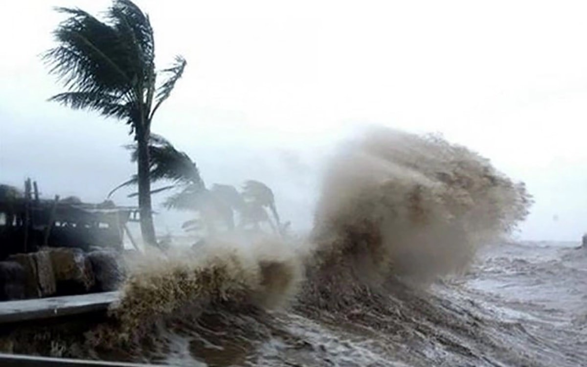
On the afternoon of July 18, speaking with reporters from Hai Phong Newspaper and Radio and Television, the leader of the city's Hydrometeorological Station stated that if the current direction and speed of movement remain the same, there is a high possibility that from the night of July 21 to 22, storm No. 3 will make landfall directly on the mainland of the provinces from Quang Ninh to Thai Binh , including Hai Phong City.
When the storm makes landfall, the wind speed is forecast to be level 7-9, gusting to level 10-11. Due to the storm's influence, from July 21 to 23, the city area will have heavy to very heavy rain. The total rainfall in these 3 days is expected to be from 150 - 250 mm, higher in some places.
On July 17, when the tropical depression had not yet strengthened into storm No. 3, the People's Committee of Hai Phong City requested departments, branches, sectors, and commune-level People's Committees to proactively respond to tropical depressions, storms, and floods according to the telegram of the Ministry of Agriculture and Environment .
Closely monitor the storm's developments, strictly manage offshore vessels, notify owners of vessels, aquaculture cages, and boats operating at sea not to enter dangerous sea areas, and proactively seek safe shelter...
Prepare forces and means for rescue when required. Increase propaganda so that people living in areas at risk of flooding, landslides, and flash floods can proactively prevent them.
The City People's Committee assigned the Department of Agriculture and Environment to proactively advise the City's Steering Committee for Natural Disaster Prevention, Search and Rescue and Civil Defense and the City People's Committee on response instructions.
Direct and guide localities to protect agricultural production and minimize damage caused by storms and floods. Inspect, review and implement measures to ensure the safety of dyke systems, reservoirs and irrigation works...
In September 2024, storm No. 3 (storm Yagi) made landfall directly, causing heavy rain and floods, causing serious damage to people and property in both Hai Duong province and Hai Phong city.
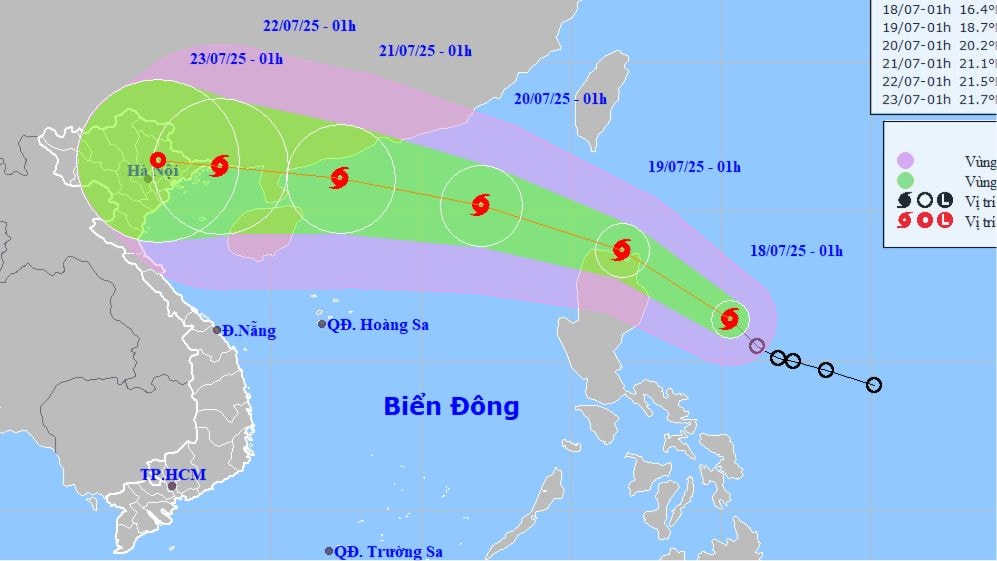
According to the National Center for Hydro-Meteorological Forecasting, at 1:00 p.m. on July 18, the center of storm No. 3 was located at about 18.3 degrees North latitude - 123.5 degrees East longitude, in the sea northeast of Luzon Island (Philippines). The strongest wind near the center of the storm was at level 8 - 9 (62 - 88 km/h), gusting to level 11. The storm moved northwest at a speed of about 30 km/h.
It is expected that tonight and tomorrow morning, Typhoon Wipha will cross the northeastern sea of Luzon Island to enter the northern East Sea area.
Source: https://baohaiphongplus.vn/du-bao-dem-21-7-bao-so-3-bao-wipha-se-do-bo-truc-tiep-vao-hai-phong-416662.html


![[Infographic] In 2025, 47 products will achieve national OCOP](https://vphoto.vietnam.vn/thumb/402x226/vietnam/resource/IMAGE/2025/7/16/5d672398b0744db3ab920e05db8e5b7d)


Comment (0)