
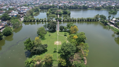
The Hanoi People's Committee has approved the detailed planning project of the central spatial axis of Quang An peninsula, scale 1/500. Location in Quang An ward, Tu Lien ward, Tay Ho district, Hanoi city.
Hanoi approves detailed planning project for central spatial axis of Quang An peninsula
The Hanoi People's Committee has approved the detailed planning project of the central spatial axis of Quang An peninsula, scale 1/500. Location in Quang An ward, Tu Lien ward, Tay Ho district, Hanoi city.
Vice Chairman of Hanoi People's Committee Duong Duc Tuan has just signed Decision No. 6132/QD-UBND approving the detailed planning project of the central spatial axis of Quang An peninsula, scale 1/500. Location in Quang An ward, Tu Lien ward, Tay Ho district, Hanoi city.
The project aims to specify the Urban Zoning Plan for the West Lake area and vicinity (A6), scale 1/2000 and locally adjust the Urban Zoning Plan A6, scale 1/2000 in planning blocks 16, 17, 19 and regional routes.
Forming a green axis, entertainment area, spiritual cultural park, thematic cultural and artistic park, including building a large-scale modern theater typical of the Capital, with a public landscape space axis, combined with a commercial development area, services, hotels serving resort tourism ensuring standards according to current regulations.
At the same time, establish a spatial axis connecting the central area of Tay Ho Tay urban area - West Lake - West Lake peninsula - Red River - Co Loa citadel. Preserve, embellish and exploit the typical values of culture, landscape, water surface of West Lake, Dam Tri lake... existing communal house, temple, pagoda relics, landscape architecture space harmoniously connecting landscape architecture space with surrounding projects.
Connecting urban underground space, underground parking lots with the general technical infrastructure system according to the City's planning. Improving technical infrastructure and traffic systems, adding parking lots, protecting the ecological environment of West Lake's water surface and the regional environment.
The research area for detailed planning of the central space of Quang An peninsula, scale 1/500, belongs to the administrative boundaries of Quang An ward, Tu Lien ward, Tay Ho district, Hanoi city. The Northeast borders Au Co street and Xuan Dieu street. The Northwest borders the land along Dang Thai Mai street and Thuy Su lake. The Southwest borders the water surface of West Lake. The Southeast borders the land along Dang Thai Mai spatial axis, Tay Ho villa area.
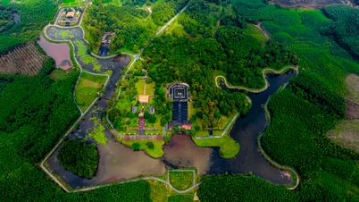
The total planned land area is about 44.1 hectares with the main functions being a specialized cultural and artistic park, City Theater, religious and belief works, entertainment area and hotel and commercial services.
The Hanoi People's Committee assigned the Tay Ho District People's Committee to preside over and coordinate with the Department of Planning and Architecture and the Hanoi Institute of Construction Planning to publicly announce the approved detailed planning project content so that relevant organizations, agencies and people can know.
Source: https://baodautu.vn/batdongsan/ha-noi-duyet-do-an-quy-hoach-chi-tiet-truc-khong-gian-trung-tam-ban-dao-quang-an-d231161.html


Comment (0)