
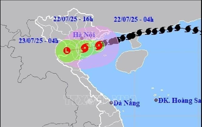
The storm is moving west at a speed of 10-15 km/h.
The National Center for Hydro-Meteorological Forecasting predicts that in the next 3 hours, the storm will move in the West-Southwest direction, at a speed of about 10-15 km/h.
Commenting on the next developments, Director of the National Center for Hydro-Meteorological Forecasting Mai Van Khiem said that after 10am this morning, storm No. 3 will enter the area south of Hai Phong and Ninh Binh with wind intensity of level 9-10, gusting to level 11, and wind inland around level 6-7, gusting to level 8.
Thunderstorm warning in Hanoi
The National Center for Hydro-Meteorological Forecasting reported that through monitoring satellite images, lightning location data and weather radar images, the cloud area in the north of the storm's circulation is moving into the Hanoi area such as: Son Tay, Tung Thien, Phuc Tho, Doai Phuong, Phuc Tho, Phuc Loc, Thach That, Ha Bang, Hoa Lac, Co Loa communes... This cloud area continues to form and develop in the Hanoi area.
From 10am to 1pm on July 2, wards in Hanoi's inner city such as Viet Hung, Bo De, Hong Ha, Ba Dinh, Khuong Dinh... will have rain, showers and possibly thunderstorms. The thunderstorm area may expand to other wards in the center of Hanoi, during thunderstorms there is a possibility of tornadoes, lightning and strong gusts of wind. Warning level of natural disaster risk due to tornadoes, lightning, hail: level 1.
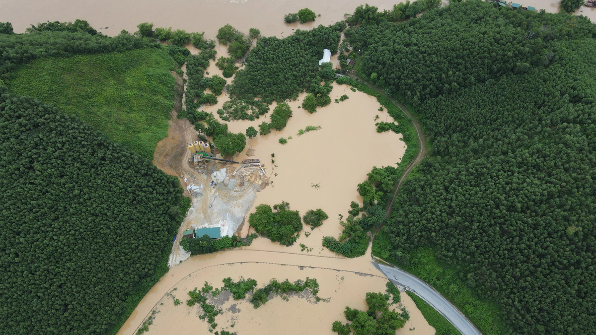
Risk of flash floods and landslides in the North, Thanh Hoa, Nghe An
Along with that, the National Center for Hydro-Meteorological Forecasting assessed that from July 22 to July 25, there will be a flood on rivers in the North, Thanh Hoa, Nghe An, with a flood amplitude of 3-5m on the rivers. During this flood, the flood peak on small rivers, the upper reaches of Thao River, Lo River, Thai Binh River, Hoang Long River, the upper reaches of Ma River, Ca River will reach alert level 1 - alert level 2; the flood peak on the lower reaches of Red River, Ma River, Ca River will be below alert level 1.
High risk of flooding in low-lying areas along rivers, urban areas in the Northern Delta, Thanh Hoa, Nghe An; flash floods and landslides on steep slopes in mountainous areas of the North, Thanh Hoa, Nghe An (real-time warning information on areas at risk of flash floods and landslides is provided online on the website of the Department of Hydrometeorology at: https://luquetsatlo.nchmf.gov.vn and in separate bulletins warning of flash floods and landslides).
Warning level 1 flood disaster risk. Floods on rivers and streams can cause flooding in low-lying areas along rivers, affecting activities such as waterway transportation, aquaculture, agricultural production, people's lives and socio-economic activities.
Water levels on rivers in the Red River - Thai Binh system, Ma River (Thanh Hoa), Ca River (Nghe An) fluctuate and are below alert level 1.
Source: https://hanoimoi.vn/khoang-sau-10-gio-ngay-22-7-bao-di-vao-khu-vuc-phia-nam-hai-phong-va-ninh-binh-709988.html


![[Photo] Signing of cooperation between ministries, branches and localities of Vietnam and Senegal](https://vphoto.vietnam.vn/thumb/1200x675/vietnam/resource/IMAGE/2025/7/24/6147c654b0ae4f2793188e982e272651)


Comment (0)