
 Author Huynh My Thuan's photo series "Ma Pi Leng - World Natural Heritage Site" showcases Ma Pi Leng Peak, located at an altitude of 1,200m in the Dong Van Karst Plateau, along the Happiness Road connecting Ha Giang city with Dong Van and Meo Vac districts. On October 3, 2010, the "Dong Van Karst Plateau Geopark" dossier was officially recognized as a Global Geopark by the UNESCO Global Geoparks Network (GGN) Advisory Council. At that time, this was the only title in Vietnam and the second in Southeast Asia. The author submitted the photo series to the Happy Vietnam Photo and Video Contest, organized by the Ministry of Information and Communications .
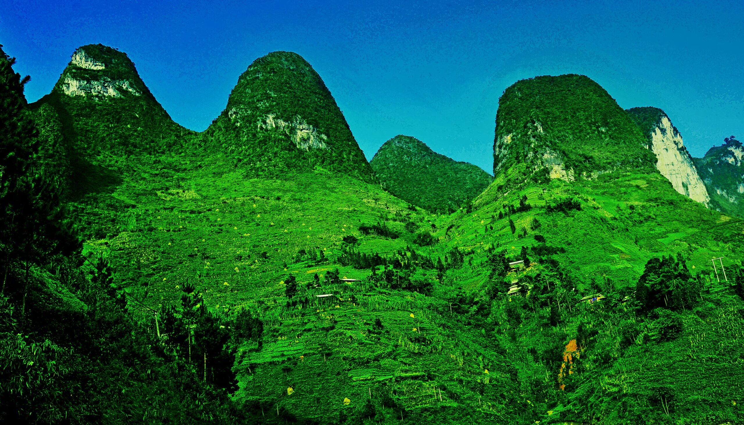
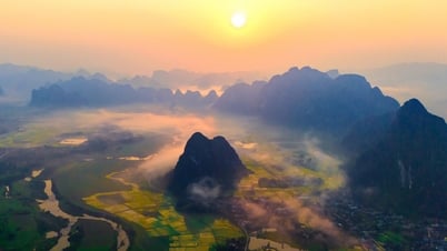
 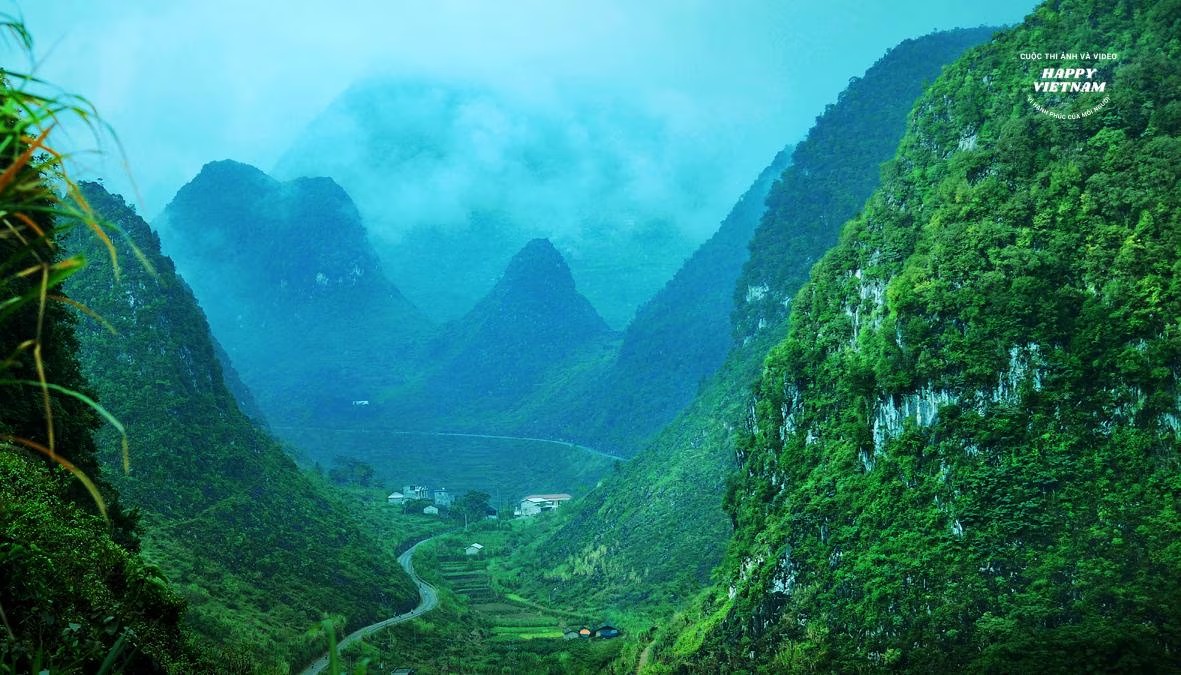 From the top of the pass, one can look out and see a vast landscape with dense ranges of towering limestone mountains of various shapes, most notably the pyramid-shaped peaks.
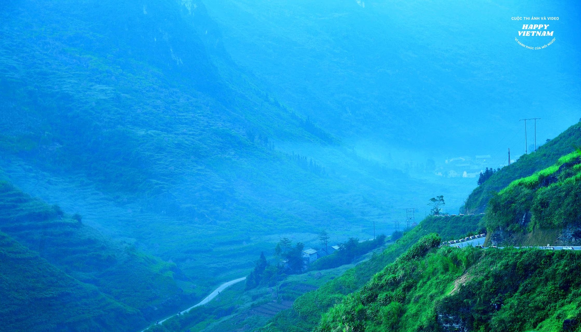
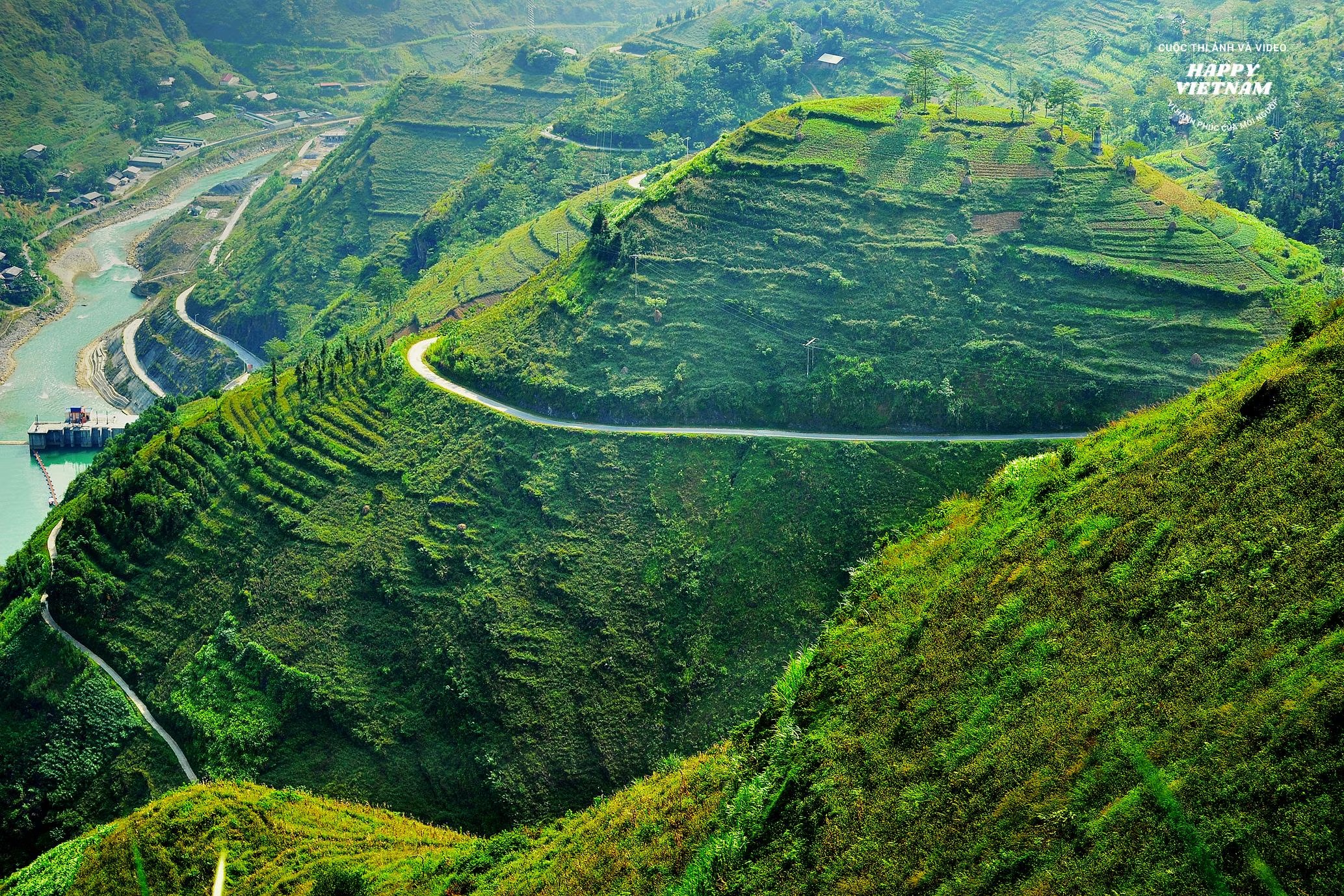 Ma Pi Leng Peak is an area with beautiful and majestic natural scenery, possessing high aesthetic value; the terrain is mainly limestone mountains with many unique and fascinating shapes, and it holds enormous potential for tourism .
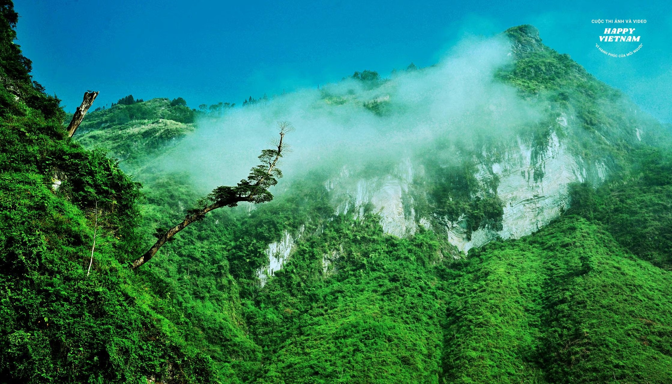
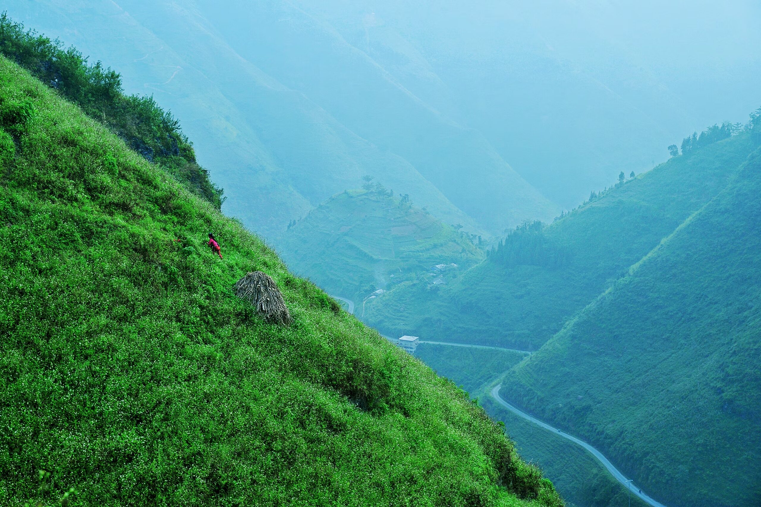
 The mountain pass runs along the right slope of the Nho Que River gorge , with steep mountain slopes and sheer cliffs . The surrounding terrain is mainly limestone mountains with continuously changing micro-tectonic forms.
 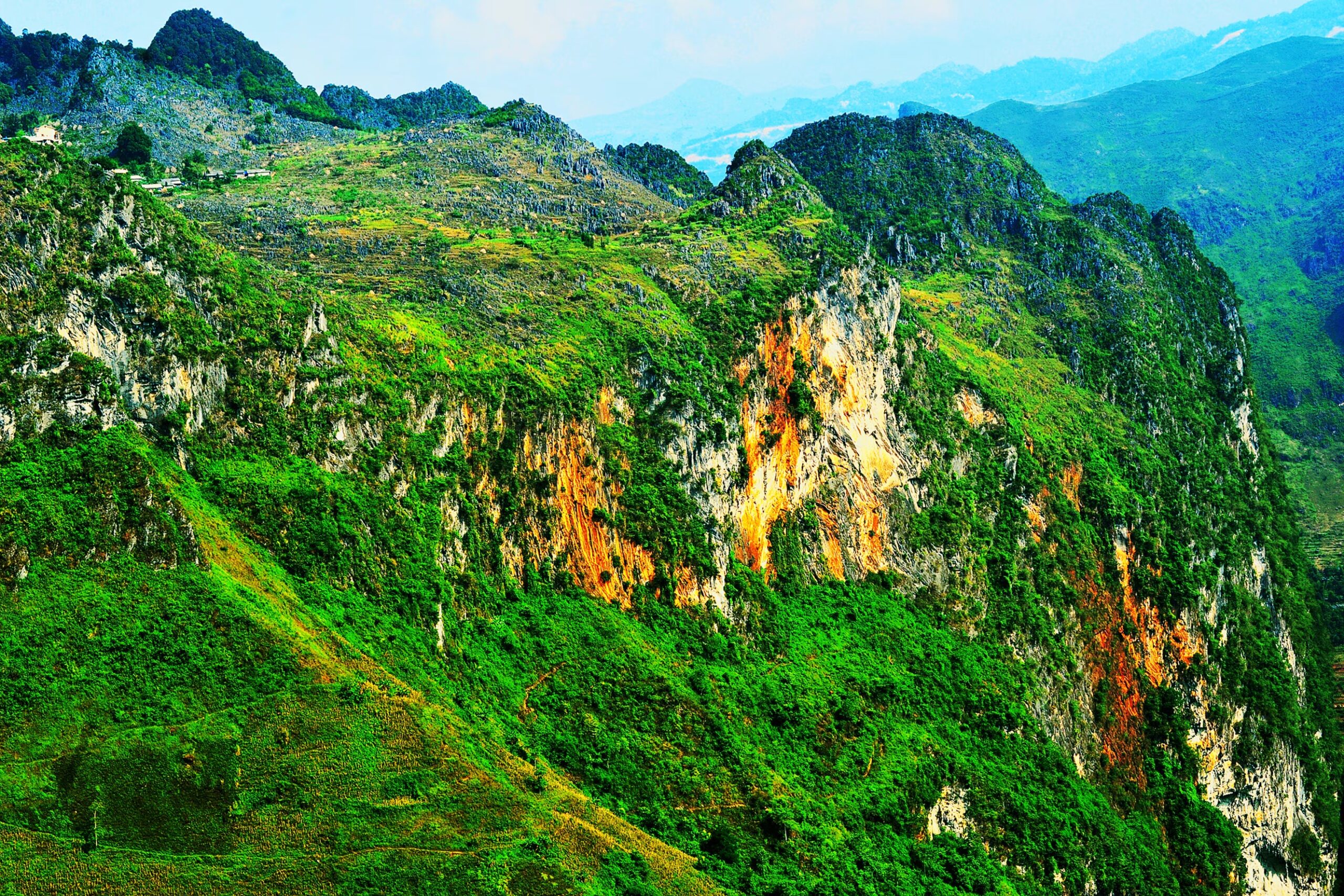 In addition, this area also has many steep, vertical rock formations, some reaching heights of several hundred meters, stretching out on both sides to form a giant rock wall.
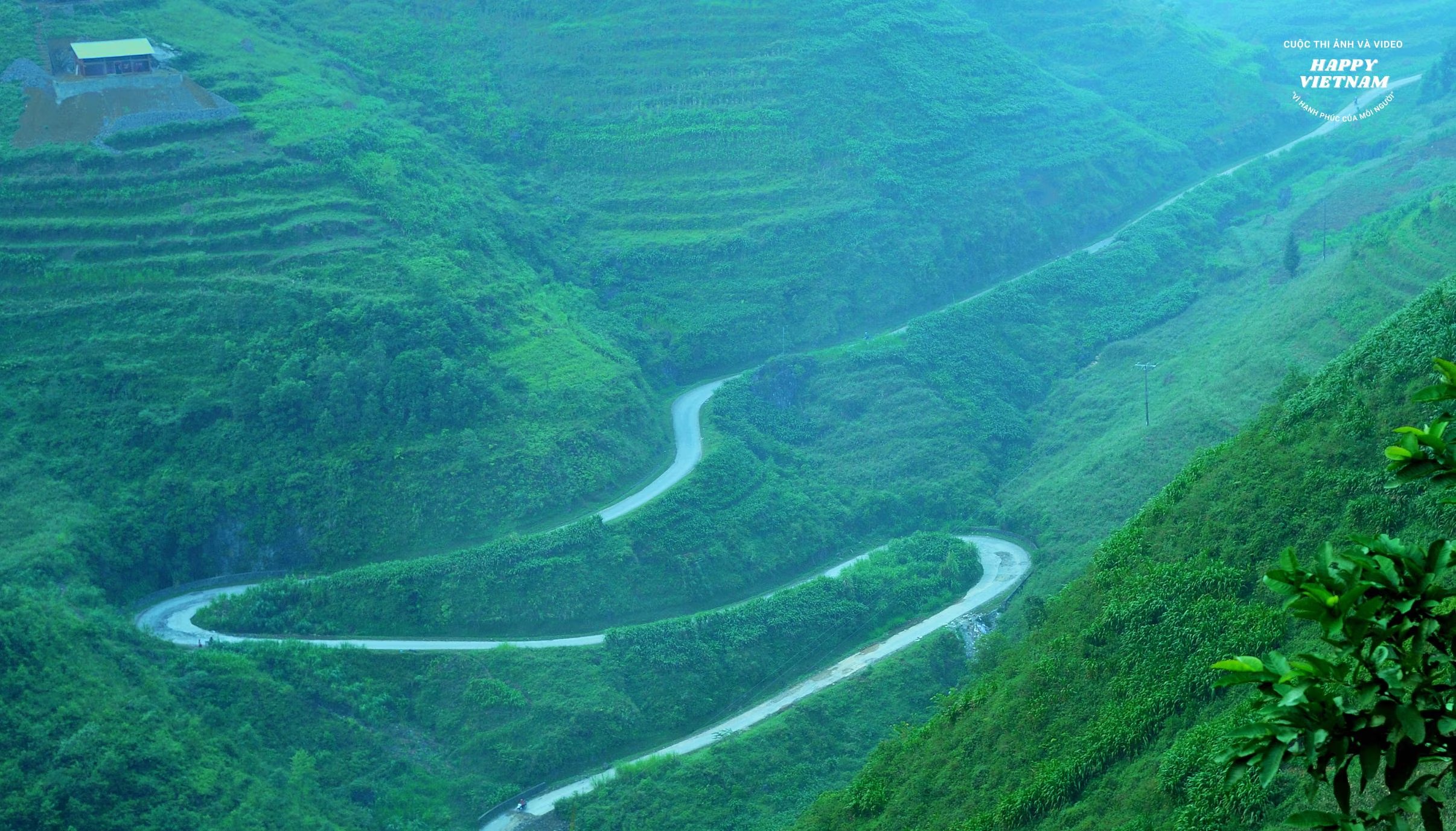
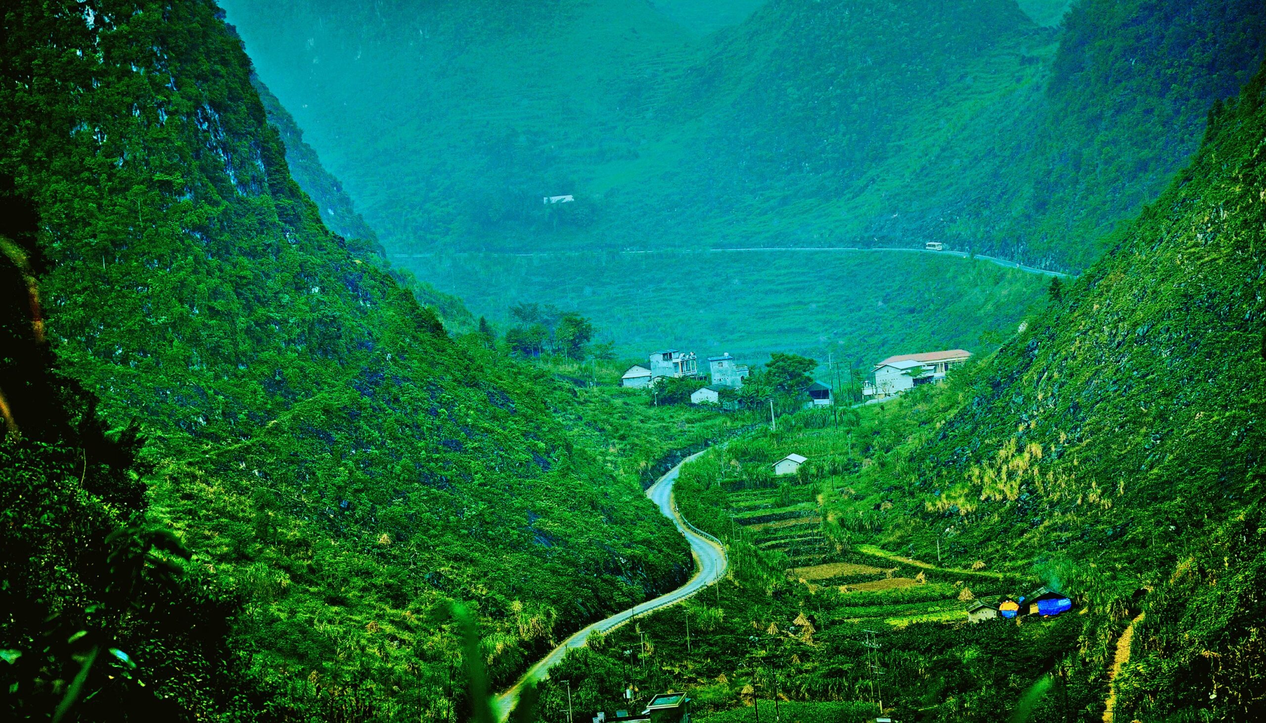
 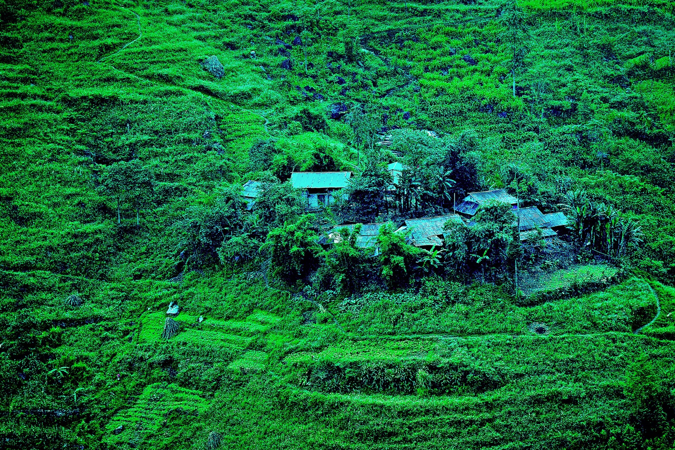 Standing atop the pass, one can take in the entire vast plateau; below, the Nho Que River flows like a colorful silk ribbon winding through narrow mountain gorges. On both sides of the mountain slopes along the river, Hmong villages are nestled amidst the green of cornfields.
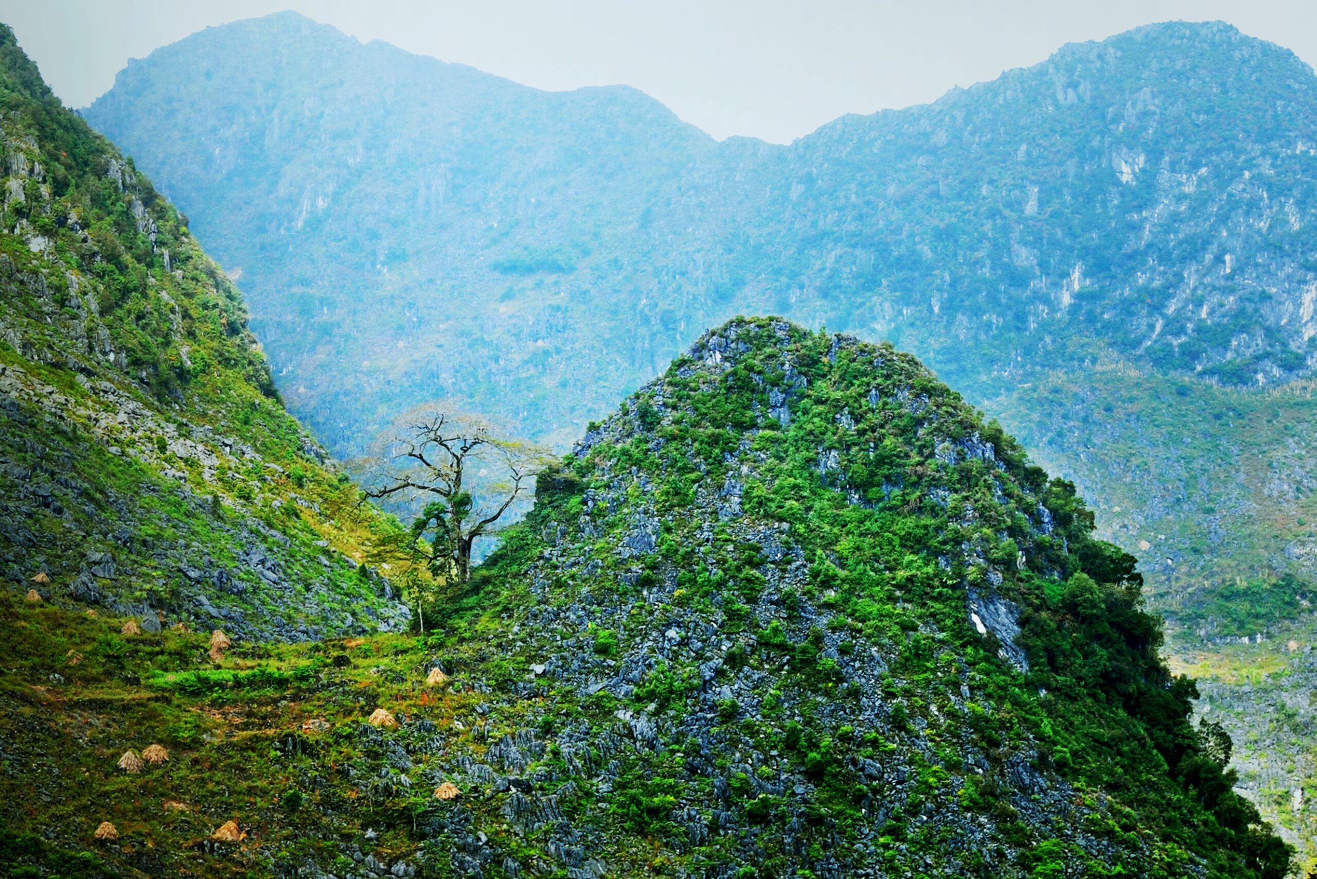
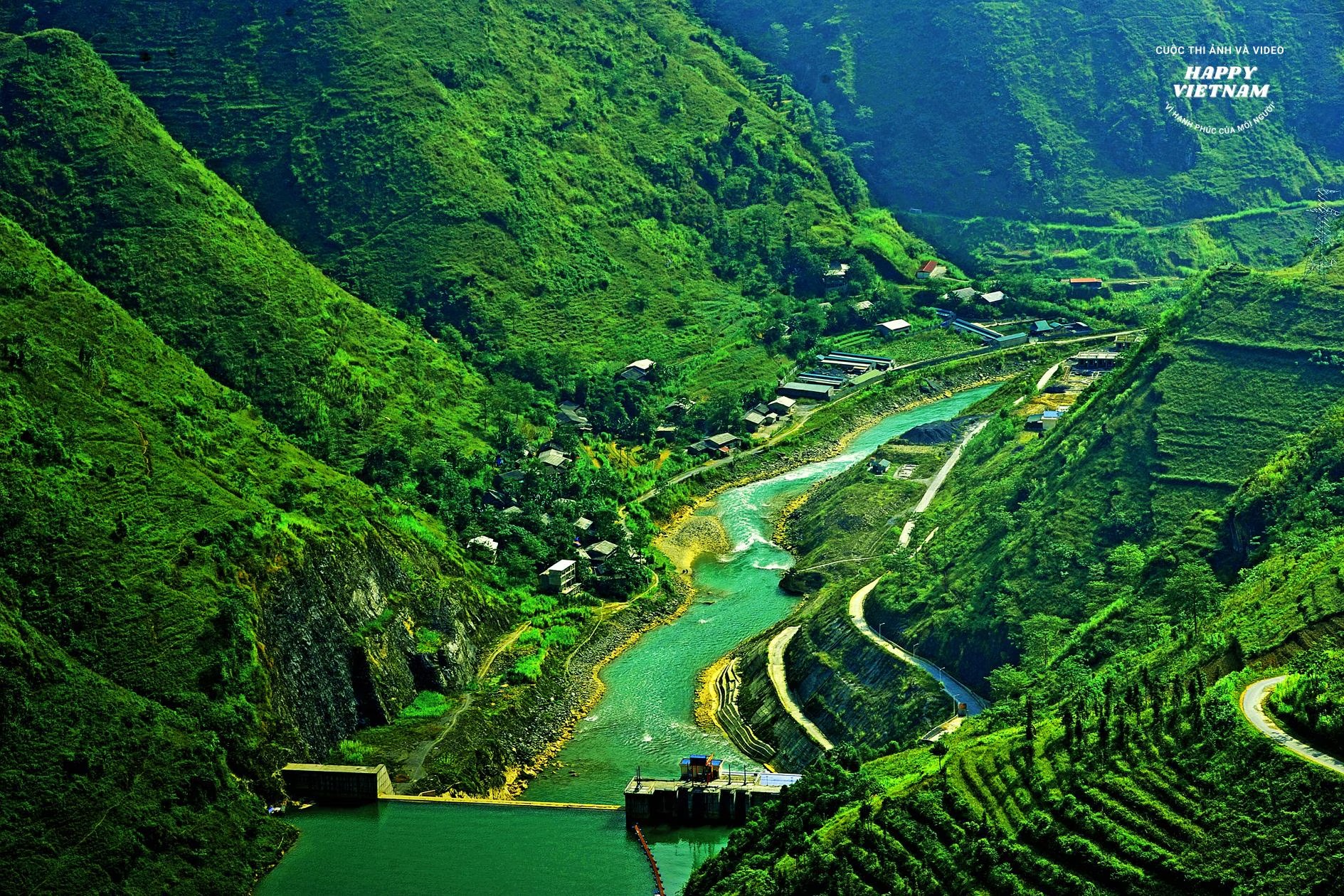 But perhaps the most beautiful and majestic is the Nho Que Gorge. Located about 1km east of the pass summit , it is flanked by sheer cliffs reaching a height of 670m, composed of limestone. Below, the Nho Que River flows through the gorge, while above, a forest of jagged limestone formations with many fascinating shapes is visible. This is what has captivated countless tourists who stop at the pass summit, and the name "the most magnificent pass , one of the four great mountain passes" has become synonymous with Ma Pi Leng.
Vietnam.vn


![[Photo] General Secretary and President To Lam meets with National Assembly delegates from ethnic minorities.](https://vphoto.vietnam.vn/thumb/1200x675/vietnam/resource/IMAGE/2026/04/20/1776696701056_a1-bnd-8331-3342-jpg.webp)
![[Image] National Assembly discusses the implementation of the socio-economic development plan.](https://vphoto.vietnam.vn/thumb/1200x675/vietnam/resource/IMAGE/2026/04/20/1776696707422_ndo_br_img-20260420-185419-jpg.webp)


Comment (0)