
According to the National Center for Hydro-Meteorological Forecasting, storm No. 3 has approached very close to the northern mainland and will make landfall this morning. The storm's circulation will cause extremely heavy rain, with a high risk of flooding, flash floods and landslides in many areas.
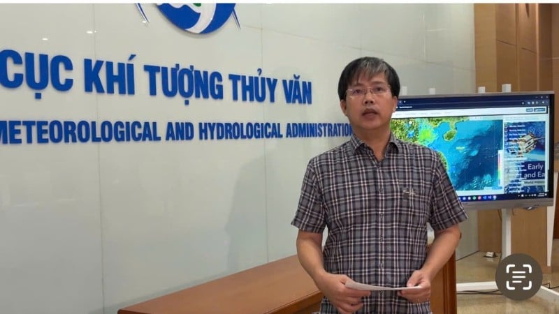
Mr. Mai Van Khiem, Director of the National Center for Hydro-Meteorological Forecasting, informed about the developments of storm No. 3 on the morning of July 22.
Storm circulation causes heavy rain, high risk of natural disasters
Informing the press on the morning of July 22, Mr. Mai Van Khiem, Director of the National Center for Hydro-Meteorological Forecasting, said: At 6:00 a.m., the center of storm No. 3 was about 70km from the Hung Yen - Ninh Binh area and about 100km from Thanh Hoa. It is forecasted that after 10:00 a.m. this morning, the storm will make landfall The southern Hai Phong and Ninh Binh areas, with strong winds of level 9, gusting to level 10-11. As it moves further inland, the storm gradually weakens, with wind intensity remaining at around level 6-7, gusting to level 8.
From July 21 to this morning, the circulation of storm No. 3 has caused very heavy rain in many provinces along the Gulf of Tonkin, with some places recording local rainfall exceeding 200mm. The National Center for Hydro-Meteorological Forecasting said that rain will continue to increase today and tomorrow (July 23), with rainfall ranging from 200mm to 300mm, and some areas may exceed 500mm.
The heavy rain is concentrated in the provinces of Hung Yen, Ninh Binh, Thanh Hoa and Nghe An . Other localities in the North and North Central regions may also record rainfall from 100mm to 200mm.
Mr. Mai Van Khiem emphasized: “In addition to the risk of flooding in urban areas, we need to pay special attention to the high risk of flash floods and landslides in mountainous areas. This dangerous situation could last for the next two to three days.”
Warning of dangerous weather in Hanoi
At 4:50 a.m. on July 22, the National Center for Hydro-Meteorological Forecasting issued a warning of thunderstorms, tornadoes, lightning, hail, and localized heavy rain in the Hanoi area. In the previous 3 hours, the radar system and satellite images recorded strong convective cloud development, causing rain in the areas of Doai Phuong, Yen Xuan, Hoa Lac, Huong Son, Dai Xuyen, Phu Xuyen, Chuyen My, Ung Hoa, Ba Vi, and Yen Bai of Hanoi.
It is expected that within the next 30 minutes to 3 hours, the convective cloud area will continue to expand and cause rain in other neighboring areas of the capital. During thunderstorms, people need to be on guard against the possibility of tornadoes, lightning and strong gusts of wind. The warning of natural disaster risks due to tornadoes, lightning and hail is determined at level 1.
Source: https://baolangson.vn/ong-mai-van-khiem-mua-lon-do-bao-so-3-se-don-dap-trong-hom-nay-va-ngay-mai-5053845.html
![[INFOGRAPHIC] Galaxy Z Fold7: Samsung's cutting-edge technology leap](https://vphoto.vietnam.vn/thumb/1200x675/vietnam/resource/IMAGE/2025/7/30/2fced87d84e54fb6afaee83be89735c1)


![[Photo] National Assembly Chairman attends the seminar "Building and operating an international financial center and recommendations for Vietnam"](https://vphoto.vietnam.vn/thumb/1200x675/vietnam/resource/IMAGE/2025/7/28/76393436936e457db31ec84433289f72)


Comment (0)