

Accordingly, high-chassis vehicles, trucks and passenger vans can still move through this area, while cars and low-chassis vehicles are temporarily unable to circulate.
To ensure traffic safety, the Vietnam Road Administration has organized temporary traffic diversion. Specifically, 4-seat vehicles and low-chassis vehicles traveling from Thai Nguyen to Hanoi will go in the following direction: from Yen Binh overpass (Thai Nguyen) to Phuong Tre intersection, turn right over Xuan Cam bridge (Da Phuc commune) to get to the Hanoi-Thai Nguyen expressway at Bac Phu intersection (Da Phuc commune, Soc Son, Hanoi).
Road Traffic Police Team No. 15 (Traffic Police Department - Hanoi City Police) has deployed forces to directly regulate, warn and coordinate with the Traffic Police Department of Thai Nguyen Provincial Police to guide vehicles to avoid flooded areas.

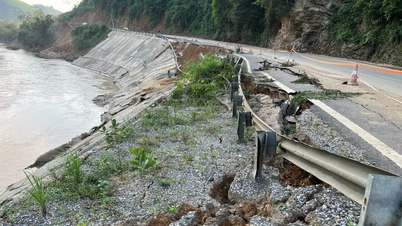
Previously, according to Road Management Office I.3 (Vietnam Road Administration), at 6:00 a.m. on October 10, the weather in the route area was not raining, but there was still localized flooding in some locations.
Specifically, the section Km28+800 – Km29+050 (direction Thai Nguyen – Hanoi) is flooded for about 150m, water level 60cm; the opposite direction (Hanoi – Thai Nguyen) is flooded about 15cm.
The authorities have coordinated traffic flow at the following locations:
Yen Binh intersection (Km41+350, Thai Nguyen direction) is managed by the Traffic Police Department of Thai Nguyen Provincial Police.
Km29+250 (towards Hanoi) is regulated by Traffic Police Team No. 15 - Hanoi City Police.
According to records, on the night of October 9, floodwaters rose high and overflowed onto the highway, causing localized flooding and traffic disruption. Authorities were on hand to guide vehicles to move safely.
On the morning of October 10, vehicles with less than 9 seats traveling from Hanoi to Thai Nguyen, Bac Kan , and Cao Bang were instructed to turn onto National Highway 3 at Km26 (Bac Phu intersection) and continue along National Highway 37. In the opposite direction, vehicles from Cao Bang, Bac Kan, and Thai Nguyen to Hanoi followed the CT07 highway to Yen Binh intersection (Km41+850), turned onto National Highway 3 at Km42, and continued to Hanoi.
Currently, functional forces are still on duty 24/7 at flooded areas to guide vehicles, monitor water levels and urgently fix problems, soon ensuring normal traffic on the entire route.
Source: https://nhandan.vn/phan-luong-tam-thoi-cao-toc-ha-noi-thai-nguyen-do-ngap-sau-tai-km29-post914379.html


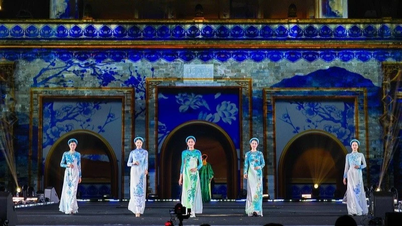
![[Photo] Discover unique experiences at the first World Cultural Festival](https://vphoto.vietnam.vn/thumb/1200x675/vietnam/resource/IMAGE/2025/10/11/1760198064937_le-hoi-van-hoa-4199-3623-jpg.webp)


![[Photo] General Secretary attends the parade to celebrate the 80th anniversary of the founding of the Korean Workers' Party](https://vphoto.vietnam.vn/thumb/1200x675/vietnam/resource/IMAGE/2025/10/11/1760150039564_vna-potal-tong-bi-thu-du-le-duyet-binh-ky-niem-80-nam-thanh-lap-dang-lao-dong-trieu-tien-8331994-jpg.webp)


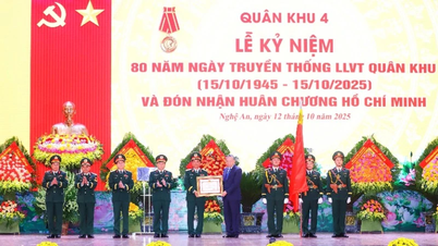
![[Photo] General Secretary attends the 80th Anniversary of the Traditional Day of the Armed Forces of Military Region 4](https://vphoto.vietnam.vn/thumb/402x226/vietnam/resource/IMAGE/2025/10/12/1760265970415_image.jpeg)


Comment (0)