
According to the National Center for Hydro-Meteorological Forecasting, early this morning, the center of the tropical depression was over the coastal areas of Quang Ninh - Hai Phong provinces with intensity of level 6, gusting to level 8.
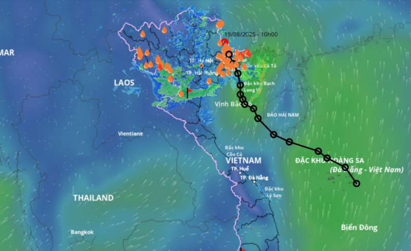
Due to the influence of the tropical depression, Quang Ha station has strong winds of level 6, gusting to level 9; Bach Long Vi station has strong winds of level 6, gusting to level 7; Co To station has strong winds of level 6, gusting to level 8; Cua Ong station has strong winds of level 6.
It is forecasted that today, the low pressure area will move northwest at about 15km per hour, enter the Vietnam-China border area and gradually weaken into a low pressure area. By 4pm this afternoon, the center of the low pressure area will be on the Vietnam-China border and gradually dissipate.
According to the National Center for Hydro-Meteorological Forecasting, currently in the Northwest Pacific region, there are strong disturbances that can develop into tropical depressions/storms, then potentially move into the East Sea, affecting the weather of the Northern and Central regions in the last days of August 2025.
The agency noted that people need to pay attention to updated news on the website www.nchmf.gov.vn, weather monitoring information and immediate warnings of thunderstorms and lightning at: www.iweather.gov.vn.
Source: https://cand.com.vn/doi-song/sau-ap-thap-nhiet-doi-bien-dong-kha-nang-don-bao-manh-i778570/


![[Photo] Politburo works with the Standing Committee of Da Nang City Party Committee and Quang Ninh Provincial Party Committee](https://vphoto.vietnam.vn/thumb/1200x675/vietnam/resource/IMAGE/2025/8/19/b1678391898c4d32a05132bec02dd6e1)
![[Photo] General Secretary and Prime Minister visit the National Exhibition and Fair Center](https://vphoto.vietnam.vn/thumb/1200x675/vietnam/resource/IMAGE/2025/8/19/f4503ad032d24a90beb39eb71c2a583f)

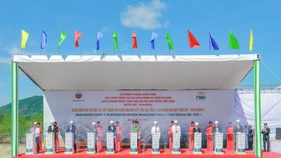
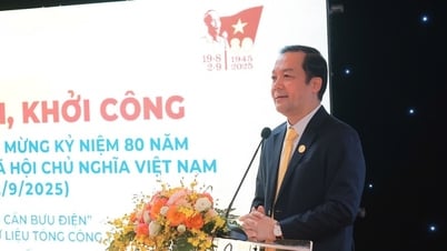
![[Photo] General Secretary To Lam attends the inauguration and groundbreaking ceremony of 250 projects to celebrate National Day](https://vphoto.vietnam.vn/thumb/1200x675/vietnam/resource/IMAGE/2025/8/19/3aa7478438a8470e9c63f4951a16248b)
![[Photo] Close-up of the first International Financial Center building in Ho Chi Minh City](https://vphoto.vietnam.vn/thumb/1200x675/vietnam/resource/IMAGE/2025/8/19/3f06082e1b534742a13b7029b76c69b6)
![[Photo] President Luong Cuong's wife and Queen of Bhutan visit Tran Quoc Pagoda](https://vphoto.vietnam.vn/thumb/1200x675/vietnam/resource/IMAGE/2025/8/19/62696af3852a44c8823ec52b03c3beb0)


Comment (0)