
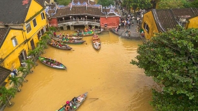
According to the provincial Hydrometeorological Station, the highest peak tide during this month's high tide will occur on November 22-24 (October 3-5 of the lunar calendar). The water level at My Thuan station is forecast to be 35cm higher than alert level III (BĐIII); Tra Vinh station is 17cm higher than BĐIII; Cho Lach station is 10cm higher than BĐIII; the remaining stations are approximately equal to or about 5cm higher than BĐIII.
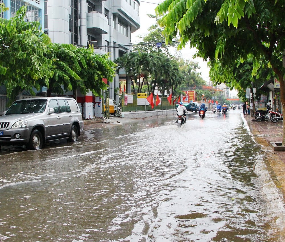 |
| Flooding potential from now until November 25th is 1-60cm. |
During the above time, the peak tide at My Thuan and Cho Lach stations occurs from 3:30 to 6:30 and 18:00 to 21:30. At My Hoa, Tra Vinh and Cau Quan stations, the peak tide falls from 2:30 to 5:00 and 17:00 to 20:30. At An Thuan, Binh Dai and Ben Trai stations, the peak tide occurs from 1:30 to 3:30 and 16:00 to 19:00.
The possibility of flooding from now until November 25th ranges from 1-60cm; the deepest level on November 22nd-24th can reach 10-60cm, while some low-lying areas such as Binh Minh bus station can be flooded by 55-75cm. The natural disaster risk warning level is ranked at level 2.
High tides are forecast to cause flooding in many low-lying areas across the province. The provincial Hydrometeorological Station recommends that localities proactively protect and reinforce dykes, raise furniture, implement flood response measures and prevent landslides caused by high tides combined with upstream water and northeast winds.
News and photos: THAO LY
Source: https://baovinhlong.com.vn/thoi-su/202511/trieu-cuong-dat-dinh-tu-222411-nguy-co-ngap-sau-toi-75cm-canh-bao-rui-ro-cap-2-5e41e06/
![[Photo] Lam Dong: Panoramic view of Lien Khuong waterfall rolling like never before](/_next/image?url=https%3A%2F%2Fvphoto.vietnam.vn%2Fthumb%2F1200x675%2Fvietnam%2Fresource%2FIMAGE%2F2025%2F11%2F20%2F1763633331783_lk7-jpg.webp&w=3840&q=75)

![[Photo] National Assembly Chairman Tran Thanh Man holds talks with South Korean National Assembly Chairman Woo Won Shik](/_next/image?url=https%3A%2F%2Fvphoto.vietnam.vn%2Fthumb%2F1200x675%2Fvietnam%2Fresource%2FIMAGE%2F2025%2F11%2F20%2F1763629724919_hq-5175-jpg.webp&w=3840&q=75)
![[Photo] President Luong Cuong receives President of the Senate of the Czech Republic Milos Vystrcil](/_next/image?url=https%3A%2F%2Fvphoto.vietnam.vn%2Fthumb%2F1200x675%2Fvietnam%2Fresource%2FIMAGE%2F2025%2F11%2F20%2F1763629737266_ndo_br_1-jpg.webp&w=3840&q=75)


Comment (0)