
According to the China National Space Administration (CNSA), the panoramic images were compiled from 14,757 photos taken by the Tianwen-1 orbiter's medium-resolution camera between November 2021 and July 2022.
The Tianwen-1 spacecraft launched from Hainan Island in July 2020. Photo: Xinhua News Agency
The maps will add to our knowledge of the red planet and improve planning for future missions, including China's Tianwen-3 mission, according to the CNSA during a ceremony celebrating China's Space Day in Hefei.
The images also helped scientists identify many geographical features near the landing site, 22 of which were named by the International Astronomical Union after locations in China.
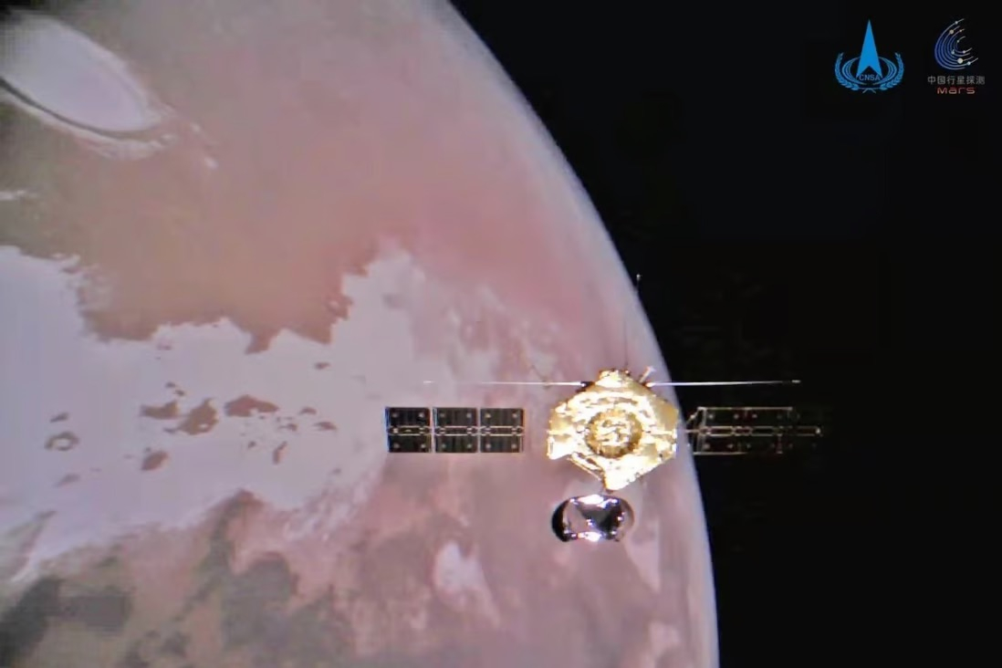
Tianwen-1 launched from southern Hainan Island in July 2020, marking the beginning of China's first interplanetary mission. After entering Mars orbit in February 2021, the spacecraft photographed pre-selected landing sites in Utopia Planitia, a vast plain, and successfully landed its lander and rover three months later.
By the end of June 2022, the Tianwen-1 orbiter had completed 1,344 orbits around Mars. It also supported data relays between the Zhurong rover and Earth and conducted global remote sensing surveys of Mars in lower orbit.
The solar-powered Zhurong rover spent a year traveling a total of 1,921 meters across the Martian surface before entering hibernation due to the harsh winter in May 2022. Zhurong remains dormant after failing to awaken as expected earlier this year when spring arrived on Mars, according to China Space Daily.
During a public address in Beijing on April 15, Jia Yang, the chief designer of the autonomous vehicle, noted that "we cannot rule out the possibility that Zhurong will never return."
The Tianwen-3 mission, scheduled to launch around 2030, aims to bring back at least 500 grams of rock from the Martian surface by remotely excavating, drilling, and sampling, according to the mission's chief designer, Liu Jizhong.
Mai Vân (according to SCMP)
Source


![[Photo] Prime Minister Pham Minh Chinh receives the Chinese Ambassador to Vietnam](https://vphoto.vietnam.vn/thumb/1200x675/vietnam/resource/IMAGE/2026/04/05/1775397481797_ndo_br_dsc-5512-jpg.webp)


Comment (0)