
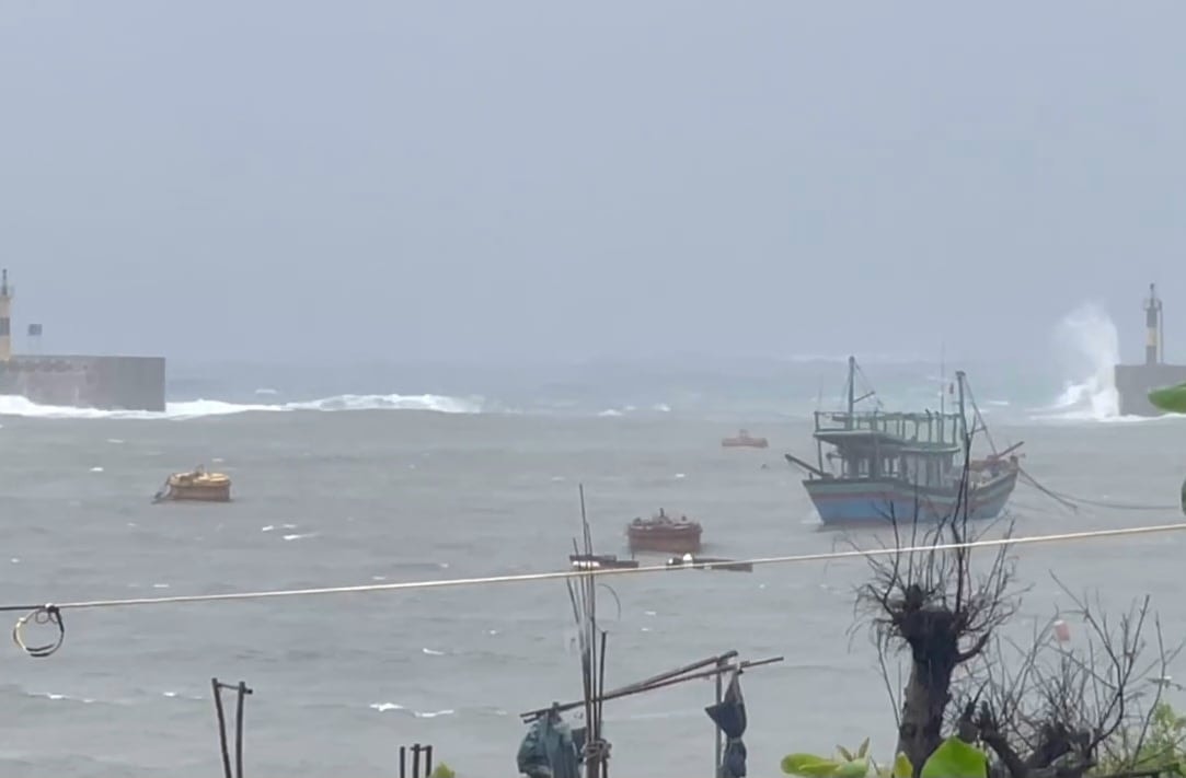
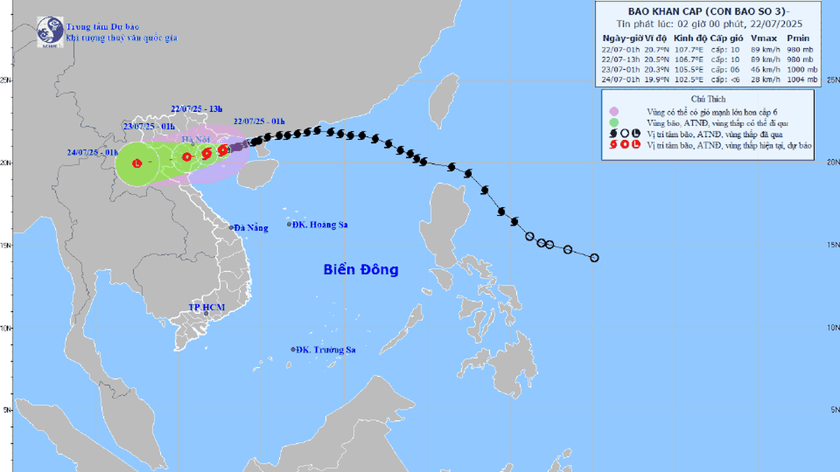
According to the Hai Phong City Hydrometeorological Station, storm No. 3 is moving from the Gulf of Tonkin straight to the mainland of our country. As of 10:00 a.m. on July 21, the center of the storm was at about 21.2 degrees north latitude, 109.6 degrees east longitude, 310 km east of Hai Phong . The strongest wind near the center of the storm is level 9 (75 - 88 km/h), gusting to level 11. It is forecasted that tonight until early morning on July 22, the storm will make landfall directly.
Due to the influence of the storm circulation, from the afternoon of July 20 to this morning of July 21, there has been rain in the sea and mainland areas of Hai Phong. Currently, the Bach Long Vy island area is experiencing heavy rain, gusts of wind at level 9, and very rough seas.
The coastal area of the city including Cat Hai, Cat Ba, Hon Dau islands... is also having rain, wind intensity level 3, no gusts yet.
It is forecasted that from 1pm this afternoon until the end of July 23, the entire mainland area of Hai Phong City will have heavy to very heavy rain. The rain will appear continuously, spreading from east to west.
From this afternoon, the coastal sea and coastal communes and wards will have gusts of level 4-5, increasing to level 6-7 at night. The communes and wards in the west of the city will have gusts of level 5 from tonight, gusts of level 6-7.
The total rainfall expected from this afternoon until the end of July 23 in Hai Phong is 150 - 250 mm (for the east) and 100 - 200 mm (for the west).
GOING STRONGSource: https://baohaiphongplus.vn/tu-chieu-nay-hai-phong-bat-dau-co-mua-to-den-rat-to-416884.html


![[Photo] National Assembly Chairman Tran Thanh Man visits Vietnamese Heroic Mother Ta Thi Tran](https://vphoto.vietnam.vn/thumb/1200x675/vietnam/resource/IMAGE/2025/7/20/765c0bd057dd44ad83ab89fe0255b783)


Comment (0)