

In order to help people, businesses and authorities be proactive in preventing and combating natural disasters, Dong Nai Newspaper reporters had an interview with Director of Dong Nai Province Hydrometeorological Station NGUYEN PHUOC HUY about this issue.
 |
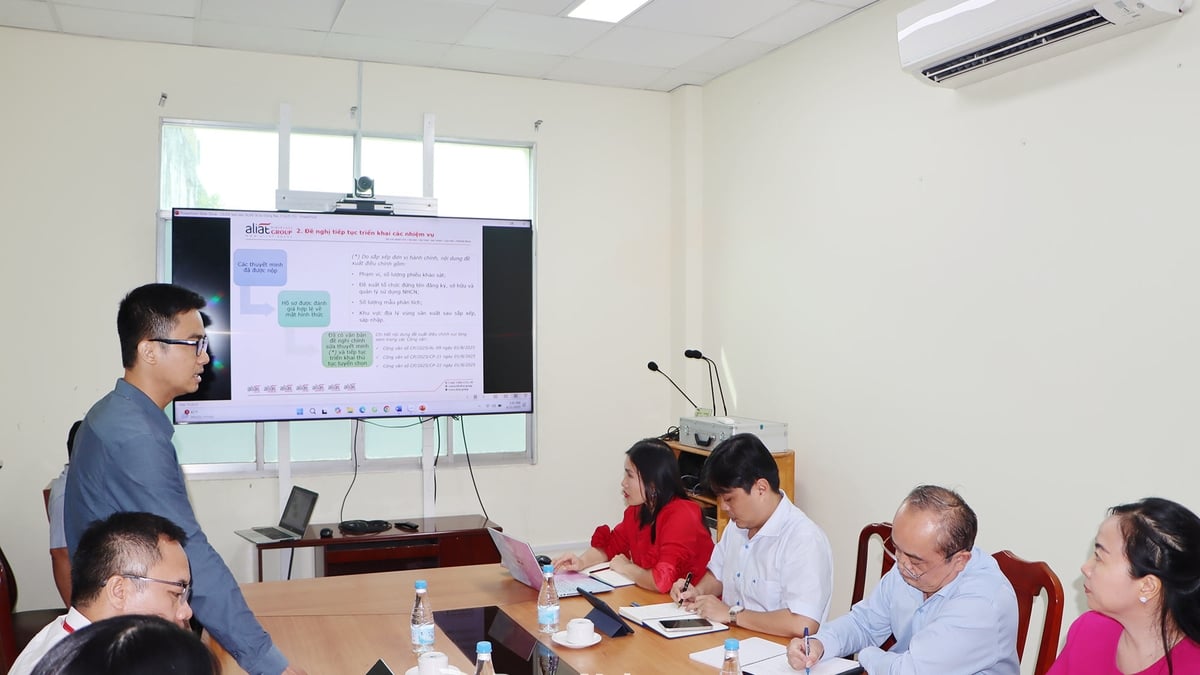
| Director of Dong Nai Province Hydrometeorological Station Nguyen Phuoc Huy. Photo: Kim Lieu |
* Sir, what is the general weather forecast from now until the end of 2025 in Dong Nai?
- From now until the end of December 2025, the weather forecast in the province in particular and the Southern region in general will continue to have many complicated developments. In particular, in the East Sea, there is a possibility of 6-8 storms or tropical depressions and about 3-5 storms are likely to directly affect the mainland.
Although Dong Nai is not often directly affected by storms, the circulation of storms and tropical depressions can cause prolonged heavy rain, thunderstorms, lightning, affecting life and production. In addition, phenomena such as thunderstorms, whirlwinds, hail, localized and unusual heavy rain can also appear during this rainy season, especially from now until the end of October.
* Can you share more specifically about the ENSO situation and its impact on the weather in Dong Nai?
- The ENSO phenomenon is maintaining a neutral state. In the first week of July 2025, the sea surface temperature in the central equatorial Pacific Ocean did not differ much from the average of many years (TBNN). It is forecasted that from now until October 2025, the neutral state is likely to remain with a probability of 70-90%, and from November to the end of 2025, the probability of maintaining this state is at 50-60%.
This shows that weather developments will be more unpredictable, extreme phenomena such as unseasonal rain, thunderstorms or sudden cold may occur. Therefore, people and local authorities need to be very proactive in disaster prevention and control.
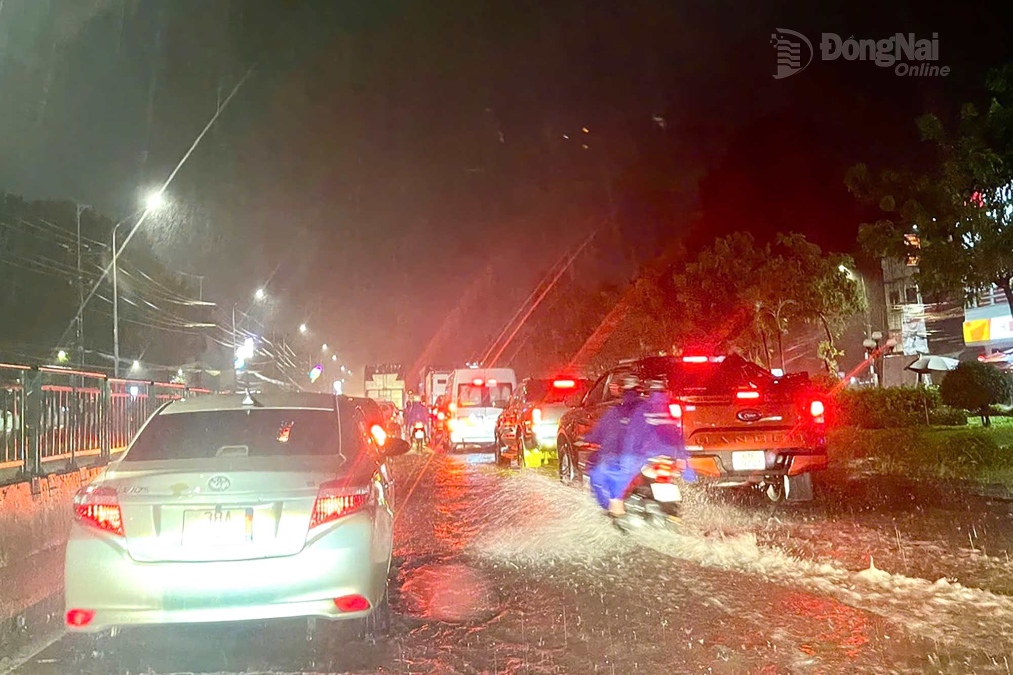 |
| Heavy rain on the evening of August 10 caused flooding on National Highway 1, through Trang Bom Commune, Dong Nai Province. Photo: Kim Lieu |
* What will the temperature and rainfall be like in the province from now on, sir?
- The average temperature from now until the end of 2025 is forecast to be approximately 0.2-0.7°C higher than the average. Specifically, in August, the temperature will be 0.2-0.7°C higher than the average. In September, the temperature in the province will be approximately the average and from October to December, the temperature will be stable, approximately the average.
Regarding rainfall, total rainfall in the last months of 2025 is also forecasted to be approximately equal to or higher than the average. August rainfall is common.
250-350mm, September rainfall from 310-400mm and from October to December rain continues to be at an average to above average level. Thus, the possibility of heavy, prolonged, and strong rains is entirely possible, especially during the strong southwest monsoon.
* With such heavy rain, what special developments are there in the hydrology of major rivers such as Dong Nai and La Nga?
- Hydrology on the Dong Nai and La Nga river systems has many fluctuations, specifically on the Dong Nai river, the water level continues to rise gradually until October, then decreases from November. The highest flood peak at Ta Lai station is likely to appear in September and October and is approximately at alert level 2 (112.5m). The water level of Tri An lake will gradually rise, peaking in December, but still lower than the average. At Bien Hoa station (downstream of Dong Nai river), the highest tide peak of the year is likely to occur in October, higher than alert level 2 (2m). On La Nga river, the highest flood peak at Phu Hiep station is expected to appear in September and October, but lower than alert level 2 (105.5m).
* In that context, what risks do people need to be aware of, sir?
- People need to pay special attention to the risk of sudden, rapid flooding on the Dong Nai and La Nga rivers when there is heavy rain upstream, especially if there is flood discharge from the reservoir.
In addition, the risk of local flooding in urban areas, flash floods in small rivers and streams, landslides in hills, river banks, and stream banks are entirely possible if heavy rains persist. These phenomena not only affect agricultural production and transportation but also threaten people's lives and property.
* So when is the period when Dong Nai needs to be especially cautious about the effects of storms and tropical depressions?
- Although Dong Nai is less directly affected by storms, from October to the end of the year, if a storm or tropical depression appears and affects the South Central Coast or the South Central Highlands, the possibility of indirect impact on Dong Nai is very high, especially in terms of rainfall.
Thunderstorms, tornadoes, lightning, hail, localized heavy rain, unusually heavy rain are likely to occur throughout the rainy season months, until the end of October. Beware of strong southwest monsoons causing widespread heavy rain. Cold air increases in intensity and frequency from November; the possibility of occurrence is approximately average compared to the same period.
In that case, heavy rain from upstream can cause major floods in the Dong Nai and La Nga rivers. In addition, strong southwest monsoons also cause widespread heavy rain, which can easily lead to flooding in low-lying and urban areas, or landslides in mountainous areas.
From around October to the end of 2025, if storms and tropical depressions appear, they will directly affect the South Central region and the Southern Central Highlands, causing heavy rain in the upper reaches of major rivers in Dong Nai, and the water will cause major floods on Dong Nai and La Nga rivers. Strong southwest monsoons will cause widespread heavy rain. Some places will have moderate, heavy to very heavy rain lasting for several days, potentially causing flooding in urban areas, low-lying areas; causing landslides in mountainous areas, landslides on river banks; streams; causing flash floods on slopes, rivers, and small streams.
* Do you have any recommendations for the people and local authorities in the coming time?
- Authorities at all levels, people and businesses need to proactively monitor weather and hydrological forecasts from specialized agencies. Do not be subjective to extreme weather patterns, even if they have indirect impacts. Develop appropriate disaster prevention and control plans, especially in the fields of agricultural production, livestock and aquaculture. At the same time, reinforce houses and civil works, check drainage systems, prepare materials and means on site to promptly respond when natural disasters occur. Improving early response capacity will help minimize damage to people and property, and protect community safety.
* Thank you!
Kim Lieu
Source: https://baodongnai.com.vn/xa-hoi/202508/tu-nay-den-cuoi-nam-kha-nang-co-thoi-tiet-cuc-doan-6a020de/


![[Photo] Politburo works with Standing Committees of Lang Son and Bac Ninh Provincial Party Committees](https://vphoto.vietnam.vn/thumb/1200x675/vietnam/resource/IMAGE/2025/8/20/0666629afb39421d8e1bd8922a0537e6)


![[Photo] An Phu intersection project connecting Ho Chi Minh City-Long Thanh-Dau Giay expressway behind schedule](https://vphoto.vietnam.vn/thumb/1200x675/vietnam/resource/IMAGE/2025/8/21/1ad80e9dd8944150bb72e6c49ecc7e08)


![[Photo] Politburo works with the Standing Committee of Hanoi Party Committee and Ho Chi Minh City Party Committee](https://vphoto.vietnam.vn/thumb/402x226/vietnam/resource/IMAGE/2025/8/21/4f3460337a6045e7847d50d38704355d)


Comment (0)