
Throughout history, the land of Quang Binh has seen an increasing number of outstanding individuals in various fields; many famous villages and clans have become reliable pillars for dynasties and, at times, for the destiny of the nation and homeland...
That was the first laureate of the Quang Binh examinations, Truong Xan, at the young age of 29. Following this, in every subsequent period, there were people whose names appeared in the Vietnamese examination records. Nearly 50 people passed the highest-level examinations, including one laureate, 27 doctors, 19 vice-bachelors, and hundreds of bachelors. The list of 49 high-level laureates highlights the presence of many families and lineages with numerous successful members; founding national heroes such as Le Thanh Hau Nguyen Huu Canh; famous writers and scholars like Huynh Con; and prominent families such as the Tran Dang, Nguyen Huu, Nguyen Duy, and Tran Khac clans... Quang Binh boasts numerous famous figures such as Duong Van An, Nguyen Huu Dat, Nguyen Kinh Chi... Talented writers and military strategists like Le Sy, Hoang Ke Viem, Le Truc, Nguyen Pham Tuan, Mai Luong... and even modern-day generals like Hoang Sam, Vo Nguyen Giap... have inherited and further developed these talents in the struggle to protect their homeland and country. Quang Binh is also a major cradle of pioneering writers in many fields, such as Luu Trong Lu, Han Mac Tu, Quach Xuan Ky...
Cultural traditions, patriotism, and revolution have flowed continuously throughout the history of Quang Binh province, and have been further enhanced since the leadership of the Communist Party of Vietnam .
During the Văn Lang - Âu Lạc period: Quảng Bình belonged to the Việt Thường region.
According to historical records and legends, the country of Van Lang - Au Lac was inhabited by 15 Lac Viet tribes, mainly in the midland and delta regions of the Red River. The Van Lang state was established by unifying the Lac Viet tribes to meet the needs of national development and defense against foreign invaders. Among the Lac Viet tribes, the Van Lang tribe was the most powerful, and its leader played a historical role in establishing the Van Lang state. The head of the Van Lang state was called Hung Vuong, and subsequent kings also bore that title. The territory of the Van Lang state encompassed the northern part of present-day Vietnam. According to the tribal divisions during the Van Lang period, Quang Binh belonged to the Viet Thuong tribe, which originally existed in an area previously recorded as Viet Thuong Thi - a rudimentary state administrative organization with geographical coordinates similar to those of present-day North Central Vietnam.
According to archaeological research, the southernmost point of the Lac Viet Bronze Age culture has been found, extending to the Gianh River basin. Therefore, the distribution of the Bronze Age culture in the North, broadly speaking, is equivalent to the area of the Van Lang Kingdom. At that time, the Van Lang people in the Quang Binh area knew how to inherit and develop the cultural achievements of previous periods to enter the Bronze Age with the aim of developing the economy, mainly agriculture and animal husbandry. Entering the Dong Son culture period, many types of weapons such as arrowheads, axes, armor plates, and daggers made of bronze were found in Quang Binh; many types of tools and household items such as bronze jars, bronze bowls, and even bronze drums were found at various archaeological sites such as Con Nen, Phu Luu, Hoa Hop... The agricultural economy under the Bronze Age developed, and the spiritual life of the people became richer. With a diverse range of jewelry in terms of type, material, and pattern, it is evident that the inhabitants here paid attention to their spiritual life and aesthetic tastes, sharing a common cultural identity with many other places in the Van Lang Kingdom during the Hung King era. However, due to unique geographical conditions, the inhabitants living in the Viet Thuong region in the south of the Van Lang Kingdom had their own distinct cultural characteristics.
In present-day northern Vietnam, alongside the Lac Viet tribes, there were also the Au Viet tribes and many other tribes living together. By the end of the 3rd century BC, the Van Lang Kingdom had developed economically, had a larger population, and expanded its territory. This was also a period of new development for the northern feudal system. The Qin Dynasty had unified all of China and plotted to expand its invasion southward to achieve its ambition of "pacifying the world." In this situation, the isolated existence of each tribe was insufficient to withstand foreign invasion. Based on economic development and the need to defend against northern invasion, as well as the need for water management, the unification of tribes that were geographically close, related by bloodline, and had similar levels of economic and cultural development became an inevitable objective necessity. This formed the basis of the unification of the Au Viet and Lac Viet tribes, leading to the establishment of the Au Lac state.
Pursuing its expansionist ambitions, the Qin dynasty launched numerous wars to the south, conquering some territories of the ethnic groups south of the Yangtze River. However, upon invading Au Lac, the people and army bravely resisted. Tens of thousands of Qin soldiers were annihilated, and their leader, Tu Thu, was killed. The people of Au Lac successfully defended their independence.
Quang Binh during the feudal rule of the North.
In 207 BC, Zhao Tuo, an official of the Qin dynasty, conquered the three prefectures of Nanhai, Guilin, and Xianglin (China), establishing the Nanyue Kingdom and declaring himself king. After establishing Nanyue, Zhao Tuo repeatedly launched wars of invasion against Au Lac, but all failed. Knowing he could not win militarily, Zhao Tuo arranged for his son, Trong Thuy, to marry My Chau, the daughter of An Duong Vuong, and live as a son-in-law in Au Lac. During this time, Trong Thuy investigated the situation, learned how to dismantle the crossbow, a powerful weapon of the Au Lac people, and launched an attack. Au Lac fell to Zhao Tuo around 179 BC. After conquering Au Lac, Zhao Tuo annexed it to Nanyue and divided it into two prefectures: Giao Chi (Northern Vietnam) and Cuu Chan (North Central Vietnam). Thus, during Zhao Tuo's reign, the Quang Binh region belonged to Cuu Chan prefecture.
During the Han dynasty and subsequent feudal dynasties of the North, the Quang Binh area belonged to Nhat Nam district.
Nhat Nam District is located south of Cuu Chan District, with Hoanh Son Mountain as the northernmost point of Cuu Chan. Therefore, Quang Binh Province lies north of Nhat Nam District.
Nhat Nam District stretched southward and was divided into several sub-districts. Researchers believe that the area of present-day Quang Binh belonged to Tay Quyen and Ty Anh districts. Tay Quyen district was located in the Gianh River basin, and Ty Anh district was in the Nhat Le River basin.
At the end of the 2nd century and the beginning of the 3rd century, the Eastern Han feudal state in China disintegrated, and the Northern feudal state experienced a "national collapse" situation. The ruling power of our country was in the hands of Shi Xie, and later it became dependent on the Wu feudal state. In 280, the Jin dynasty destroyed Wu and temporarily unified China. Under the Jin dynasty, they reorganized the districts and counties, separating the land of Xi Quyuan and adding the county of Shou Ling (in the 10th year of Tai Kang), separating the land of Bi Ying and adding the county of Wu Lao, which is equivalent to the southern part of Quang Binh today. Thus, under the Jin dynasty, Quang Binh had 4 counties: Xi Quyuan and Shou Ling in the north and Bi Ying and Wu Lao in the south. In reality, at this time, the state of Lam Ap had already been established. As early as the 9th year of Zhengshui of the Wei dynasty (248), the state of Lam Ap had gradually advanced to the county of Shou Ling and used this county as its border. But in the Tai Kang era, the Jin dynasty repelled Lam Ap and recaptured the counties belonging to Nhat Nam. From the reign of Vinh Hoa onwards, the king of Lam Ap repeatedly invaded Nhat Nam and demanded Hoanh Son as a border, but the Jin dynasty essentially retained control of Nhat Nam north of Hai Van. However, although the Jin dynasty established prefectures and counties in the area from Hai Van to Hoanh Son, they were no longer entirely on the territory of the Han dynasty's prefectures.
During the Champa Kingdom period : Quang Binh province had two administrative units: Bo Chinh and Dia Ly.
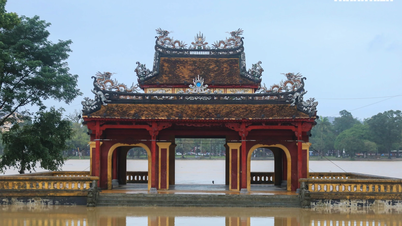
Similar to the northern districts of Giao Chi and Cuu Chan, the people of the tribes in the southern district of Nhat Nam were heavily exploited by the Chinese feudal dynasties. After the Trung Sisters' rebellion in 40 AD in Giao Chi, the people of Nhat Nam district continuously rose up against the invaders to reclaim their rights. The center of these rebellions was Tuong Lam district. The people here were mainly Cham, with a tradition of martial prowess and indomitable spirit, who repeatedly revolted against the rule of the Southern Han army. In 100 AD, the people here rose up in rebellion but failed. The Eastern Han government implemented an extremely brutal repressive policy and established a harsh regime. Towards the end of the Han dynasty, the people of Tuong Lam, under the leadership of Khu Lien, revolted, killed the district magistrate, and proclaimed themselves kings, establishing the Lam Ap kingdom. The Kingdom of Lâm Ấp later changed its name to Hoàn Vương in 749 and Champa in 872. Although many wars subsequently broke out over the former Nhật Nam district, from Hoành Sơn to Hải Vân, between the Chinese feudal dynasties and the Kingdom of Lâm Ấp, the Quảng Bình region, after the Han period, essentially belonged to Lâm Ấp, later Champa. After expanding its border to the north, south of Hoành Sơn, recognizing this as a strategically important area and a strategic frontier, the Champa dynasties focused on building a strong system of fortifications in Quảng Bình. A prime example is the Hoàn Vương rampart, built from east to west at the foot of Hoành Sơn, serving as a defensive barrier against the advance of Chinese feudal dynasties southward. In addition, many other strong fortifications were built, such as the Khu Túc fortress and the Nhà Ngô fortress, many remnants of which still remain. During the Champa period, the Quảng Bình region was known as Châu Bố Chính and Địa Lý.
Quang Binh belonged to the Dai Viet nation under the Ly, Tran, and Le dynasties.
Under the Ly Dynasty, these were the districts of Bo Chinh and Lam Binh.
For ten centuries under the rule of Chinese feudal dynasties, the people of the Au Lac tribe continuously fought for national independence. After the uprising of the Trung Sisters in the 40s of the first century AD came the uprisings of Luong Long (178-181), Ba Trieu (248), followed by the uprising of Ly Bi to regain national independence and establish the Van Xuan Kingdom (544-589). Subsequently, the Chinese feudal dynasties of the Sui and Tang dynasties again sent troops to invade and impose their rule on our country. Throughout the three centuries of Tang rule, our people continuously rose up against the feudal rule of the North. Major uprisings during this period include the uprisings of Ly Tu Tien and Dinh Kien (687), Mai Thuc Loan (722), Phung Hung (766-791), and Duong Thanh (819-820). At the end of the 9th century, the Tang dynasty entered a period of decline, and the fragmentation of power among feudal factions from the North emerged. Seizing this opportunity, Khuc Thua Du rose up to drive out the invaders, establishing an independent government and essentially ending the rule of the Northern feudal regime. In 938, the Southern Han army invaded our country again. Under the leadership of Ngo Quyen, our army and people defeated the invading army on the Bach Dang River, protecting our complete independence and ending 1000 years of Northern domination.
After gaining independence from the Dinh dynasty, the Ly dynasty ascended the throne. Ly Thai To (Ly Cong Uan) moved the capital to Thang Long, naming the country Dai Viet. He established a centralized state, built and strengthened the army, focused on economic development, and protected the country's territorial sovereignty. In the North, after suffering a heavy defeat in the first invasion of Vietnam under the Early Le dynasty, the Song dynasty still harbored ambitions of invading Vietnam again. In the South, despite suffering heavy defeats in previous attacks, the Champa kingdoms continued their ambitions to expand their influence northward and conspired with the Song dynasty to invade Vietnamese territory. Faced with this situation, King Ly Thanh Tong decided to lead an army against Champa to protect the southern borders and prevent the Song dynasty's invasion from the North. In 1069, Ly Thanh Tong, along with his vanguard general Ly Thuong Kiet, attacked the Champa capital, capturing the Champa king, Che Cu, and bringing him back to Thang Long. To ransom his life, Chế Cũ offered to cede the three provinces of Bố Chính, Địa Lý, and Ma Linh (the area of present-day Quảng Bình and Quảng Trị) to the Lý dynasty. In 1075, Lý Thường Kiệt commissioned the drawing of maps of the three provinces of Bố Chính, Địa Lý, and Ma Linh, renaming Địa Lý province to Lâm Bình and Ma Linh to Minh Linh, and encouraged people to settle and cultivate the land.
Thus, under the Ly Dynasty from 1075, the ancient Quang Binh region became an administrative unit of Dai Viet, known as Chau Bo Chinh and Chau Lam Binh. This can be considered an important historical milestone that shaped the geographical area of residence for the Vietnamese community in what is now Quang Binh.
Following the call of Emperor Lý Nhân Tông, the first settlers arrived here to cultivate new land and establish villages. A key characteristic of the village formation in present-day Quảng Bình is that the southern areas of Châu Lâm Bình were first settled because this fertile land was favorable for land reclamation and agriculture, and also due to the need to create a borderland in the southern part of Đại Việt. The first settlers were primarily people from nearby localities, mainly Châu Hoan and Châu Ái (present-day Nghệ An and Thanh Hóa). During these migrations, people often gathered together from the same clan to facilitate mutual support and assistance. They traveled together, cleared land, and then established villages. Therefore, in Quang Binh, village names often bear the name of a clan, such as Phan Xa, Ngo Xa, Hoang Xa, Vo Xa, etc. This characteristic has created a strong bond within the community because it is not only an administrative unit but also has elements of bloodline and kinship.
After the decline of the Ly Dynasty, the Tran Dynasty was established, continuing the work of national reconstruction, consolidating national unity, expanding borders, protecting territorial sovereignty, and expanding the country's territory southward. The exploitation of the Bo Chinh and Lam Binh regions was intensified. The Tran Dynasty implemented several administrative reforms to strengthen the centralized system. Administrative units were reorganized to better suit the management of the central government. At the beginning of the Tran Dynasty, Lam Binh Châu, formerly under the Ly Dynasty, was renamed Lam Binh Prefecture. During the reign of Emperor Due Tong (1372-1377), Lam Binh Prefecture was renamed Tan Binh Prefecture, later Tan Binh Province. In the 10th year of Quang Thai (1397), Le Quy Ly, acting as regent and Grand Tutor, reformed the administrative system, changing the provinces and prefectures into villages. Tan Binh Prefecture was renamed Tan Binh Town. Thus, at the end of the Tran Dynasty, the Vietnamese community lived in the following administrative units:
Tan Binh town comprises Thuong Phuc district, Nha Nghi district, and Tri Kien district.
Chau Bo Chinh comprises Bo Chinh district, Dang Gia district, and Tong Chat district.
Towards the end of the Tran dynasty, the Ho dynasty briefly seized power. After overthrowing the Ho dynasty, the Ming dynasty, a feudal Chinese dynasty, conquered Dai Viet, transforming the country into Giao Chi district and making some changes to the administrative divisions. The Ming dynasty established prefectures and counties into 15 provinces and 5 large prefectures, including Tan Binh prefecture; Bo Chinh prefecture was renamed Tran Binh prefecture; Thuong Phuc county was renamed Phuc Khang county; Bo Chinh county was renamed Chinh Hoa county; and Dang Gia county was renamed Co Dang county.
According to Minh Chi, during the Vinh Lac era, Tan Binh prefecture had 37 communes with 2,132 households and 4,738 inhabitants.
After driving out the Ming army and restoring national independence, the process of land reclamation was intensified. Under the reign of Le Thanh Tong, there was a policy of encouraging the cultivation of land in the Bo Chinh region, and villages in Tan Binh and Bo Chinh developed more. In the 10th year of Quang Thuan, which was the year of Ky Suu (1469), a map of the whole country was drawn up. Tan Binh prefecture had two districts, Le Thuy and Khang Loc, and two sub-districts, Minh Linh and Bo Chinh. Le Loi divided the whole country into 5 provinces: Southern Province, Northern Province, Eastern Province, Western Province, and Hai Tay Province.
The town of Tân Bình was renamed Tân Bình district, belonging to Hải Tây province.
In the 7th year of Quang Thuan (1466), in order to strengthen unified administrative management, Le Thanh Tong divided the whole country into 12 administrative divisions, changed the prefectures to provinces, and changed the towns to districts.
Originally Tan Binh road, during the reign of Hoang Dinh (1600) due to a taboo on using the name, Le Kinh Tong changed it to Tien Binh.
During this historical period, the country experienced significant upheavals. At the beginning of the 16th century, the Le dynasty weakened. In 1527, the feudal faction led by Mac Dang Dung prevailed, overthrowing the Le dynasty and establishing the Mac dynasty. As soon as the Mac family seized power, opposing feudal factions, under the guise of restoring the legitimate dynasty, rose up in many places. Finally, a former general of the Le dynasty, Nguyen Kim, rallied forces against the Mac, seizing control of Thanh Hoa and Nghe An provinces and establishing a separate government under the name of the Le Trung Hung dynasty. In 1545, Nguyen Kim died, and power fell to his son-in-law, Trinh Kiem. The conflict between these feudal factions resulted in the country being divided into two regions. The Mac dynasty ruled the northern region, known as the Northern Dynasty, while the Trinh family controlled the area south of Thanh Hoa, known as the Southern Dynasty. This war between the two feudal factions lasted for over half a century. In 1592, the Southern Dynasty defeated the Northern Dynasty and captured Thang Long, but the Mac Dynasty forces still occupied many places, retreating to Cao Bang to hold out until the 1770s. During this time, the Tan Binh area remained under the Trinh family's (Le Trung Hung) control and its name did not change until 1600 when it was renamed Tien Binh. After the North-South civil war ended, a new war broke out between the Trinh and Nguyen feudal factions, which lasted longer and was even more fierce.
The name Quang Binh appeared.
After establishing his territory in the South and unifying the administrative units under his authority, Nguyen Hoang (1525-1613) renamed the Tien Binh prefecture to Quang Binh prefecture. The name Quang Binh officially entered history.
During the Trinh-Nguyen conflict, Bo Chinh province was divided into North Bo Chinh and South Bo Chinh. North Bo Chinh belongs to present-day Nghe An province, and South Bo Chinh belongs to Quang Binh province, with the Gianh River as the boundary.
At the beginning of Gia Long's reign, after defeating the Tay Son dynasty, in the central region, near the capital, the Nguyen dynasty established four directly subordinate administrative districts: Quang Binh, Quang Tri, Quang Duc, and Quang Nam. In the second year of Minh Mang's reign (1821), the Quang Binh administrative district was changed to Quang Binh province, removing the two words "directly subordinate". In the twelfth year of Minh Mang's reign (1831), Quang Binh province was changed to Quang Binh province. At this point, Quang Binh had a provincial-level administrative structure.
The administrative divisions in Quang Binh during this period underwent the following changes:
Tien Binh Prefecture, originally Tan Binh, was renamed Tien Binh during the reign of Hoang Dinh (1600); in 1604 Nguyen Hoang renamed it Quang Binh Prefecture; in the 12th year of Minh Mang (1831) it was renamed Quang Ninh.
Khang Loc District: During the early Le Dynasty, it was called Kien Loc, later changed to Khang Loc; in the 5th year of Gia Long (1806), it was changed to Phong Loc, under the jurisdiction of Quang Binh Prefecture; in the 7th year of Minh Mang, it was administered by Quang Binh Prefecture (later changed to Quang Ninh Prefecture); in the 19th year of Minh Mang, the land of Phong Loc District was separated to form Phong Phu District, after which the district chief was abolished and the prefecture took over administration. The current area belongs mainly to the land of Quang Ninh District, Quang Binh Province today.
Le Thuy District is located mainly on the right bank of the middle section of the Kien Giang River, which is now Le Thuy District in Quang Binh Province.
Bo Chinh District: During the Le Trung Hung period, Bac Bo Chinh District belonged to Nghe An, and Nam Bo Chinh District belonged to Quang Binh. During the Tay Son period, the two districts were renamed Thuan Chinh District. During the Gia Long period, it was divided into two districts, inner and outer Bo Chinh, later renamed as two counties, Bo Trach and Binh Chinh, both under the jurisdiction of Quang Ninh Prefecture. In the 19th year of Minh Mang (1838), the land of the two counties was separated to create Minh Chinh County, which was under the jurisdiction of Quang Trach Prefecture. In the 28th year of Tu Duc (1874), Tuyen Hoa County was added to the jurisdiction of Quang Trach Prefecture. Bo Chinh District is equivalent to the land of the present-day Quang Trach, Bo Trach, Tuyen Hoa, and Minh Hoa districts of Quang Binh Province.
During the French colonial period, from 1950 to 1945, Quang Binh province essentially retained its old geographical boundaries and its name remained Quang Binh province.
Following the success of the August Revolution in 1945, the Democratic Republic of Vietnam continued to maintain the original boundaries and name of the province, Quang Binh, until 1976.
From May 1976, Binh Tri Thien province was established on the basis of merging the three provinces of Quang Binh, Quang Tri, and Thua Thien - Hue. The Vinh Linh area of Quang Binh ceased to be a provincial-level administrative unit, and the districts of the former Quang Binh province became subordinate to Binh Tri Thien province.
From July 1989, Binh Tri Thien province was divided into three provinces: Quang Binh, Quang Tri, and Thua Thien Hue. Quang Binh reverted to its old boundaries and became an administrative unit directly under the central government.
Source: Proceedings of the National Scientific Conference on Notable Figures of Quang Binh
Provincial e-Government Portal

![[Photo] Prime Minister Pham Minh Chinh attends the Conference on the Implementation of Tasks for 2026 of the Industry and Trade Sector](/_next/image?url=https%3A%2F%2Fvphoto.vietnam.vn%2Fthumb%2F1200x675%2Fvietnam%2Fresource%2FIMAGE%2F2025%2F12%2F19%2F1766159500458_ndo_br_shared31-jpg.webp&w=3840&q=75)


Comment (0)