
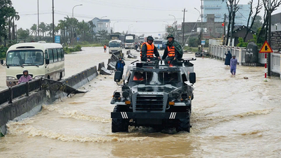
In that context, the national science and technology task "Research on building a toolkit for assessing, forecasting morphological changes and solutions to stabilize beaches in the Central Central region", code DTĐL.CN-42/22, chaired by Prof. Dr. Nguyen Trung Viet, has deployed a systematic and modern approach, responding to the long-standing "gap" in coastal management: Lack of an integrated toolkit to monitor, assess and forecast morphological changes based on multi-source data and advanced modeling.
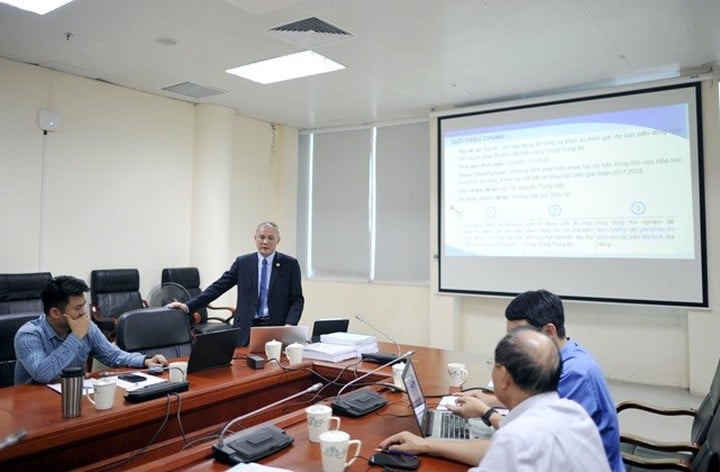
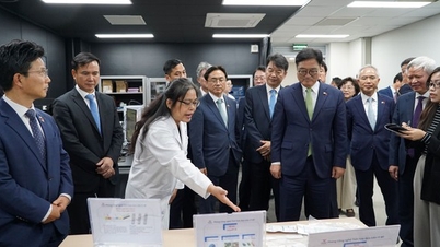
Prof. Dr. Nguyen Trung Viet, on behalf of the research team, presented a summary of the research content and results of the task.
Access to modern science, integrating multiple data sources
The mission sets three key objectives: Building a toolkit to assess and forecast changes in beach morphology; clarifying the specific hydro-lithodynamic mechanisms of the area; and testing proposed stabilization solutions for My Khe beach ( Da Nang ). To achieve this goal, the research team deployed a series of methods from observation to simulation, combining qualitative and quantitative data.
The most prominent feature is the integration of multiple data sources according to international standards: multi-decade satellite images (1990-2024), high-resolution UAV images, online coastal camera data and field measurements. The massive dataset is synchronized, processed and standardized to serve as input for mathematical models simulating waves - tides - currents - sand transport. Thereby, shoreline change scenarios are simulated with high accuracy, becoming an important foundation for risk analysis and solution selection.
From the data warehouse built, the research team has identified many important rules governing the instability of the Central Coast beaches. Steep terrain, large waves and strong coastal currents make sand easily washed away, making it difficult to replenish, especially in the northeast winter. Short-term fluctuations such as erosion channels, mega-cusps or rip currents are also continuously monitored through a fixed camera system, contributing to a clearer explanation of the erosion mechanism by day, season and storm.
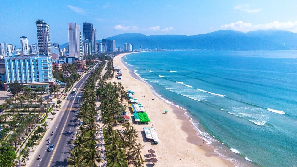
The results of shoreline analysis show that many areas have a tendency of "more erosion - less deposition". My Khe is the beach with the strongest fluctuations due to large waves and complex terrain changes; meanwhile Gio Hai and Tam Tien are more stable due to the sloping beach and favorable optical conditions. This is an important scientific basis for proposing appropriate solutions for each section of the coast.
Proposing regional scale solution system
Based on the simulation results, the research team proposed a diverse and flexible set of solutions according to each beach condition.
First is the beach nourishment solution, with two scales: small-scale beach nourishment to maintain the beach, and large beach nourishment at key erosion points such as My Khe with a total sand volume of up to 1 million m³. Next is the Perched Beach option, a solution that is being widely applied in the world , helping to stabilize sand materials and maintain the beach surface for a long time. The study proposes to arrange 6 perched beaches along My Khe, combining a system of welding groins and underground breakwaters.
A particularly noteworthy solution is the Artificial Surf Reef (ASR), which not only protects the shore but also facilitates the development of surfing tourism, suitable for the Da Nang area. In addition, there are ecological works such as Geo-cell revetments, artificial headlands and angled dikes, which help disperse wave energy, stabilize the sand and protect the infrastructure behind.
Solutions are quantitatively evaluated on the model, from which the optimal solution is selected for each beach, ensuring the following goals: protecting the shore, maintaining tourism, stabilizing the ecosystem and adapting to climate change.
The DTĐL.CN-42/22 mission brings values beyond the scope of a single study. In terms of science and technology, the mission has mastered the chain of observation - analysis - modeling technology according to international standards, contributing to realizing the goals of the Basic Science Development Program in the fields of Earth Science and Marine Science.
For the host unit – Thuyloi University, the research helps to form a strong interdisciplinary group on coastal simulation and engineering, and at the same time build a regional-scale spatial-temporal data warehouse, serving future consulting and technology transfer tasks.
The research team proposed a diverse and flexible set of solutions according to each beach condition.
More importantly, the Central Central localities, including Quang Tri, Thua Thien Hue and Da Nang, now have a set of tools to monitor and forecast shoreline changes, helping them to proactively monitor instead of relying entirely on research units.
The toolkit also supports risk-informed coastal spatial planning, evidence-based selection of structural and non-structural solutions, and the development of sustainable ocean economic development strategies.
In the context of increasingly complex erosion and unpredictable climate change, the DTĐL.CN-42/22 mission is a pioneering step in building an integrated tool system, based on big data and modern modeling, to proactively respond to changes in beach morphology.
The results of the mission not only created a “toolkit” in the technical sense, but also opened up new thinking in coastal management: based on evidence, continuous monitoring, long-term forecasting and choosing optimal solutions for each beach. This is an important foundation for the Central provinces to protect the coast, develop sustainable tourism and effectively adapt to the challenges of the future.
Source: https://mst.gov.vn/xay-dung-bo-cong-cu-danh-gia-du-bao-bien-dong-hinh-thai-va-giai-phap-on-dinh-bai-bien-trung-trung-bo-197251120162606423.htm
![[Photo] General Secretary To Lam receives President of the Senate of the Czech Republic Milos Vystrcil](/_next/image?url=https%3A%2F%2Fvphoto.vietnam.vn%2Fthumb%2F1200x675%2Fvietnam%2Fresource%2FIMAGE%2F2025%2F11%2F21%2F1763723946294_ndo_br_1-8401-jpg.webp&w=3840&q=75)

![[Photo] National Assembly Chairman Tran Thanh Man holds talks with President of the Senate of the Czech Republic Milos Vystrcil](/_next/image?url=https%3A%2F%2Fvphoto.vietnam.vn%2Fthumb%2F1200x675%2Fvietnam%2Fresource%2FIMAGE%2F2025%2F11%2F21%2F1763715853195_ndo_br_bnd-6440-jpg.webp&w=3840&q=75)

![[Photo] Visit Hung Yen to admire the "wooden masterpiece" pagoda in the heart of the Northern Delta](/_next/image?url=https%3A%2F%2Fvphoto.vietnam.vn%2Fthumb%2F1200x675%2Fvietnam%2Fresource%2FIMAGE%2F2025%2F11%2F21%2F1763716446000_a1-bnd-8471-1769-jpg.webp&w=3840&q=75)
![[Photo] President Luong Cuong receives Speaker of the Korean National Assembly Woo Won Shik](/_next/image?url=https%3A%2F%2Fvphoto.vietnam.vn%2Fthumb%2F1200x675%2Fvietnam%2Fresource%2FIMAGE%2F2025%2F11%2F21%2F1763720046458_ndo_br_1-jpg.webp&w=3840&q=75)


Comment (0)