
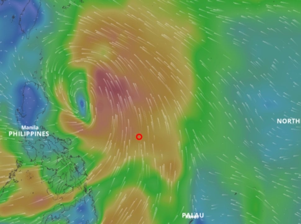
According to information from the National Center for Hydro-Meteorological Forecasting, a tropical depression is forming off the coast of the Philippines with a very fast moving speed, forecast to strengthen into a storm and enter the East Sea on the night of July 18.
At 1:00 a.m. on July 17, the center of the tropical depression was over the eastern sea of the Philippines with the strongest wind near the center of the tropical depression at level 6-7 (39-61 km/h), gusting to level 9. In the previous hours, the tropical depression moved west-northwest at a speed of about 20 km/h.
The assessment on the morning of July 17 shows that the tropical depression will enter the East Sea on the night of July 18. Thanks to favorable conditions of a very warm sea surface, the storm will increase in intensity very quickly. It is likely that this will be a very strong storm this year in the East Sea.
Storm forecast developments in each stage
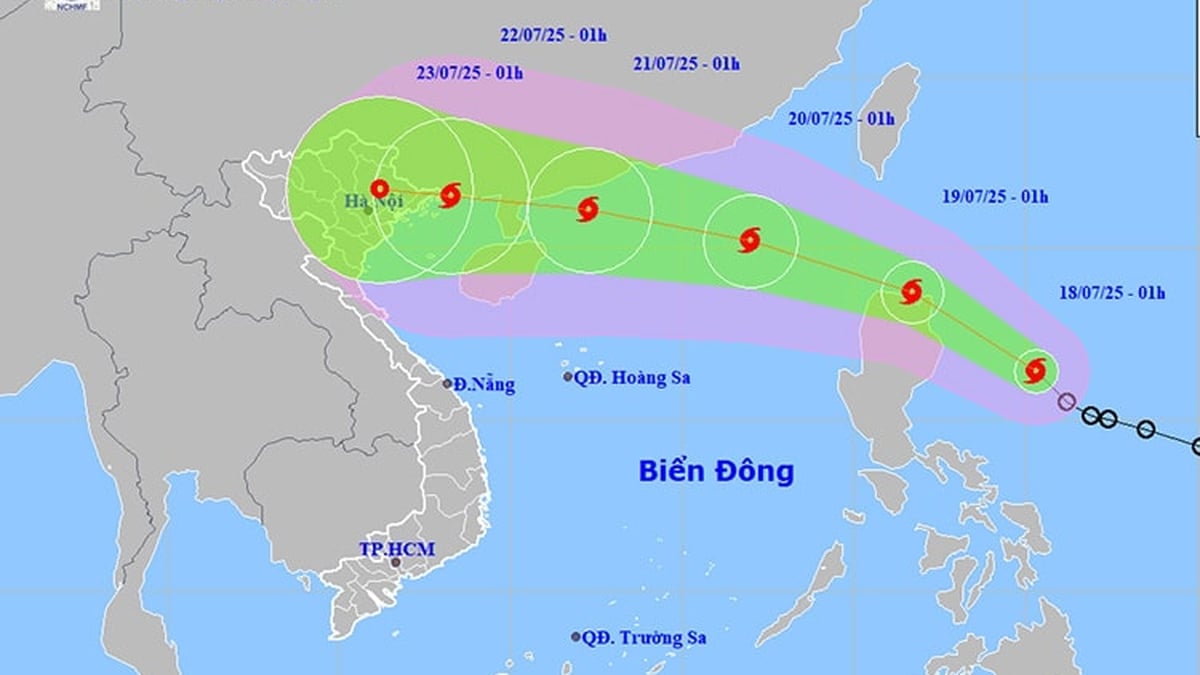
In the 24 hours from 1:00 a.m. on July 17, the tropical depression moved rapidly in a west-northwest direction, traveling about 20 km per hour, and strengthened into a storm.
At 1:00 a.m. on July 18, the storm center was in the sea east of Luzon Island, Philippines, with a strong intensity of level 8, gusting to level 10.
In the next 24-48 hours, the storm will move northwest, continuing to maintain a very fast speed of about 20-25 km/h and is likely to strengthen.
At 1:00 a.m. on July 19, the storm center was in the eastern part of the North East Sea with a strong intensity of level 10, gusting to level 12. Thus, in just one day, the storm could increase by 2 levels.
It is forecasted that in the next 48 to 72 hours, the storm will move mainly in the west-northwest direction, traveling 15-20 km per hour and may strengthen further.
According to the National Center for Hydro-Meteorological Forecasting, the forecast of the storm's development in the East Sea will be very complicated and unpredictable, requiring continuous updates of the latest forecasts.
Further assessment, from mid-July to October, there will be about 6-7 storms/tropical depressions active in the East Sea, of which about 3 can directly affect our mainland.
Previously, in May and June, there were 2 storms and tropical depressions in the East Sea. Of which, storm No. 1, although not directly making landfall in our country, caused a record flood in June for the central provinces, from the southern region of Ha Tinh to Quang Ngai.
Source: https://baonghean.vn/ap-thap-nhiet-doi-di-chuyen-rat-nhanh-du-bao-thanh-bao-rat-manh-tren-bien-dong-10302481.html


Comment (0)