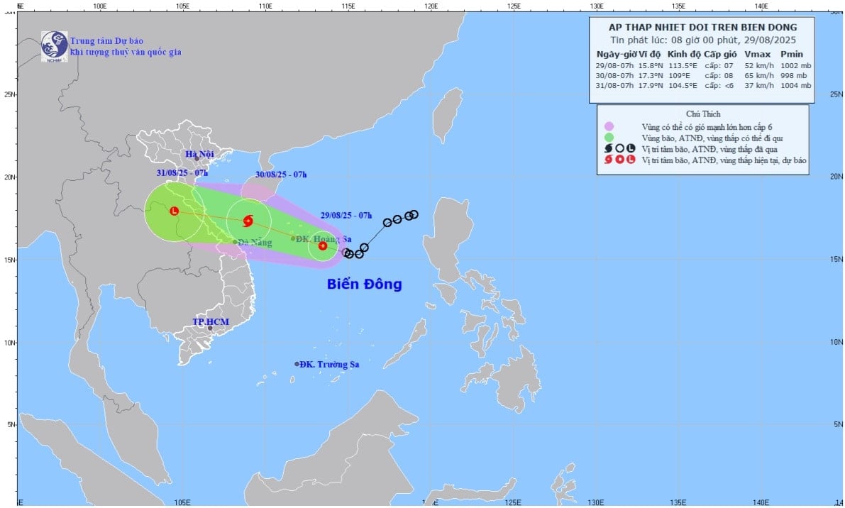
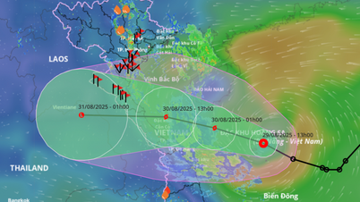
Director of the National Center for Hydro-Meteorological Forecasting, Mr. Mai Van Khiem said that by 7:00 a.m. on August 30, the center of the tropical depression is forecast to be at about 17.3 degrees North latitude; 109.0 degrees East longitude on the sea from Nghe An to Hue City. The strongest wind near the center of the tropical depression is level 8, gusting to level 10; moving in the West Northwest direction at a speed of about 20km/hour.
The Hydrometeorological Agency forecasts that the tropical depression will make landfall in the provinces from Nghe An to Hue City in the evening and night of August 30. The risk level of natural disasters caused by the tropical depression is level 3; the dangerous area is the western sea area of the North East Sea (including Hoang Sa special zone), the sea area from Nghe An to Hue City.
Due to the influence of a tropical depression, on August 29, the western sea area of the North East Sea (including Hoang Sa special zone) had heavy thunderstorms; strong winds of level 6 - 7, near the storm's center, strong winds of level 8, gusts of level 10, waves 2 - 5m high, rough seas.
From the night of August 29, the sea area from Nghe An to Hue City (including Hon Ngu Island and Con Co Special Zone) will have heavy rain and thunderstorms; winds will gradually increase to level 6 - 7, near the storm center, winds will increase to level 8, gusting to level 10; waves will be 2 - 5m high, and the sea will be rough.
Hydrometeorological experts warn that ships operating in the above-mentioned dangerous areas are likely to be affected by storms, whirlwinds, strong winds, and large waves.
On land, from the evening and night of August 29 to the night of August 30, the midlands, the Northern Delta and Da Nang City will have moderate rain, heavy rain and thunderstorms with common rainfall of 70 - 150mm, locally very heavy rain over 300mm. The area from Thanh Hoa to Hue City will have heavy to very heavy rain with common rainfall of 120 - 250mm, locally over 450mm.
It is forecasted that on August 31, heavy rain will continue in the midlands and the Northern Delta, from Thanh Hoa to Da Nang City. Rainfall in the midlands, the Northern Delta and Da Nang City is from 30 - 50mm, locally over 100mm; in the area from Thanh Hoa to Hue City is from 50 - 100mm, locally over 150mm.
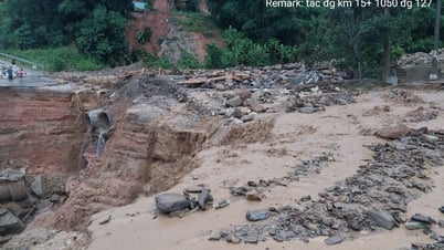
Given the above weather developments, Mr. Mai Van Khiem warned that heavy rains could cause flooding in low-lying areas, urban and industrial areas; flash floods on small rivers and streams; and landslides on steep slopes.
Source: https://baohaiphong.vn/ap-thap-nhiet-doi-du-bao-di-vao-mien-trung-519423.html




![[Photo] President Luong Cuong receives Speaker of the New Zealand Parliament Gerry Brownlee](https://vphoto.vietnam.vn/thumb/1200x675/vietnam/resource/IMAGE/2025/8/29/7accfe1f5d85485da58b0a61d35dc10f)



















Comment (0)