
On the morning of September 18, the tropical depression in the northeastern part of the East Sea maintained its strong intensity, moving rapidly in a northwest direction. The meteorological agency warned that this system is likely to strengthen into a storm, causing strong winds, large waves and rough seas in the coming days.
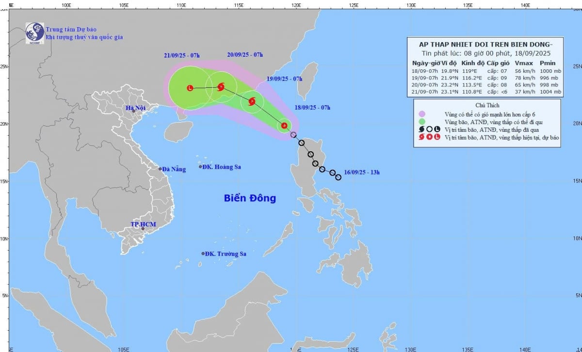 |
According to the National Center for Hydro-Meteorological Forecasting, at 7:00 a.m. this morning (September 18), the center of the tropical depression was at about 19.8 degrees North latitude; 119.0 degrees East longitude, the strongest wind near the center reached 50-61 km/h, gusting to level 9. Moving northwest at a speed of about 20 km/h. In the next 2-3 days, the storm will mainly move west at a speed of about 10 km/h and gradually weaken.
Forecast of tropical depression/storm development (in the next 24-48 hours):
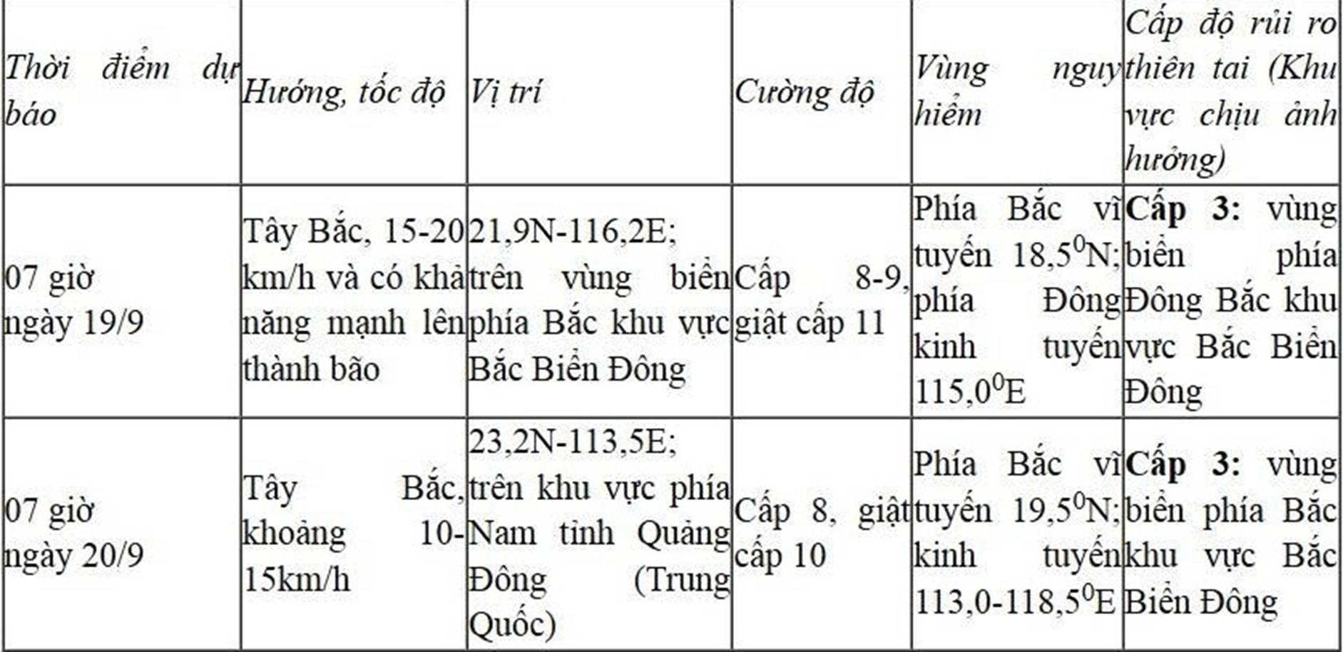 |
At sea, the northeastern part of the North East Sea will have winds gradually increasing to level 6-7, gusting to level 9; near the storm center, winds will be level 8-9, gusting to level 11. Waves will be 3-5 m high, with very rough seas. Vessels operating in the dangerous area are warned to face a high risk of storms, whirlwinds, strong winds and large waves.
According to PV/vov.vn
Source: https://baovinhlong.com.vn/thoi-su/202509/ap-thap-nhiet-doi-tren-bien-dong-manh-len-bien-dong-song-cao-toi-5m-e000251/

![[Photo] Secret Garden will appear in Nhan Dan Newspaper's Good Morning Vietnam 2025 project](https://vphoto.vietnam.vn/thumb/1200x675/vietnam/resource/IMAGE/2025/9/19/cec307f0cfdd4836b1b36954efe35a79)


![[Photo] Prime Minister Pham Minh Chinh chairs the sixth meeting of the Red River Delta Coordination Council](https://vphoto.vietnam.vn/thumb/1200x675/vietnam/resource/IMAGE/2025/9/20/310e73a867174433b2c489ec309c9063)


![[Photo] Spreading Vietnamese culture to Russian children](https://vphoto.vietnam.vn/thumb/1200x675/vietnam/resource/IMAGE/2025/9/19/0c3a3a23fc544b9c9b67f4e243f1e165)


![[VIDEO] 50 years of Petrovietnam: Keeping the legacy alive, creating national energy](https://vphoto.vietnam.vn/thumb/402x226/vietnam/resource/IMAGE/2025/9/20/dff4ddb3d15a4076ba5f67fcdc6c7189)


Comment (0)