
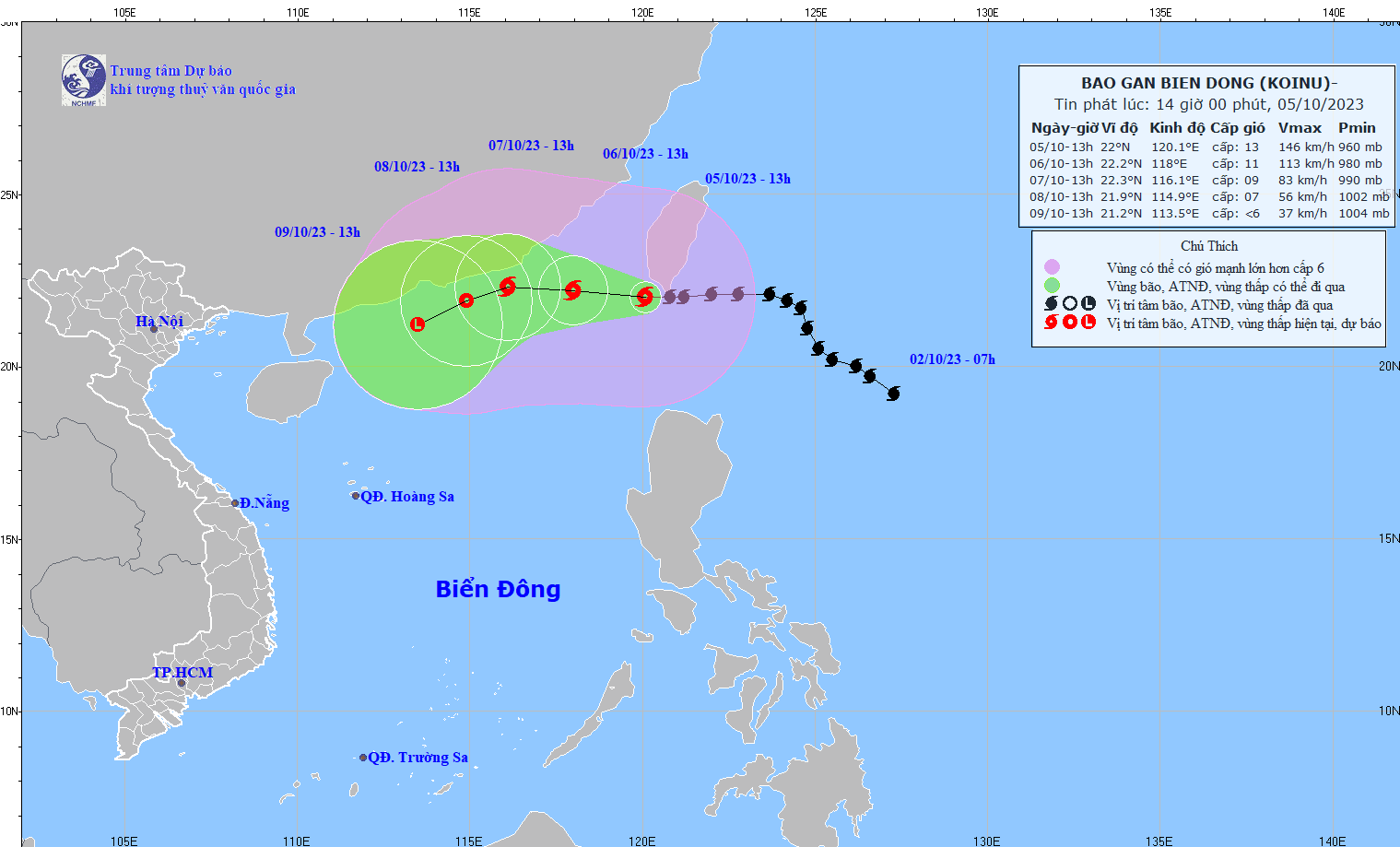
By 1pm on October 6, typhoon KOINU is likely to move mainly westward at about 10km/h, then move into the East Sea and gradually weaken. The typhoon is forecast to be about 180km east-southeast of Guangdong (China), with the strongest winds near the centre of the typhoon at level 10-11, gusting to level 13.
At 1:00 p.m. on October 7, typhoon KOINU in the sea southeast of Guangdong province (China), the strongest wind near the storm center was level 8-9, gusting to level 11, continuing to move mainly west, 5-10km/h and weakening further.
As of 1 p.m. on October 8, the storm was still in the sea southeast of Guangdong province (China), with the strongest wind near the storm center at level 7, gusting to level 9. The storm changed direction, moving west-southwest at about 5km/h and weakened into a tropical depression.
From the next 72 to 96 hours, the tropical depression moves mainly in the West Southwest direction, about 5km per hour and weakens into a low pressure area.
The northeastern sea area of the North East Sea has strong winds of level 7-10, the area near the eye of the storm has strong winds of level 11-12, gusting to level 15; the sea is very rough. The northern East Sea area has waves 2-4m high, the northeastern area has waves 4-6m high, the area near the eye of the storm has waves 6-8m high.
Source


Comment (0)