


Current status of tropical depression
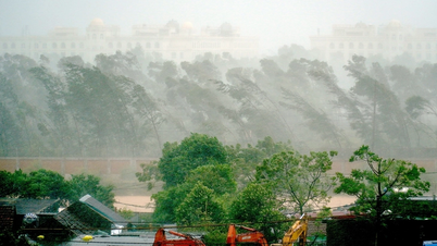
Due to the influence of storm No. 5, at Bach Long Vi station ( Hai Phong ) there are strong winds of level 7, gusting to level 9; Co To station (Quang Ninh) there are strong winds of level 7, gusting to level 10; Hon Ngu station (Nghe An) there are strong winds of level 8, gusting to level 11. Coastal areas of provinces from Quang Ninh to Thanh Hoa have strong winds of level 6-8, gusting to level 9.
Nghe An - Ha Tinh area has strong winds of level 8-10, gusts of level 12-15 such as: Dien Chau station (Nghe An) has strong winds of level 10, gusts of level 12; Do Luong station has gusts of level 15; Vinh station has gusts of level 12; Ky Anh station (Ha Tinh) has strong winds of level 8, gusts of level 11; Cam Nhuong station (Ha Tinh) has strong winds of level 10, gusts of level 13,... Storm surge in Sam Son (Thanh Hoa) 1.01m, Hon Ngu (Nghe An) 1.66m, Vung Ang (Ha Tinh) 0.51m.
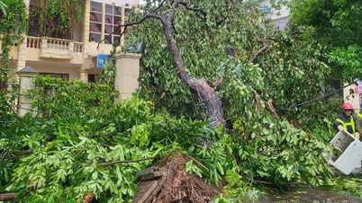
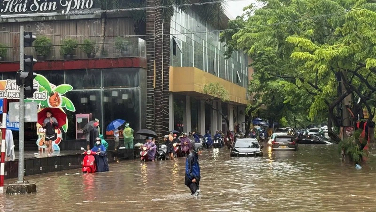
In the Northern Delta provinces, from Thanh Hoa to Quang Tri, there has been moderate to heavy rain, with some places experiencing very heavy rain of over 600mm. Early this morning (August 26), storm No. 5 moved to Central Laos and weakened into a tropical depression.
At 4:00 a.m., the center of the tropical depression was at about 18.9 degrees North latitude; 104.5 degrees East longitude, in the Central Laos region. The strongest wind near the center of the tropical depression was level 7 (50-61 km/h), gusting to level 9; moving in the West Northwest direction at a speed of 15-20 km/h.
Forecasting the impact of tropical depression
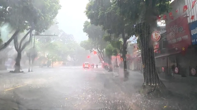
This morning (August 26), in the Gulf of Tonkin (including the special zones: Bach Long Vi, Cat Hai, Co To, Van Don and Hon Ngu island), there are still strong winds of level 6-7, gusting to level 8; waves 2.0-5.0m high; rough seas. On the mainland in the Thanh Hoa-Nghe An area and the coastal area of Ninh Binh, there are still strong winds of 6-7, gusting to level 9.
From early morning of August 26 to the end of August 26, in the midlands and deltas of the North, Lao Cai, Son La and from Thanh Hoa to Ha Tinh, there will be heavy rain with common rainfall of 50-100mm, locally over 200mm. Warning of the risk of heavy rain (>100mm/3 hours).
From early morning of August 26 to the end of August 26, Hanoi capital area will have heavy rain and thunderstorms; Da Nang city will have no rain; Ho Chi Minh city area will have rain, showers and thunderstorms (thunderstorms concentrated in the afternoon and evening). During thunderstorms, be on guard against the risk of tornadoes and strong gusts of wind.
From early morning of August 26 to August 27, the Upper and Central Laos regions had heavy rain with common rainfall of 100-250mm, especially in the Central Laos region, some places had over 500mm.
Source: https://baolaocai.vn/bao-so-5-suy-yeu-thanh-ap-thap-nhiet-doi-post880496.html


![[Photo] Hanoi: Authorities work hard to overcome the effects of heavy rain](https://vphoto.vietnam.vn/thumb/1200x675/vietnam/resource/IMAGE/2025/8/26/380f98ee36a34e62a9b7894b020112a8)

![[Photo] Multi-colored cultural space at the Exhibition "80 years of the journey of Independence - Freedom - Happiness"](https://vphoto.vietnam.vn/thumb/1200x675/vietnam/resource/IMAGE/2025/8/26/fe69de34803e4ac1bf88ce49813d95d8)


![[Podcast] - Decoding Danang University's 2025 admission scores](https://vphoto.vietnam.vn/thumb/402x226/vietnam/resource/IMAGE/2025/8/26/c89fdb410fec44479fd37acd9fd76093)


Comment (0)