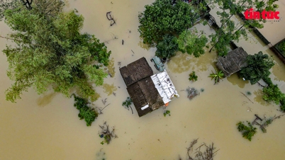
According to the flood warning in the Mekong Delta, the flood in the upper Mekong River at Tan Chau and Chau Doc stations is showing a strong increasing trend due to the flood from upstream combined with high tides.
Currently, the tropical depression in the East Sea has strengthened into storm number 4 , affecting the weather in the southern provinces and cities.
The Southern Institute of Water Resources Planning has issued warnings so that provinces and cities can promptly and proactively respond to natural disasters.
Flood warning combined with high tide causing inundation
According to the forecast of the Southern Institute of Irrigation Planning, on September 19, the Central Highlands and the South will have moderate rain, heavy rain, thunderstorms, and locally very heavy rain with rainfall ranging from 40-80mm, in some places over 150mm, concentrated in the afternoon and at night.
The Institute warns of flood developments in the Mekong Delta, with floods at the headwaters of the Mekong River at Tan Chau and Chau Doc stations showing a strong upward trend due to upstream floods combined with high tides.
On the other hand, the Institute believes that water levels at the Mekong mainstream stations in the lower Laos region will tend to increase again in the coming days. Meanwhile, water levels in the Cambodian region at Kratie station will tend to continue to increase quite strongly in the next 5 days.
Therefore, the flood flow upstream to the Mekong River source at Tan Chau and Chau Doc will continue to increase, with the high tide forecast to peak on September 19.
Floods combined with high tides make it likely that the flood peak in September 2024 in Tan Chau will reach 3.1-3.2m, in Chau Doc it will reach 2.9-3.0m, peaking around September 21-22.
The water level then tends to change slowly and then decrease slightly due to the sharp decrease in the tides in the following days, although the flow on the main Mekong River still tends to increase.
Regarding the development of flood peaks in the Mekong Delta during the high tide combined with rain and flood from upstream from September 19-22, the Southern Institute of Water Resources Planning informed that the water level in the upstream stations is generally below alert level 1.
Some stations change from alarm 1 to alarm 2; there are 2 stations including Long Xuyen and Vam Nao station in An Giang province that will exceed alarm 2. Water levels of stations in the middle region are generally from alarm 2 to alarm 3. Some stations along the main river exceed alarm 3 including Can Tho station in Can Tho city; My Thuan station in Vinh Long province; Cao Lanh and Lai Vung stations in Dong Thap province and some other stations.
Therefore, there is a high risk of flooding due to high tides combined with heavy rain in low-lying areas in the Mekong Delta from September 19-22.
Especially in the central and coastal areas, including Can Tho city, Vinh Long, Ben Tre, Tra Vinh provinces; riverside districts and districts between two rivers of Dong Thap; central areas of Ca Mau peninsula such as Vi Thanh city, Nga Bay city of Hau Giang province.
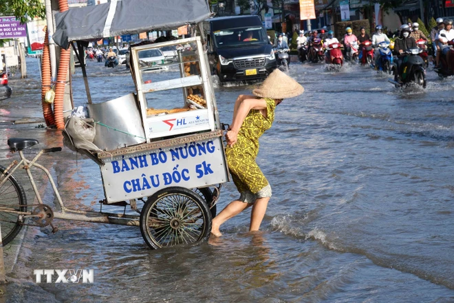
Along with that are Phuoc Long and Hong Dan districts of Bac Lieu province; Nga Nam town and My Tu district of Soc Trang province; Tran Van Thoi and Thoi Binh districts, Ca Mau city of Ca Mau province and some areas in the upper region such as Long Xuyen city of An Giang province.
Develop appropriate response plans
Mr. Doan Van Danh, Director of the Department of Agriculture and Rural Development of Ben Tre, said that localities in the province have proactively reviewed and coordinated with dike and irrigation management units to strengthen inspection and immediately repair damaged and degraded areas.
At the same time, reinforce and raise low-lying areas, flooded areas, and important areas such as dykes, fruit gardens, aquaculture areas, key works, and embankments.
The province has increased inspection and screening of residential areas along the coast, rivers, canals, and streams, especially the areas of Phu Da, Thanh Long, and Tam Hiep islets; coastal erosion points in Ba Tri and Thanh Phu districts; and erosion on Giao Hoa riverbanks...
In Binh Duong, Mr. Mai Hung Dung, Permanent Vice Chairman of Binh Duong Provincial People's Committee requested provincial departments, branches, sectors and People's Committees of districts, cities and units to deploy response to thunderstorms, floods and strong winds.
The entire province reviews, updates, adjusts, and supplements response plans for specific types of natural disasters, suitable to the local situation and conditions, especially plans to respond to storms, flood discharge from reservoirs, heavy rain, thunderstorms, lightning; evacuates people in areas at high risk of flooding and riverbank landslides to safety.
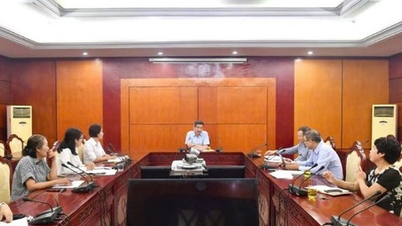
Mr. Tran Dinh Minh, Deputy Director of the Department of Agriculture and Rural Development of Dong Nai, said that in order to proactively respond to natural disasters such as heavy rain, thunderstorms, strong winds, floods, flash floods, landslides, riverbank erosion, the Steering Committee for Natural Disaster Prevention and Search and Rescue of Dong Nai province requested functional forces to inspect and review key areas along rivers and streams, areas that are often at risk of flooding, landslides, and flash floods when there is heavy rain.
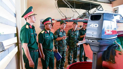
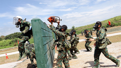
At the same time, proactively develop plans and strategies for the industry, locality and unit to respond promptly when bad situations occur; prepare forces and means to mobilize people and assets to move to a safe place.
Vietnamplus.vn
Source: https://www.vietnamplus.vn/cac-tinh-thanh-khu-vuc-phia-nam-chu-dong-cac-phuong-an-ung-pho-voi-thien-tai-post977731.vnp































Comment (0)