
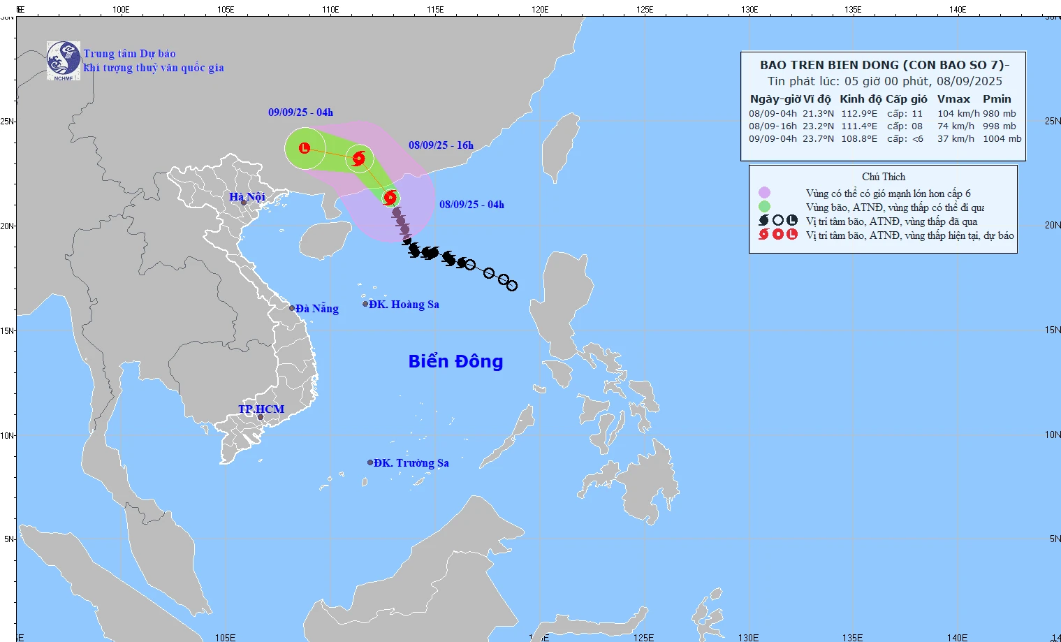
Forecast map of storm trajectory and intensity at 05:00 on September 8, 2025. Photo: nchmf
At 4:00 p.m. on September 8, the storm moved northwest at a speed of 20-25 km/h. The center of the storm was located at about 23.2N-111.4E, on the mainland of Guangdong province (China). Wind force was level 8, gusting to level 10. The range of strong winds was level 6 or higher in the north of latitude 19.5N; longitude 110.5-115.0E. Level 3 warning for the northwest sea area of the North East Sea.
At 4:00 a.m. on September 9, the storm continued to move west-northwest at a speed of 20-25 km/h. The center of the storm was located at approximately 23.7N-108.8E, on the mainland of Guangxi province (China). Wind speed decreased to below level 6.
The Northwestern sea area of the North East Sea has strong winds of level 7-8, near the storm center strong winds of level 9-11, gusts of level 13; waves 4.0-6.0m high, rough seas. Ships operating in the above-mentioned dangerous areas are likely to be affected by storms, whirlwinds, strong winds, and large waves.
Although not directly affected by the storm circulation, areas on the far edge of the storm circulation such as the Gulf of Tonkin and the eastern coastal areas of the North may experience thunderstorms, tornadoes and strong gusts of wind.
The meteorological agency said that from the afternoon and night of September 9, the North will have widespread rain. Mountainous and midland areas are likely to experience heavy rain, with average rainfall of 70-150 mm, and in many places over 300 mm. Some areas may experience heavy rain, over 100 mm in three hours.
From September 11, when the low pressure gradually dissipated, rain in the North decreased; from September 12 to 14, the sky cleared up and the weather was cool.
LP
Source: https://baothanhhoa.vn/chieu-nay-bao-so-7-di-vao-dat-lien-trung-quoc-mien-bac-se-co-1-dot-mua-lon-260852.htm


Comment (0)