

Map warning areas where floods and landslides may occur today
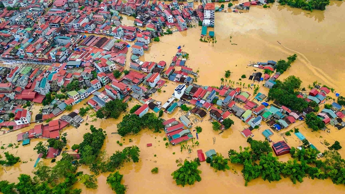
Currently, floods on Cau River and Thuong River continue to rise; water level at 7:00 a.m. on October 8 on Cau River at Gia Bay station: 29.84m, 1.03m above the historical level in 2024 (28.81m), on Thuong River at Cau Son station: 17.48m above BĐ3 1.48m.
It is forecasted that in the next 12-24 hours, the flood on Cau River at Gia Bay station will fluctuate at its peak level; Cau River at Dap Cau and Thuong River at Phu Lang Thuong will continue to rise; the flood on Thuong River at Phu Lang Thuong will rise and exceed the historical flood level of 1986 (7.52m).
To ensure the safety of the dike system, the National Civil Defense Steering Committee requests the People's Committees of provinces and cities to direct relevant agencies and units to urgently implement the following contents:
Mobilize all forces, materials, means, and equipment to proactively prevent overflows and reinforce weak dikes with insufficient elevation that are at risk of overflowing and breaking; ensure safety for dikes in case flood water levels continue to rise.
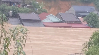
Regularly inspect key locations of weak dikes, locations where incidents have occurred but have not been handled or repaired, and unfinished dike projects; in particular, pay special attention to low dike sections, close to the river, which are often pushed up, leaked, or eroded during floods, and weak and damaged culverts on the dike routes. Strictly carry out patrolling and guarding to protect dikes during the flood season according to regulations, promptly detect and handle incidents and situations that occur from the first hour.
Proactively organize the urgent evacuation of people in low-lying areas and riverside areas at high risk of flooding to safety.
Do Huong
Source: https://baochinhphu.vn/chu-dong-ung-pho-voi-lu-dac-biet-lon-tren-song-cau-song-thuong-1022510081004507.htm


![[Photo] Closing of the 13th Conference of the 13th Party Central Committee](https://vphoto.vietnam.vn/thumb/1200x675/vietnam/resource/IMAGE/2025/10/08/1759893763535_ndo_br_a3-bnd-2504-jpg.webp)


Comment (0)