
 |
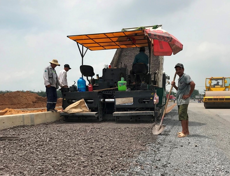
| Construction of resettlement area of Long Thanh International Airport. (Photo: KV) |
According to the leader of the Long Thanh District People's Committee, the Long Thanh airport's special functional area has a regional scale of 9,260 hectares located in Cam Duong commune and part of Long An , Long Phuoc, Binh Son and Bau Can communes. Particularly, the 5,000-hectare area of Long Thanh airport is planned to have a capacity to serve 100 million passengers/year and 5 million tons of cargo/year when completed.
In addition, the content of the Dong Nai planning for the period 2021-2030 and the vision to 2050 of the Government also clearly states the "dynamic urban quadrilateral" around Long Thanh airport to be formed in the future. According to the planning project, the development plan for dynamic areas of Dong Nai province until 2030 takes 2 areas as new development drivers of this province, including the Long Thanh airport urban area and the Dong Nai river corridor area.
For Long Thanh airport urban area: Complete the transport infrastructure system connecting Long Thanh International Airport with the national and regional highway and railway systems. Comprehensively develop aviation services within the scope of Long Thanh International Airport.
In Long Thanh district: Developing urban areas in the southwest of Long Thanh International Airport; developing industrial and logistics clusters in the southeast of Long Thanh International Airport, linking with the industrial - logistics service system of Cai Mep - Thi Vai seaport; developing urban - industrial - service chains along the Bien Hoa - Vung Tau expressway, National Highway 51 and Ring Road 4 of Ho Chi Minh City.
In Nhon Trach district: Develop a chain of urban - service - high-tech industry, synchronously connect infrastructure, logistics services with the Cai Mep - Thi Vai seaport system, Phuoc An seaport, Ho Chi Minh City center; develop a service - tourism route connecting Long Thanh International Airport with Can Gio biosphere reserve.
In Cam My district: Developing Song Nhan urban - industrial - service area at the northeastern gateway of Long Thanh International Airport.
Regarding this issue, Dong Nai province has just held a conference to discuss the planning of Long Thanh District until 2040, with a vision to 2050. According to the planning project, Long Thanh District has an area of over 43,000 hectares, aiming to build a dynamic economic development area of Dong Nai province, the easternmost point of Ho Chi Minh City; an international traffic hub of the national region with strengths in developing industry, high-tech agriculture, urban areas, services, and trade of the national region with strengths in developing urban areas, services - trade, industry, high-tech agriculture, and specialized agriculture.
Long Thanh district will develop on 5 strategies, including 3 urban areas Long Thanh, Binh Son, Phuoc Thai associated with Long Thanh airport area, Go Dau port system and expressways Bien Hoa - Vung Tau; Ho Chi Minh City - Long Thanh - Dau Giay; Ben Luc - Long Thanh. At the conference, representatives of many enterprises contributed their opinions to the planning project of Long Thanh district such as: need to have more exhibition areas, international conference centers in Long Thanh airport city; reserve land fund around the airport for future development; calculate the development of high-end service and commercial areas and reserve land fund around Long Thanh airport to meet the needs of people, businesses and tourists.
The planning aims to effectively exploit the natural conditions, typical ecosystems and advantages of Long Thanh International Airport, the national and regional technical infrastructure system in the area to develop urban spaces and suitable functional areas to increase land use efficiency. Aiming to make Long Thanh one of the key urban areas of the Southeast region and the Southern dynamic region, the nucleus promoting the socio-economic development of Dong Nai province.
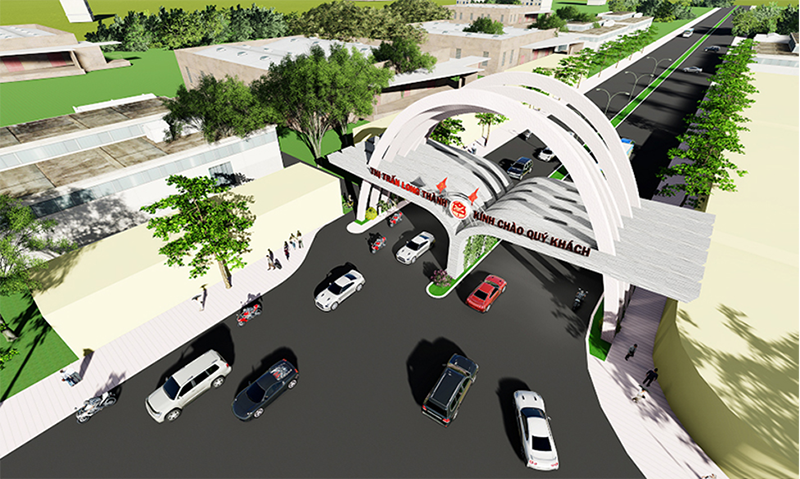 |
| Long Thanh urban perspective - Dong Nai |
Long Thanh urban area is also identified as a city under Dong Nai province, playing the role of one of the key urban areas of the Southern dynamic region and the central sub-region of the Southeast region, a dynamic urban area for economic and social development in the central urban area of Dong Nai province. At the same time, it is an urban area connected to Long Thanh airport to become the country's gateway to the international community, a logistics service center supporting Long Thanh airport, a center for logistics, warehousing, multi-industry, industry, and high technology of the Southeast region.
Regarding the goal, Long Thanh urban area will develop to meet the criteria of a type III urban area before 2030 and after 2030 towards a type II urban area. Regarding population size, it is forecasted that by 2030 Long Thanh urban area will have a population of about 340-370 thousand people and by 2045 it will have a population of about 480-500 thousand people.
It is known that according to the planning, in the future Dong Nai will form a "dynamic urban quadrangle" around Long Thanh International Airport (airport city). Bien Hoa is determined to become an urban area focusing on large-scale trade and service development, tourism combined with the Dong Nai river landscape. Long Thanh City is a smart urban area, a trade and service center, international exchange, a traffic hub connecting the whole region, and at the same time forming logistics zones and high-tech industrial zones./.


![[Infographic] In 2025, 47 products will achieve national OCOP](https://vphoto.vietnam.vn/thumb/402x226/vietnam/resource/IMAGE/2025/7/16/5d672398b0744db3ab920e05db8e5b7d)


Comment (0)