
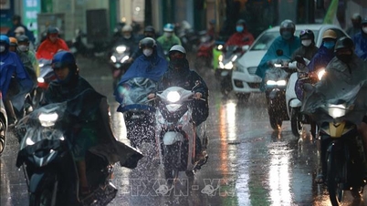
"The path and impact of storm Wipha will be similar to that of storm Yagi . We need to pay close attention and have plans to prevent strong storms when they make landfall at level 10-11, gusting to level 14, 15."
The above information was mentioned by Director of the National Center for Hydro-Meteorological Forecasting Mai Van Khiem at a meeting to respond to storm Wipha organized by the Ministry of Agriculture and Environment on the afternoon of July 18.

Mr. Mai Van Khiem said that at 1:00 p.m. on July 18, the center of storm Wipha was at about 18.3 degrees North latitude, 123.5 degrees East longitude, in the sea northeast of Luzon Island, Philippines.
The strongest wind near the storm center is level 8-9 (62-88km/h), gusting to level 11. The storm is moving northwest at a speed of about 30km/h.
The Director of the National Center for Hydro-Meteorological Forecasting predicts that in the early morning of July 19, storm Wipha will enter the East Sea and become the third storm this year.
The storm is located in an area of sea with very favorable environmental conditions for increasing intensity: high sea surface temperature, large ocean heat, weak mid-level wind shear and high-level wind divergence.
Regarding the direction of the storm, Mr. Mai Van Khiem said that international forecasts are not yet highly consistent, especially when the storm enters the sea area east of Leizhou Peninsula (China), the forecast options are still off by about 100km, if it moves up to the North or deviates to the South into the Gulf of Tonkin, the impact, rain and wind on our mainland will be different.
The storm is forecast to have the strongest intensity of level 12, gusting to level 15 in the sea area east of Hainan Island (China). When entering the Gulf of Tonkin, the impact on our mainland will be about level 10.
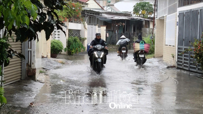
"Around the morning of July 21 (Monday), the storm will move into the Gulf of Tonkin. From the evening to the night of July 21, it is likely to begin affecting the mainland. From July 21 to July 24, heavy to very heavy rain is forecast to occur in the Northern and North Central regions," said Mr. Khiem.
If the storm deviates further north, moving along the coastal mainland of Guangxi (China), the impacts of rain and wind will be reduced.

Referring to the notes for storm Wipha, Mr. Mai Van Khiem stated that on the morning of July 19, it will move into the East Sea, with the strongest intensity in the east of Leizhou (China).
The storm moves quickly after entering the East Sea and is likely to affect mainland Vietnam (early from the evening and night of July 21, expected on July 22), the affected area is from Quang Ninh - Nghe An .
The meteorological agency noted the possibility of storms causing heavy rain in the North, Thanh Hoa, Nghe An, the rain period from July 21 to 24, rainfall of 200-350mm, some places over 600mm (this is an initial preliminary assessment, not highly reliable, need to be updated in the next bulletins).
Source: https://baolaocai.vn/duong-di-tac-dong-cua-bao-wipha-co-hinh-dang-bao-yagi-post649120.html
![[Photo] Parade to celebrate the 50th anniversary of Laos' National Day](/_next/image?url=https%3A%2F%2Fvphoto.vietnam.vn%2Fthumb%2F1200x675%2Fvietnam%2Fresource%2FIMAGE%2F2025%2F12%2F02%2F1764691918289_ndo_br_0-jpg.webp&w=3840&q=75)


![[Photo] Worshiping the Tuyet Son statue - a nearly 400-year-old treasure at Keo Pagoda](/_next/image?url=https%3A%2F%2Fvphoto.vietnam.vn%2Fthumb%2F1200x675%2Fvietnam%2Fresource%2FIMAGE%2F2025%2F12%2F02%2F1764679323086_ndo_br_tempimageomw0hi-4884-jpg.webp&w=3840&q=75)


Comment (0)