
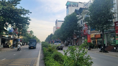
According to the Decision, the plan and location of the Ta Thanh Oai axis road, scale 1/500, prepared by the Hanoi Institute of Construction Planning, was appraised by the Department of Planning and Architecture. The road is located in Ta Thanh Oai commune, Thanh Tri district. The route is consistent with the Gs urban zoning plan, scale 1/5000, approved by the City People's Committee in Decision No. 3976/QD-UBND dated August 13, 2015.
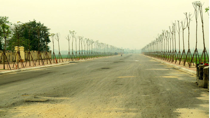
The starting point of the route intersects with the road connecting Ta Thanh Oai Street with the road connecting Highway 70 running along Hoa Binh River (point 1); The end point of the route intersects with Ta Thanh Oai - Dai Ang - Lien Ninh Road (point 11); the route length is about 2.7km.
The route has a typical cross-sectional scale of B = 25.0m, the cross-sectional components include: 15.0m wide roadway (4 lanes); 2x5.0m wide sidewalks on both sides. The cross-sectional components of the route will be specifically determined during the process of establishing the road construction investment project approved by the competent authority.
The intersections on the planned routes are determined to be level crossings. The red line boundaries at the intersections and cross-roads will be specifically determined during the investment project preparation process for works in the area approved by competent authorities.
The City People's Committee assigned the Department of Planning and Architecture to inspect and confirm the project documents and location of the Ta Thanh Oai axis road, scale 1/500, in accordance with the content of this Decision.
Thanh Tri District People's Committee presides over and coordinates with the Department of Planning and Architecture and relevant units to organize the announcement and handover of the project documents and location of the Ta Thanh Oai axis road approved by the City People's Committee to the Ta Thanh Oai Commune People's Committee to manage the construction planning along both sides of the road; deploy the installation of road boundary markers according to the plan at the same time as the implementation of land acquisition and site clearance (during the implementation of the road investment project) to avoid waste and overlap in the work of installing boundary markers.
In addition, the People's Committee of Thanh Tri district and the People's Committee of Ta Thanh Oai commune are responsible for organizing the management of boundary markers and construction order of works along both sides of the road according to the red line and approved boundary markers. Inspect and handle cases of planning violations according to their authority and regulations of law.
Source: https://kinhtedothi.vn/phe-duyet-phuong-an-vi-tri-tuyen-duong-truc-ta-thanh-oai.html
![[Photo] Panorama of the cable-stayed bridge, the final bottleneck of the Ben Luc-Long Thanh expressway](https://vphoto.vietnam.vn/thumb/1200x675/vietnam/resource/IMAGE/2025/9/30/391fdf21025541d6b2f092e49a17243f)
![[Photo] President Luong Cuong receives President of the Cuban National Assembly Esteban Lazo Hernandez](https://vphoto.vietnam.vn/thumb/1200x675/vietnam/resource/IMAGE/2025/9/30/4d38932911c24f6ea1936252bd5427fa)

![[Photo] General Secretary To Lam, Secretary of the Central Military Commission attends the 12th Party Congress of the Army](https://vphoto.vietnam.vn/thumb/1200x675/vietnam/resource/IMAGE/2025/9/30/9b63aaa37ddb472ead84e3870a8ae825)
![[Photo] The 1st Congress of Phu Tho Provincial Party Committee, term 2025-2030](https://vphoto.vietnam.vn/thumb/1200x675/vietnam/resource/IMAGE/2025/9/30/1507da06216649bba8a1ce6251816820)
![[Photo] Solemn opening of the 12th Military Party Congress for the 2025-2030 term](https://vphoto.vietnam.vn/thumb/1200x675/vietnam/resource/IMAGE/2025/9/30/2cd383b3130d41a1a4b5ace0d5eb989d)


Comment (0)