
On July 23, the Department of Dyke Management and Natural Disaster Prevention and Control ( Ministry of Agriculture and Environment ) said that storm No. 3 (Wipha) and its circulation caused floods and rains, leaving one person missing and one person injured (both in Nghe An province).
Regarding housing, the storm damaged 420 houses, with roofs blown off (8 houses in Phu Tho, 251 houses in Thanh Hoa, and 161 houses in Nghe An). Regarding agriculture , 119,408 hectares of rice were flooded (26,000 hectares in Hung Yen; 74,017 hectares in Ninh Binh, 19,391 hectares in Thanh Hoa; other provinces are making statistics). Currently, the provinces are operating pumps to drain water and prevent flooding. Localities also recorded 9 livestock and 3,276 poultry dead or swept away.

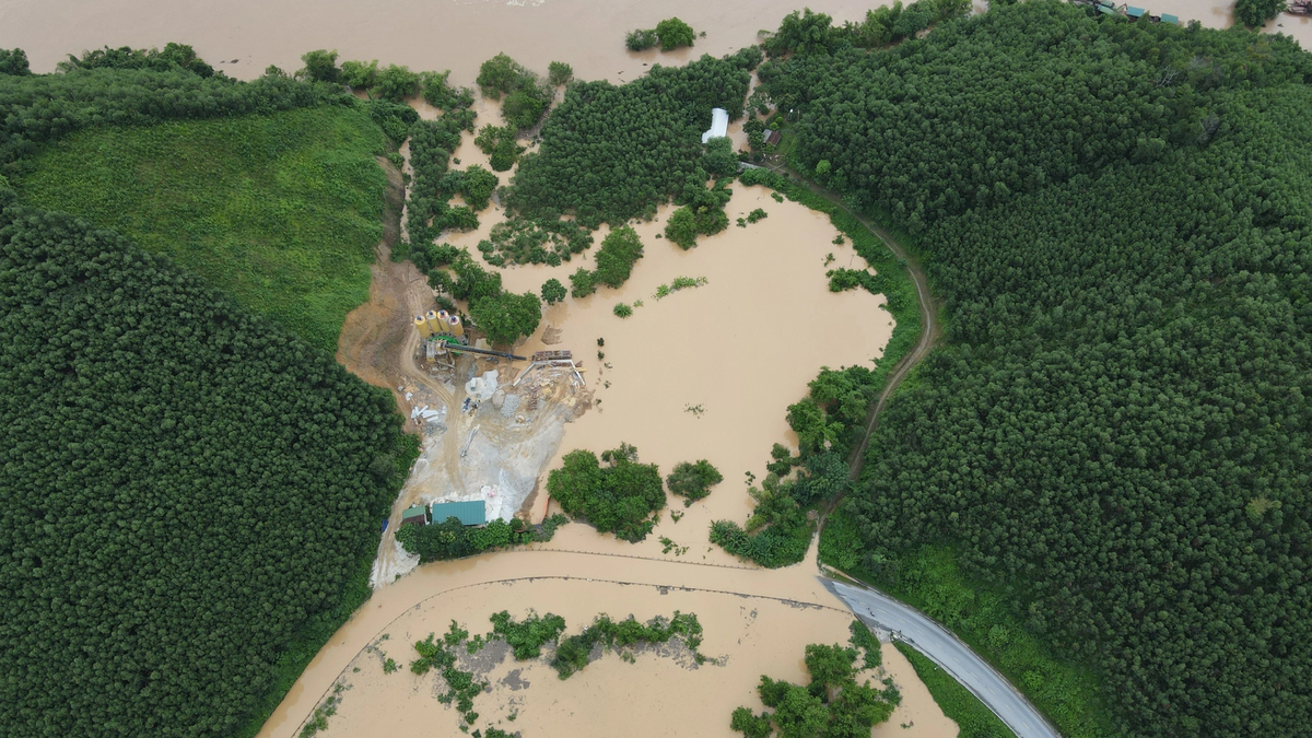
Floods after storm No. 3 caused many places in Nghe An to be deeply flooded.
According to the National Center for Hydro-Meteorological Forecasting, on the night of July 22, the tropical depression (weakened from storm No. 3 Wipha) weakened into a low pressure area over the Vietnam - Laos border area. Today, the North and North Central regions will continue to receive rain.
Forecast for the day and night of July 23, the North will have scattered showers and thunderstorms, locally heavy rain with rainfall of 15-30 mm, some places over 80 mm. On July 24-25, the North, Thanh Hoa and Nghe An are likely to have widespread heavy rain with common rainfall of 60-120 mm, some places over 200 mm.
Risk of heavy rainfall, over 90mm in just 3 hours. Heavy rainfall in a short period of time increases the possibility of flash floods on rivers and streams, landslides on steep slopes and flooding in urban areas and low-lying areas along rivers. During thunderstorms, extreme weather phenomena such as tornadoes, lightning, hail and strong gusts of wind may occur.
Notably, according to the National Center for Hydro-Meteorological Forecasting at 10:00 a.m. on July 23, a tropical depression was active in the northwest sea of Luzon Island (Philippines). The strongest wind near the center of the tropical depression was level 6 (39-49 km/h), gusting to level 8. It is forecasted that this afternoon to evening, the tropical depression will enter the East Sea. After entering the East Sea, the storm will continue to change direction to the southwest, then to the east, then to the northeast and leave the East Sea.
In terms of intensity, the tropical depression is likely to strengthen into a storm (wind force 8 in the next 24 hours. However, this tropical cyclone is unlikely to strengthen further. Due to the influence of the storm, in the eastern sea of the North East Sea, the wind will be strong at level 6-7, near the center of the storm, it will be strong at level 8, gusting at level 10, and the waves will be 2-3.5m high. Ships operating in the above-mentioned dangerous areas are likely to be affected by storms, whirlwinds, strong winds, and large waves.
Meanwhile, off the coast of the Philippines, Typhoon Francisco - the seventh typhoon in the Northwest Pacific - has also formed since 7am this morning. Typhoon Francisco is forecast to move towards the northern waters of Taiwan.
Source: https://cand.com.vn/Xa-hoi/sau-bao-so-3-bien-dong-don-ap-thap-nhiet-doi-i775715/


![[Photo] Signing of cooperation between ministries, branches and localities of Vietnam and Senegal](https://vphoto.vietnam.vn/thumb/1200x675/vietnam/resource/IMAGE/2025/7/24/6147c654b0ae4f2793188e982e272651)


Comment (0)