
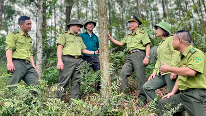
Loc Binh Regional Forest Protection Department is responsible for managing nearly 70,000 hectares of forest in 7 communes. The forest area in the area frequently fluctuates due to new planting and exploitation by local people. Previously, all field information collection to update forest developments in the area was done manually. Local forest rangers had to go to each forest block and plot to check the current status and mark on paper maps. Because it takes a lot of time, on average, each year, the unit can only update the developments of about 1,000 hectares of forest. Since 2020, the Regional Forest Protection Department has promoted the application of information technology, contributing to improving the efficiency of the above work.
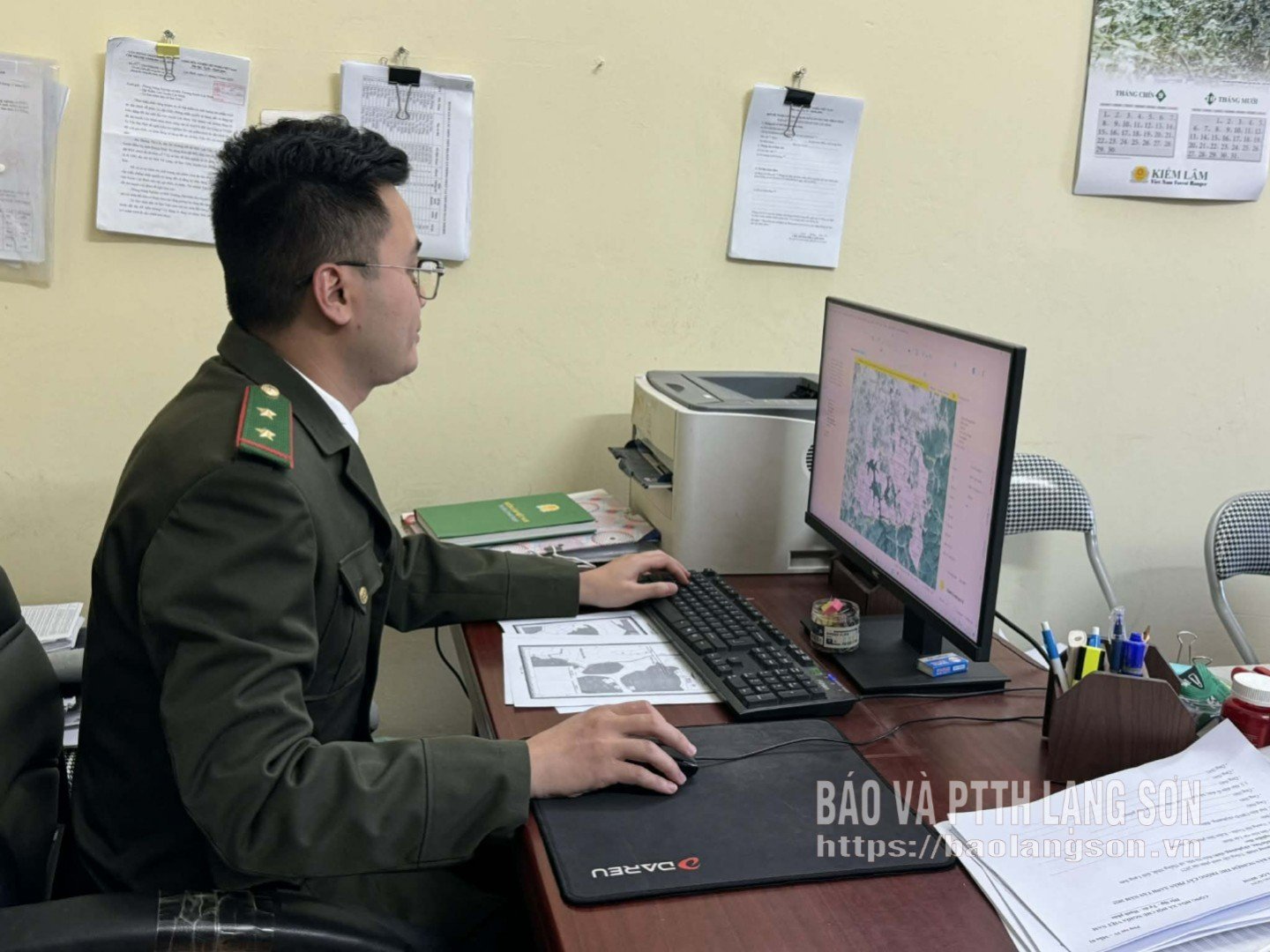
Mr. Nong Van Huan, Deputy Head of Loc Binh Regional Forest Protection Department, said: Currently, the unit uses remote sensing images and analyzes them on the latest forest change update software (FMRS version 4.0). In addition, in 2025, the unit was equipped with a flycam for field work, making it easier, faster and safer to verify information in hard-to-reach areas. Thanks to that, the efficiency of forest change update work has been increased 3-4 times compared to the previous manual method. On average, each year, the unit updates about 3,000-4,000 hectares of forest in the area.
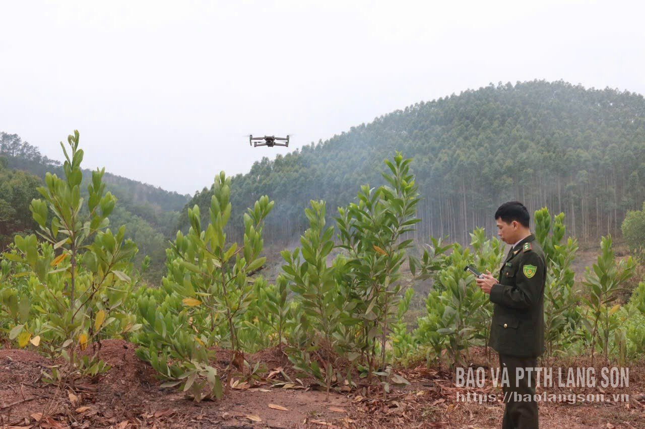
As for the Dinh Lap Regional Forest Protection Department, the unit is in charge of managing over 90,000 hectares of forest, each local forest ranger has to manage tens of thousands of hectares. From 2020 to now, the unit has been equipped with 2 GPS devices, 4 flycams and high-configuration laptops with FRMS applications installed for local forest rangers. At the same time, the collection and processing of information and data is carried out by the unit's forest rangers using many software and applications such as: vTools (application to support field survey work, map making), FRMS Mobile (software to update forest changes on mobile phone platform), map editing software (MapInfo), GTFiel (application to replace paper maps)....
Mr. Be Duc Thuan, an officer of the Dinh Lap Regional Forest Protection Department, said: With the use of flycam devices and software, it is easier to check the current state of forests and analyze information when forest fires occur, especially in rugged mountainous areas. The images and data collected will be analyzed and early warnings will be given when there are signs of violations or risks of forest fires. Thanks to that, patrolling and monitoring forests, quickly detecting illegal activities such as deforestation, illegal hunting, forest fires, monitoring forest developments, etc. are optimized in terms of time and resources.
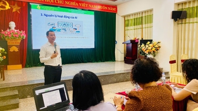
Along with the above two locations, according to information from the Provincial Forest Protection Department, from 2020 to now, the provincial forestry sector has deployed software applications used on computers and smart mobile phones to serve tasks such as: monitoring forest changes, monitoring forest status; planning forest exploitation and restoration; detecting and giving early warning of forest fire risks;... In particular, many software and applications have become effective tools for the forest rangers such as geographic information systems (GIS); unmanned aerial vehicles (drones, flycam); forestry management information system (FORMIS)...
The effective implementation of information technology applications has contributed to improving the management efficiency and work performance of the provincial forest rangers. From the beginning of the year to the end of October 2025, the provincial forest rangers promptly detected and handled 98 violations in the forestry sector (a decrease of 16 cases compared to the same period). At the same time, the forestry sector promptly updated over 21,000 hectares of fluctuating forests. In addition, information and activities of 144 forest product processing facilities and 159 wildlife breeding facilities in the province are monitored and updated regularly...
According to Mr. Vu Quang Hung, Head of the Forest Protection and Nature Conservation Department, the Provincial Forest Protection Department, in the coming time, the department will continue to advise the leaders of the Provincial Forest Protection Department to develop and implement plans to promote the application of information technology and digital transformation in forestry management in the coming time. In particular, the focus is on training and improving the level of digital transformation for forest rangers. At the same time, continue to review, supplement and improve technical infrastructure to meet the digital transformation work.
Currently, Lang Son is one of the localities with the largest forest area in the country with more than 580,000 hectares. In recent years, forestry production activities have helped people develop the economy . Promoting the application of information technology and digital transformation of the provincial forestry sector will contribute to facilitating and improving the efficiency of forestry management in the area. From there, it will help maximize the strengths of existing forestry development, contributing to the socio-economic development of the province.
Source: https://baolangson.vn/giai-phap-thong-minh-trong-quan-ly-bao-ve-rung-5065759.html


Comment (0)