
 Residents of Van Ha ward ( Bac Ninh ) were isolated in the flood. (Photo: Phan Phuong/VNA)
According to the National Center for Hydro-Meteorological Forecasting, on the day and night of October 11, the area from Quang Tri to Lam Dong and the South will continue to have scattered showers and thunderstorms, with some places having heavy rain of over 80mm.
Floods on Cau River, Thuong River (Bac Ninh) and Trung River ( Lang Son ) continue to recede, but are still at alert level 3.
At 3:00 a.m. on October 11, the water level on the Cau River at Dap Cau station was 7.1m, 0.8m above alert level 3; on the Thuong River at Cau Son station was 15.99m, at alert level 3; at Phu Lang Thuong station was 7.32m, 1.02m above alert level 3, 0.21m below the historic flood in 1986 (7.53m).
On Trung River at Huu Lung station 19.62m (at 1:00 a.m. on October 11), 0.62m above alarm level 3.
It is forecasted that in the next 12 hours, flood on Cau River at Dap Cau station, on Thuong River at Phu Lang Thuong station will decrease and remain above alert level 3; flood on Trung River at Huu Lung station will continue to decrease and remain below alert level 3.
In the next 12-24 hours, flood on Cau River at Dap Cau station will continue to decrease and stay below alert level 3; flood on Thuong River at Phu Lang Thuong station will continue to decrease and stay above alert level 3; flood on Trung River at Huu Lung station will continue to decrease and stay below alert level 2.
In the next 24 hours, flood on Luc Nam River (Bac Ninh) at Luc Nam station, flood on Thai Binh River (Hai Phong) at Pha Lai station will decrease and be below alert level 1.
Flooding in Thai Nguyen, Bac Ninh, Lang Son provinces and Hanoi city is likely to last for the next 1-3 days; there is a risk of riverbank and river dyke erosion and landslides on slopes in the above areas. The flood disaster risk warning level is level 3.
 A corner of Van Ha ward (Bac Ninh) is deeply submerged in water. (Photo: Tran Viet/VNA)
River floods inundate low-lying areas along the river, affecting activities such as waterway transport, aquaculture, agricultural production, people's lives and socio-economic activities.
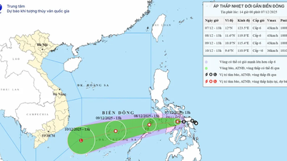
Thunderstorms and strong winds at sea
Currently, the Central and Southern East Sea area (including Truong Sa special zone), the sea area from Quang Tri to Ca Mau, Ca Mau to An Giang and the Gulf of Thailand are experiencing showers and thunderstorms.
Forecast for the day and night of October 11, the Southern Gulf of Tonkin, the Northern East Sea (including Hoang Sa special zone), the Central and Southern East Sea (including Truong Sa special zone), the sea area from Quang Tri to Ca Mau, Ca Mau to An Giang and the Gulf of Thailand will have scattered showers and thunderstorms. During thunderstorms, there is a possibility of tornadoes, strong gusts of wind of level 6-7 and waves over 2m high.
All vessels operating in the above areas are at risk of being affected by tornadoes and strong gusts of wind.
Specific weather in each region
In the Northwest, there is fog in some places in the early morning. During the day, it is sunny and there is rain in some places at night. The lowest temperature is generally from 22 to 25 degrees Celsius, in some places below 22 degrees Celsius; the highest temperature is from 30 to 33 degrees Celsius, in some places it can be above 33 degrees Celsius.
The weather in the Northeast is cloudy, with some fog in the early morning. During the day, it is sunny and rains in some places at night; in the coastal areas, there will be scattered showers and thunderstorms in the morning and at night. The lowest temperature is from 23 to 26 degrees Celsius, in mountainous areas, it will be below 23 degrees Celsius; the highest temperature is from 30 to 33 degrees Celsius, in some places, it will be above 33 degrees Celsius.
From Thanh Hoa to Hue, the North is cloudy, sunny during the day, rain in some places at night, fog in some places in the early morning. The South is cloudy, with scattered showers and thunderstorms, locally heavy rain in some places. During thunderstorms, there is a possibility of tornadoes, lightning and strong gusts of wind. The lowest temperature is from 23 to 26 degrees Celsius, the highest is from 28 to 31 degrees Celsius.
The South Central Coast has scattered showers and thunderstorms, with some areas experiencing heavy rain, concentrated in the afternoon and evening. Thunderstorms are likely to produce tornadoes, lightning, and strong gusts of wind. The lowest temperature ranges from 23 to 26 degrees Celsius, and the highest from 29 to 32 degrees Celsius.
The Central Highlands also has scattered showers and thunderstorms, with some places experiencing heavy rain, concentrated in the afternoon and evening. During thunderstorms, there is a possibility of tornadoes, lightning and strong gusts of wind. The lowest temperature ranges from 18 to 21 degrees Celsius, the highest from 28 to 31 degrees Celsius.
The South has scattered showers and thunderstorms, with some places experiencing heavy rain, mainly in the afternoon and evening. During thunderstorms, there is a possibility of tornadoes, lightning, and strong gusts of wind. The lowest temperature ranges from 24 to 27 degrees Celsius, with some places below 24 degrees Celsius; the highest ranges from 30 to 33 degrees Celsius.
Hanoi is cloudy, with scattered light fog in the early morning. Sunny during the day, with scattered showers at night. Lowest temperatures range from 23 to 25 degrees Celsius, highest from 31 to 33 degrees Celsius.
Ho Chi Minh City has scattered showers and thunderstorms in the afternoon and evening. Thunderstorms are likely to cause tornadoes, lightning and strong gusts of wind. The lowest temperature ranges from 24 to 26 degrees Celsius, the highest from 30 to 32 degrees Celsius.
Source vietnam+
Source: https://baophutho.vn/thoi-weather-ngay-11-10-lu-tai-cac-song-o-bac-ninh-lang-son-van-tren-bao-dong-3-240948.htm


Comment (0)